Torpedownia
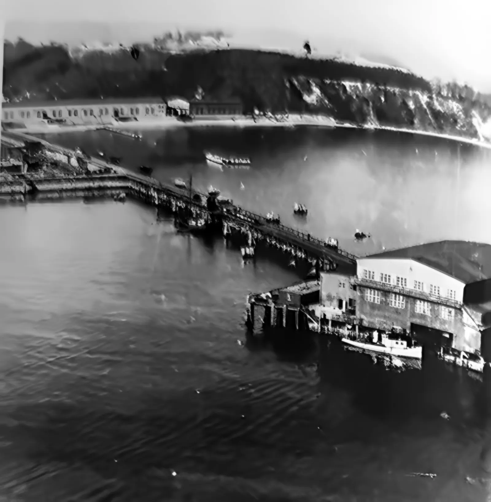
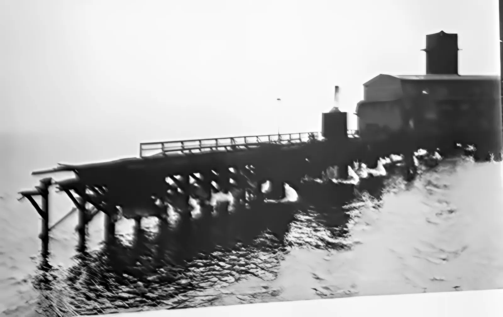
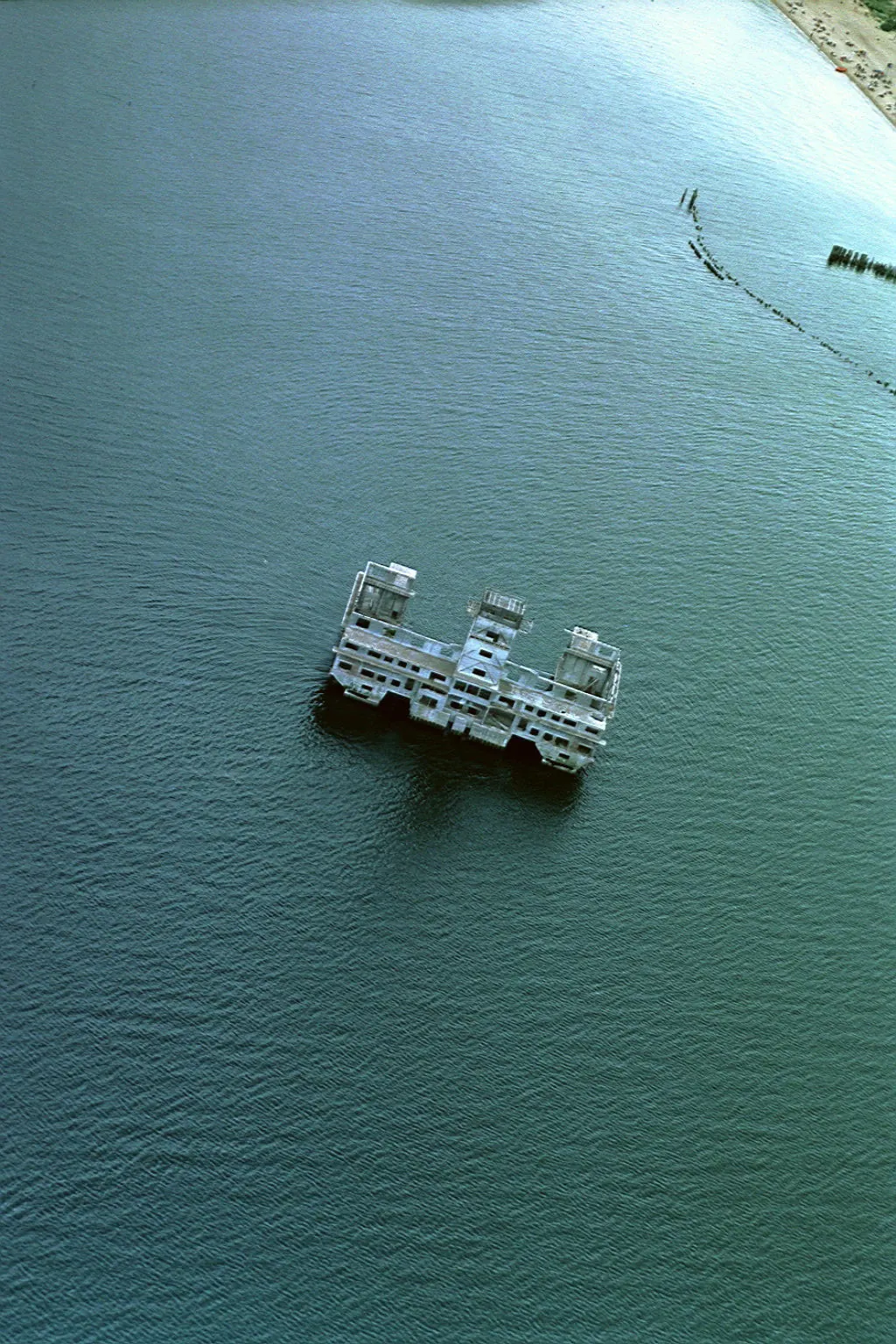
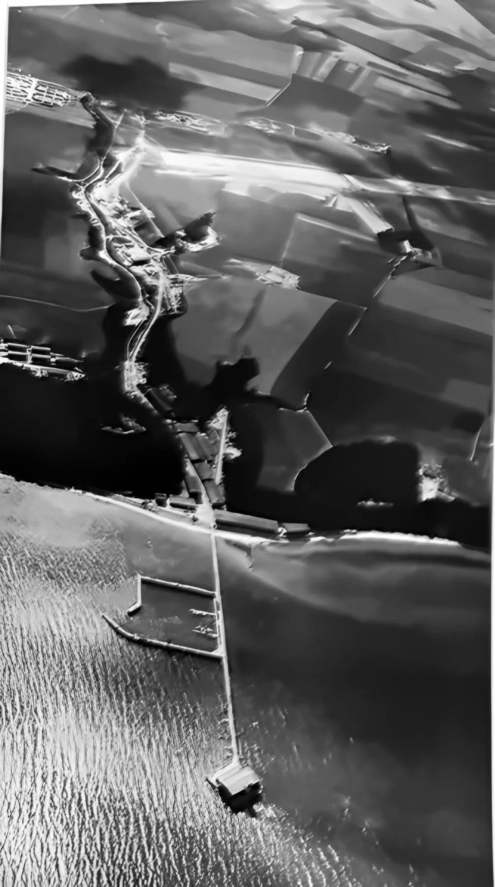
Aerial photograph from 1942: the torpedo firing range in the sea, the long wooden pier and the cliff of Kępa Oksywska
Photo from 1942 · AI reconstruction and colourisation

Gdynia · Babie Doły · Oksywie · 1940–1945

TorpedowniaThe secret of Hexengrund

For more than eighty years a building has stood in the Gulf of Gdańsk that no road leads to. Everyone who comes to the beach at Babie Doły can see it. Almost no one knows what went on inside it and around it.

2,500 people on the payroll 300 m offshore 1942–1945 Luftwaffe Torpedo Weapons Range
Prologue

A building in the sea

Listen to this chapter · 1 min 9 s

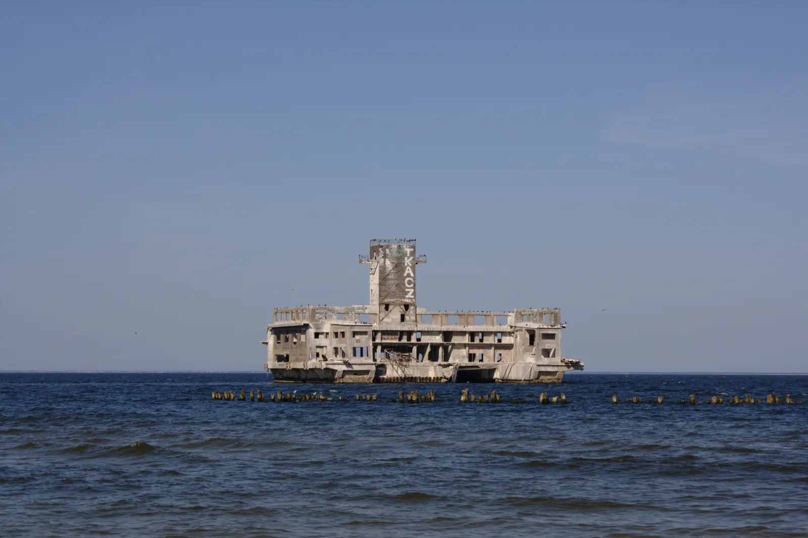
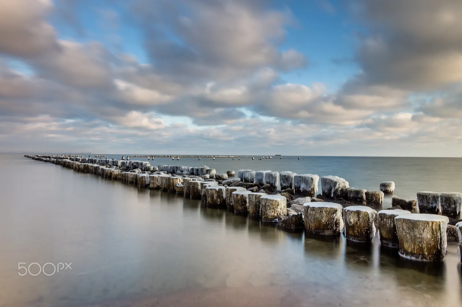
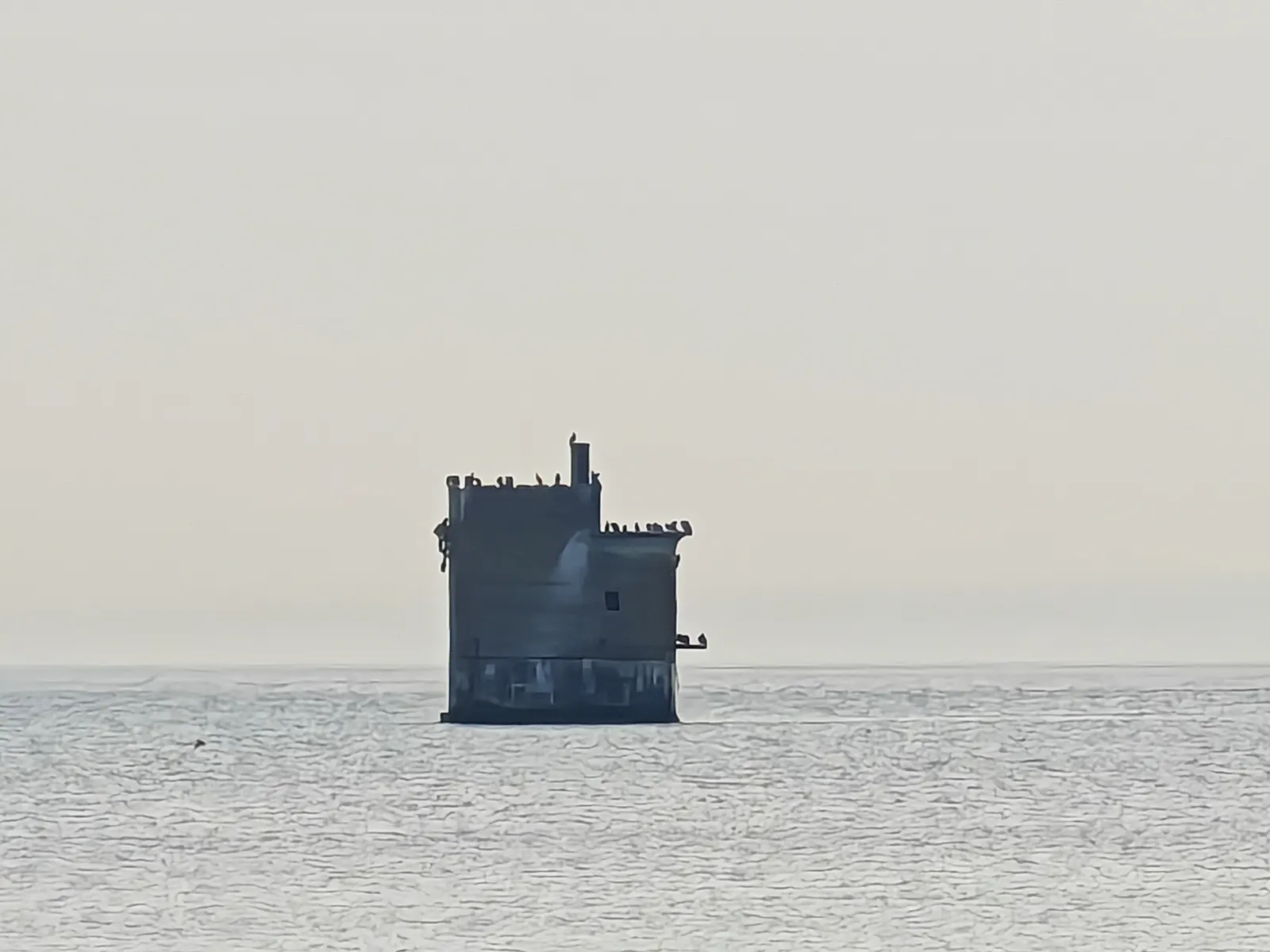
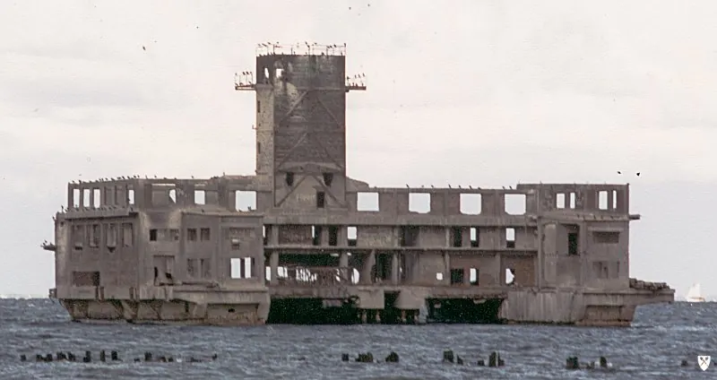
From the beach it looks like a sunken castle: a concrete block with a tower, empty windows, gulls on the ledges, a row of blackened piles leading nowhere. The people of Gdynia simply call it torpedownia – the torpedo station. Many confuse it with the other one – its twin – which stands a few kilometres to the south, at Oksywie, and still belongs to the Polish Navy.

Both were built during the war, when Gdynia was called Gotenhafen. Both served one purpose: firing torpedoes. But the one at Babie Doły – in German Hexengrund, “Witches' Hollow” – has a history that almost no one has told in Polish.

That history was written down in 1981 by a man who worked there. Friedrich Lauck headed test group E III at Hexengrund, responsible for torpedo guidance. His book Der Lufttorpedo contains a chapter on the establishment – with names, figures and photographs that are practically absent from the Polish internet. Here we tell it in English, and thanks to artificial-intelligence tools we see the period photographs more clearly than at any time since 1945.

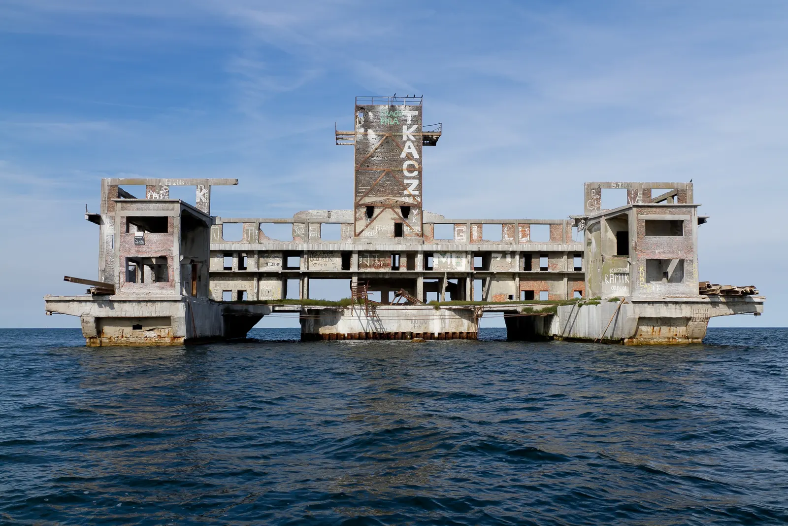
The ruin of the torpedo station at Babie Doły – present state
The ruin of the torpedo station at Babie Doły – present state. Photo: Czonek, CC BY-SA 3.0 / GFDL, Wikimedia Commons
300 m
that far offshore the firing range was built; a wooden pier connected it to the land
2,500
people were served by the TWP payroll office (according to Lauck)
1,500
Ukrainians in the “Russian camp” just outside the main gate
900
aerial torpedoes a month – the Reich's production peak, July 1944
Chapter 1 · The site

Two torpedo stations, one bay

Listen to this chapter · 41 s

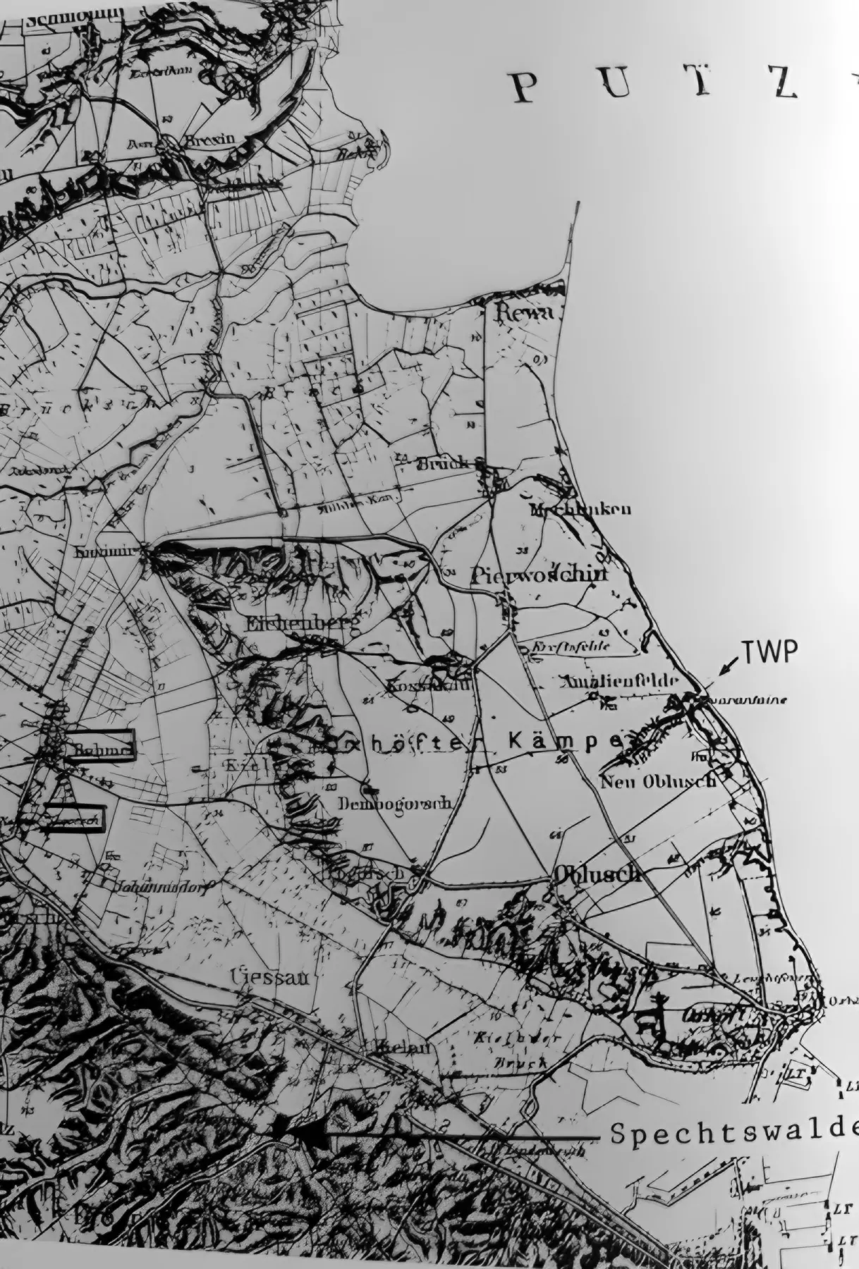
North of the naval port, Kępa Oksywska (Oxhöfter Kämpe) drops to the sea in a 50-metre cliff. A ravine runs down its slope, Babi Dół – before the war a Polish quarantine station stood here for the crews of ships calling at Gdynia.

In October 1940 the Kriegsmarine, while setting up its torpedo test establishment (TVA) at Oksywie (Oxhöft), chose the ravine for a new aerial torpedo works. Construction began in early 1941. Two years later an airfield was operating on the plateau, and in the sea – two concrete firing ranges.

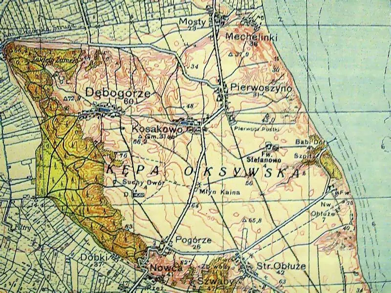
WIG map of 1935: Kępa Oksywska before the war
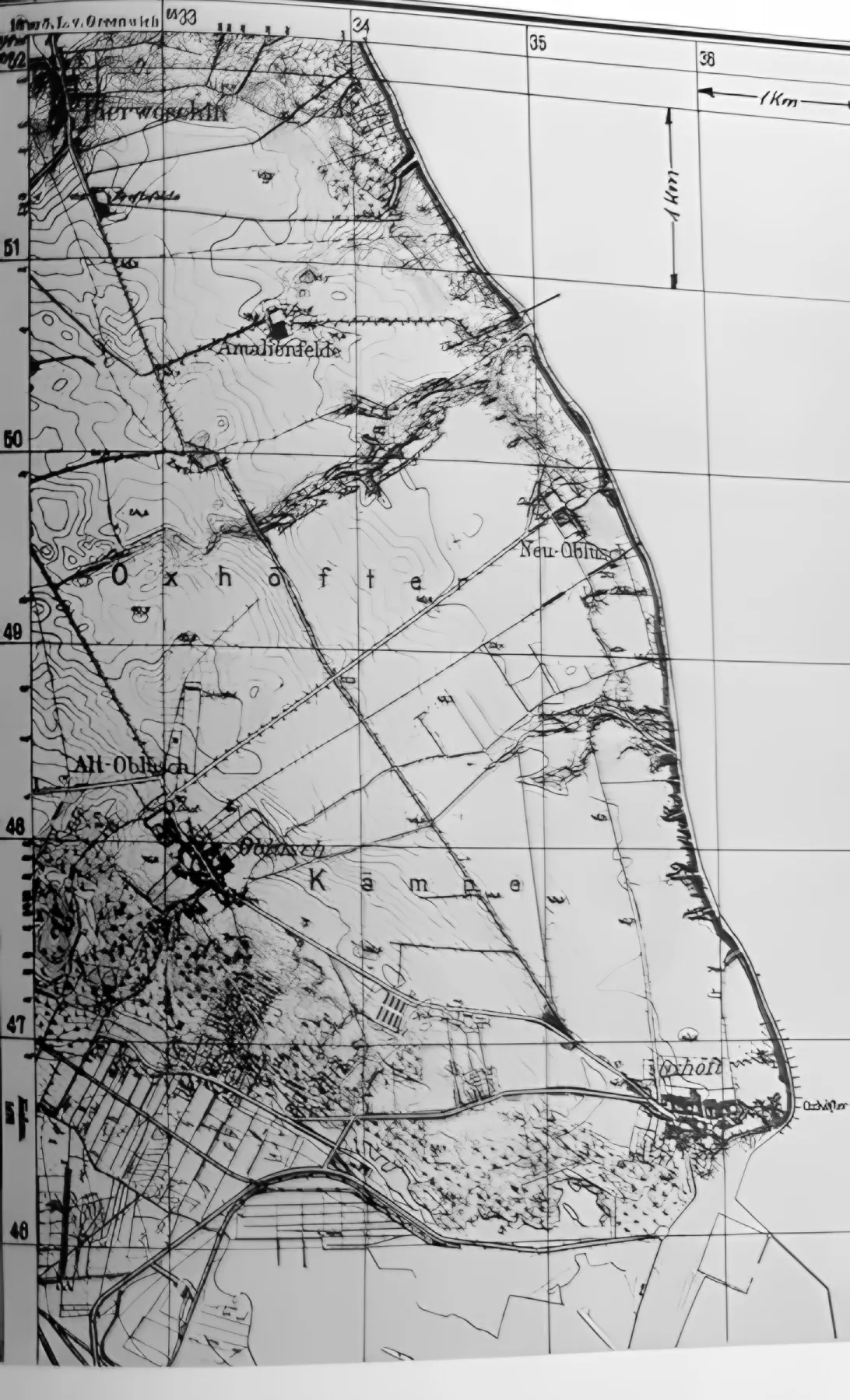
German map of 1944: the same area with Hexengrund
WIG 1935German ed. 1944

Move the slider: the Polish WIG map of 1935 (public domain) and the German edition of 1944 based on WIG material from 1938 (Lauck's fig. 135). The maps differ in scale and extent.

The ruin of the Babie Doły torpedo station in the sea
Babie Doły · Hexengrund

Luftwaffe Torpedo Weapons Range (TWP)

Operator
Kriegsmarine (built 1941), Luftwaffe from 4.07.1942
Purpose
assembly, test-firing and development of aerial torpedoes (F5b, F5W, F5u, LT 350)
Offshore
approx. 300 m, water depth approx. 7 m
Today
ruin without a pier, visible from the beach; entry dangerous
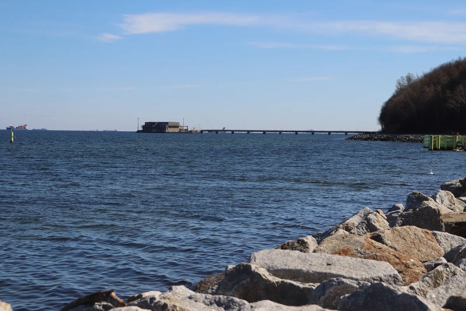
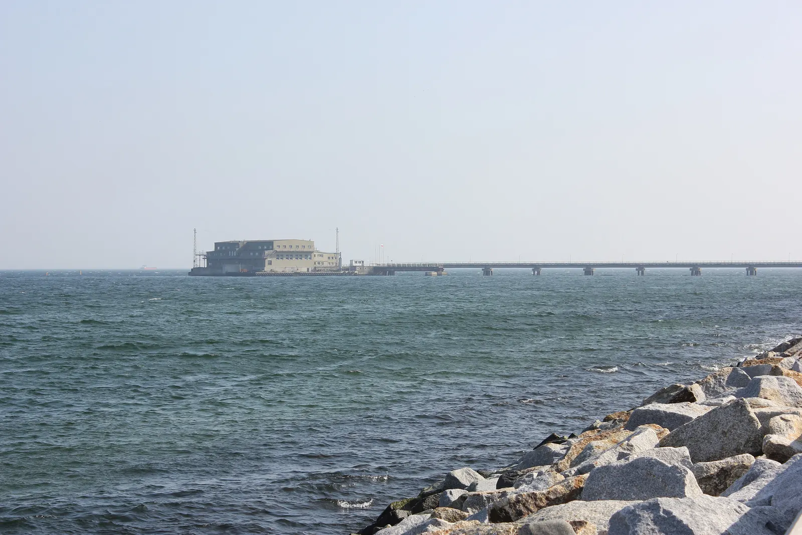
The Oksywie torpedo station with its long concrete pier
Oksywie · Oxhöft · “Formoza”

Kriegsmarine TVA firing range

Operator
Kriegsmarine (Torpedoversuchsanstalt), after the war the Polish Navy
Purpose
ship and submarine torpedoes, including acoustic homing torpedoes
Offshore
approx. 500 m (sources also give 700 m)
Today
military area; visible from the beach and the promenade at Oksywie
State of knowledge
more limited than for Babie Doły: Lauck describes the TWP and mentions the Oksywie torpedo station only a few times

Click a point to see its description. The positions of Spechtswalde, Rahmel airfield and the measuring bases are approximate.

Chapter 2 · Chronology

From quarantine to ruin

Listen to this chapter · 5 min 49 s
  1. Quarantine station at Babi Dół

    While building the port of Gdynia, Poland sets up an infectious-diseases hospital in the ravine, with a quarantine station for ships' crews and a small landing stage. The initiator was the government commissioner Franciszek Sokół. The year of construction is uncertain.

  2. End of the defence of Kępa Oksywska

    After nine days of fighting, Colonel Stanisław Dąbek takes his own life near Babie Doły. He is buried beside the quarantine station. He was exhumed in 1946.

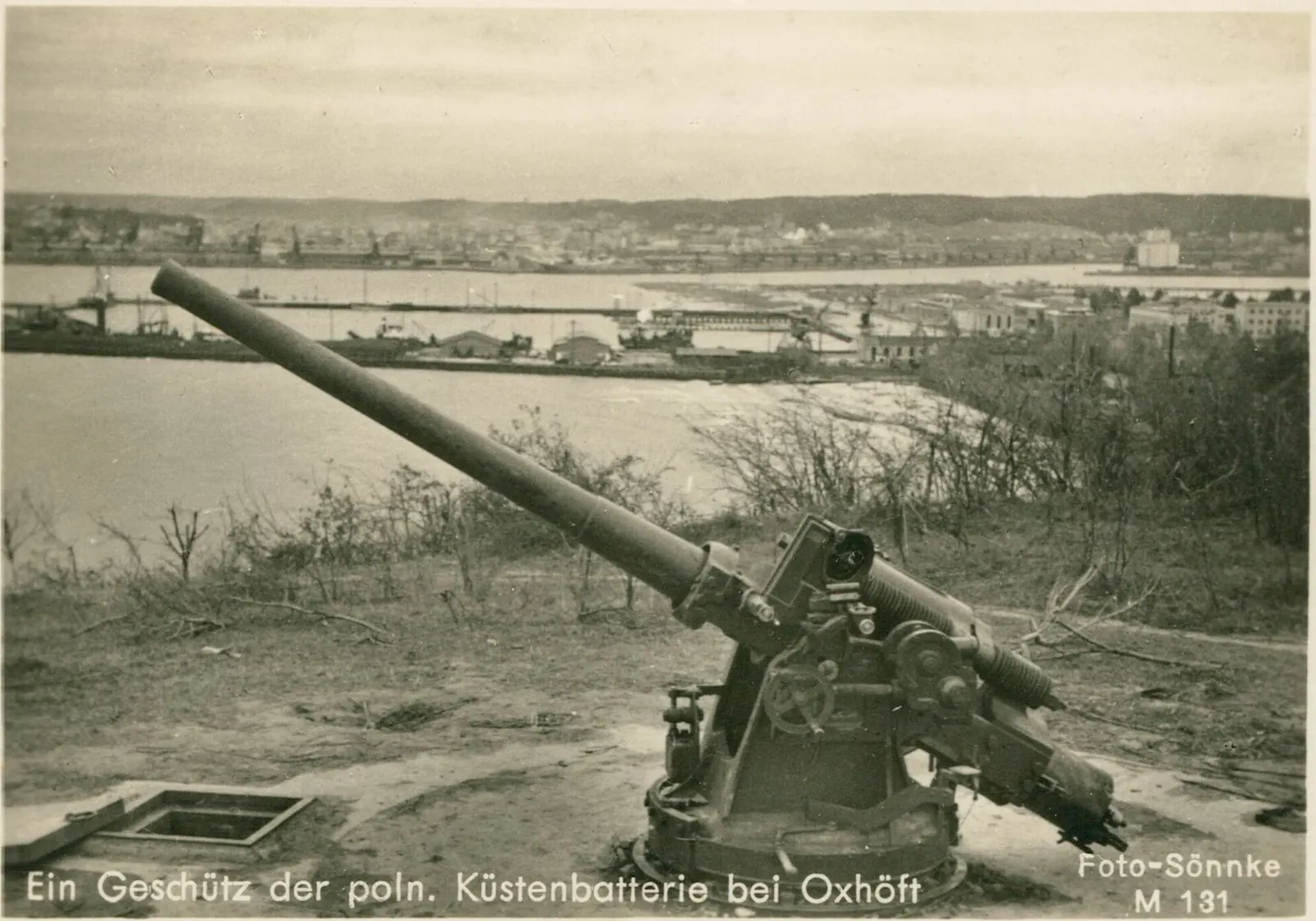
    A gun of the Polish coastal battery at Oksywie, 1939 (German postcard)
    A gun of the Polish coastal battery at Oksywie, 1939 (German postcard). Photo: Foto-Sönnke, public domain, Wikimedia Commons
  3. The Kriegsmarine chooses the ravine

    While building the torpedo establishment (TVA) at Oksywie, the navy plans special aerial torpedo works at Babi Dół – now Hexengrund.

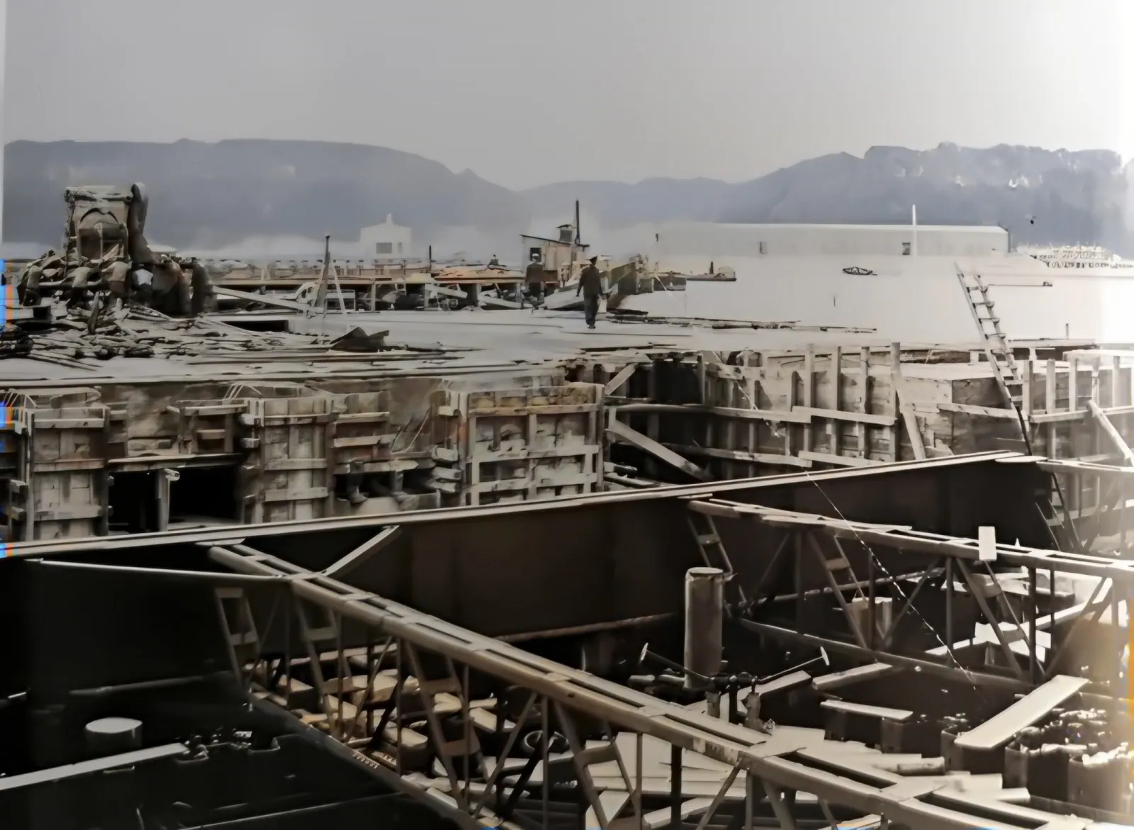
  4. Building the firing range

    The firing range rises 300 m offshore, in water approx. 7 m deep. The quarantine building becomes the headquarters; assembly halls and a power station with three Schwartzkopf compressors go up along the beach.

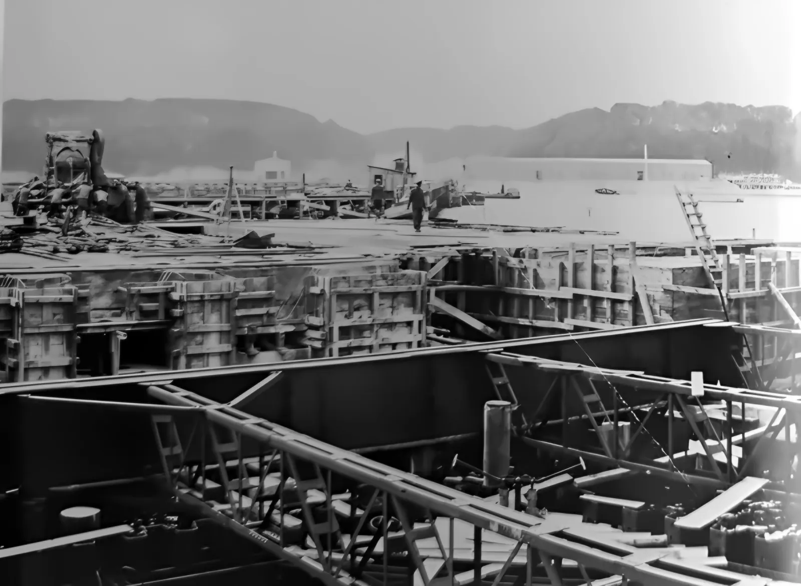
    Building the firing range: steel girders and wooden formwork against the cliff
    Fig. 134. The Hexengrund firing range under construction (summer 1941). F. Lauck, Der Lufttorpedo, München 1981
  5. Birth of the TWP

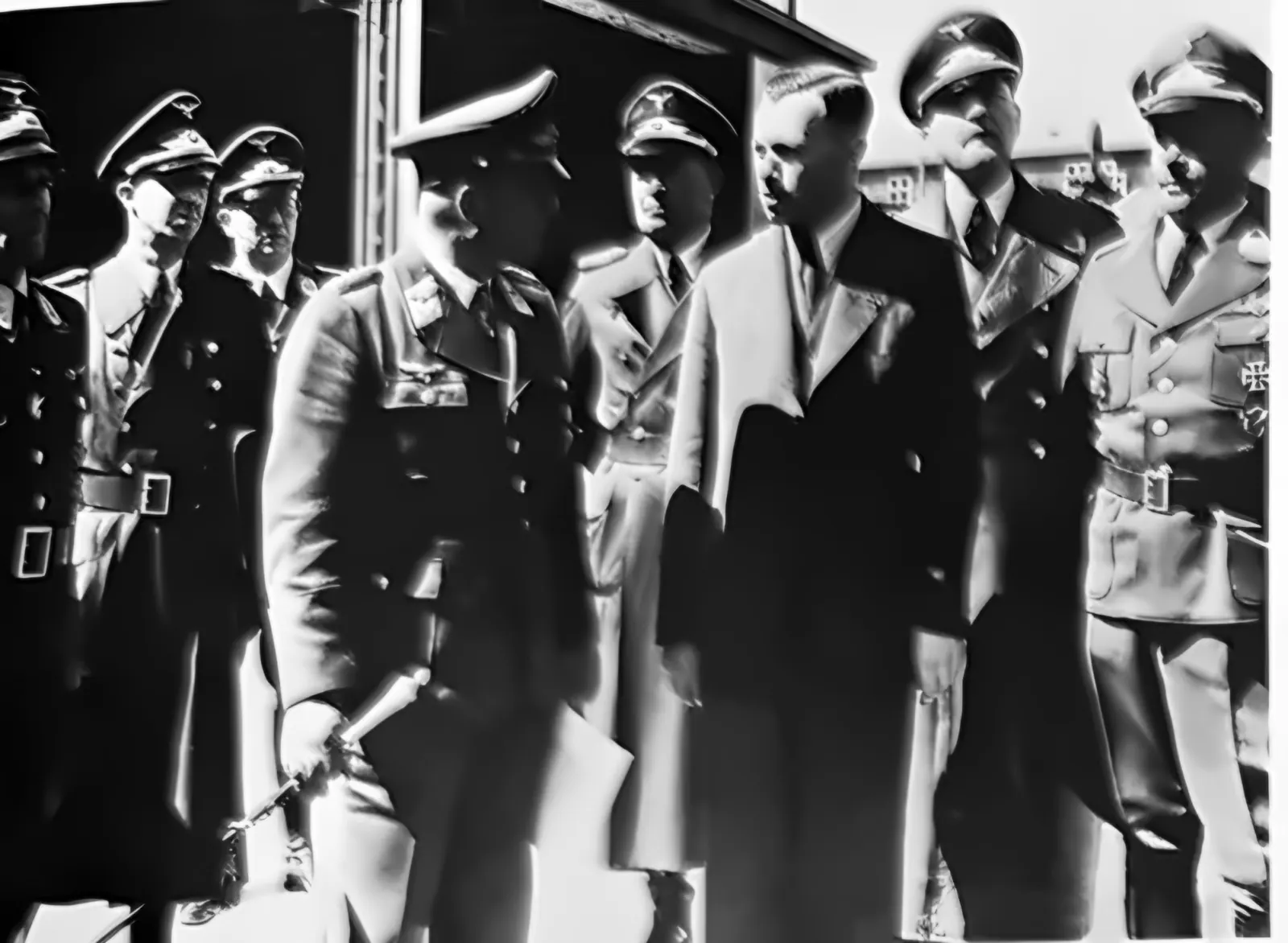
    The Kriegsmarine hands the facilities over to the Luftwaffe together with approx. 1,500 workers. The Torpedowaffenplatz der Luftwaffe Gotenhafen-Hexengrund – the Torpedo Weapons Range – is established.

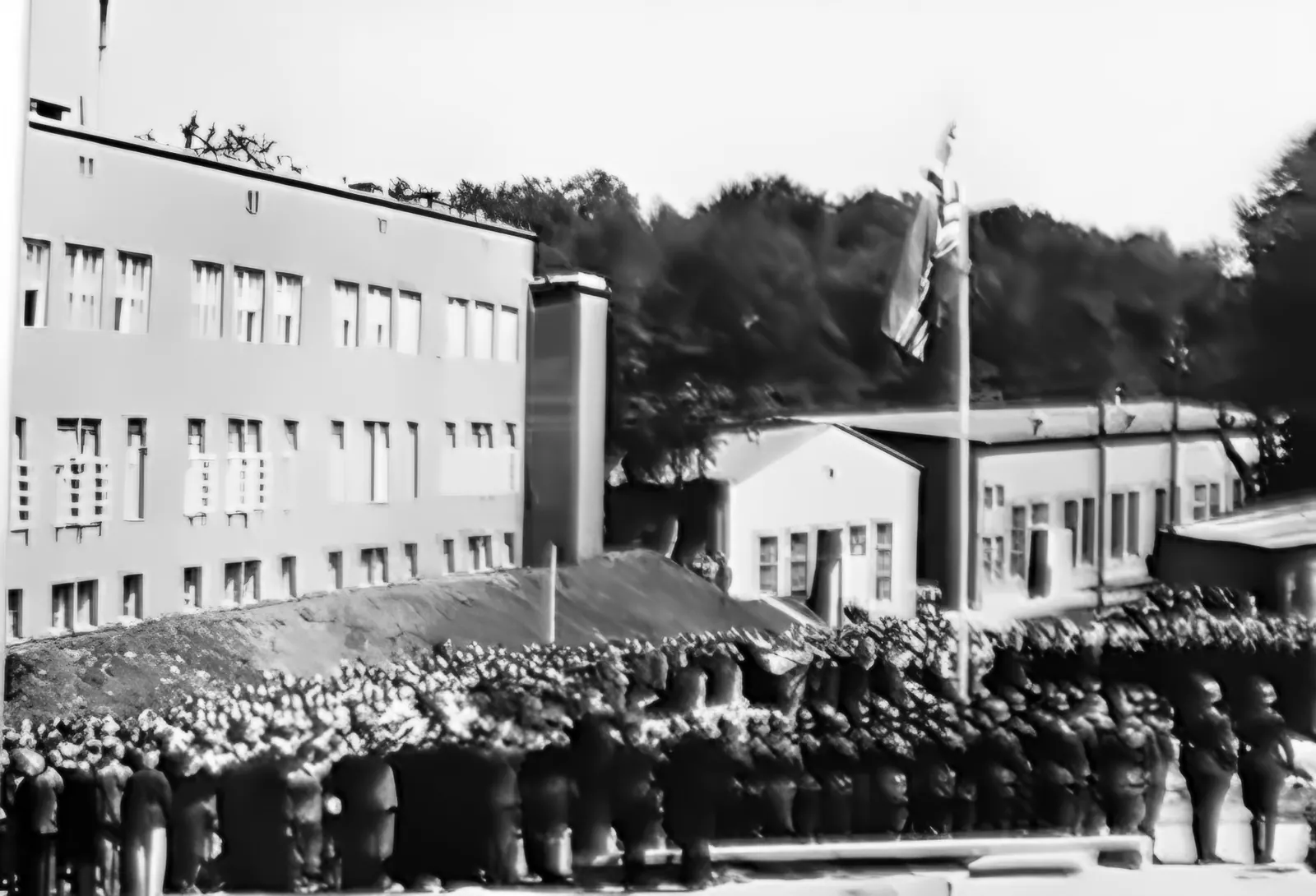
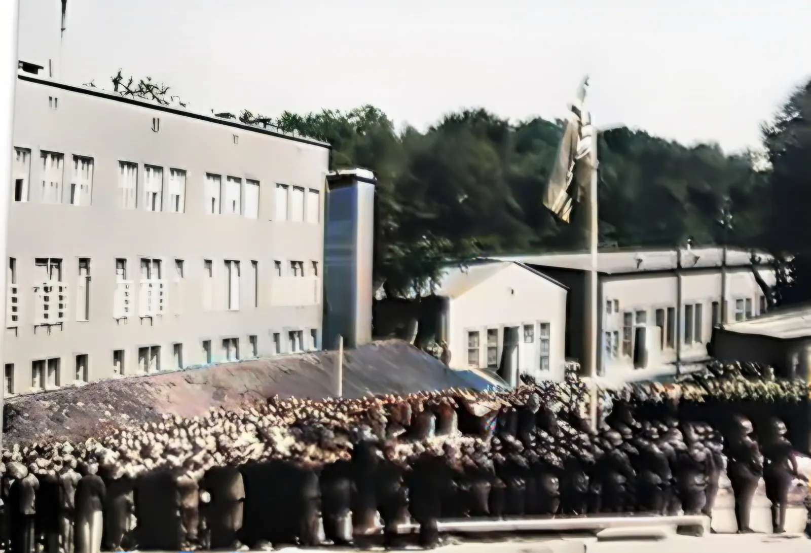
    Roll call in front of the headquarters building on the day the TWP opened
    Fig. 136. Opening of the Luftwaffe Torpedo Weapons Range Gotenhafen-Hexengrund, 4 July 1942. On the left the headquarters building – formerly the Polish quarantine station. F. Lauck, Der Lufttorpedo, München 1981
  6. Military command

    The TWP gets a commander: Colonel Hermann Jordan, with Major Josef Sched on his staff; both knew aerial torpedoes from the front. The first head of the establishment, Oberstingenieur Beckmann, and the first head of trials, Rudolf Eberhard, are transferred. Johannes Hillermann heads the trials until the end of the war.

  7. The “Holstein” hits a mine

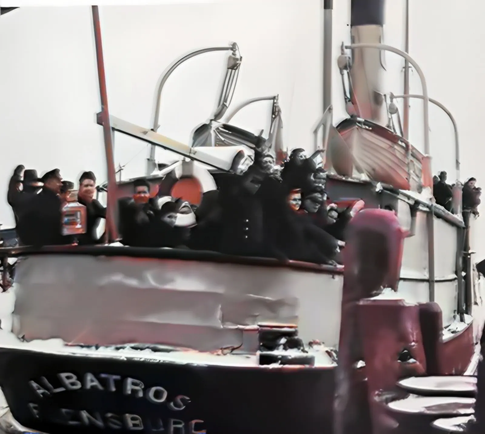
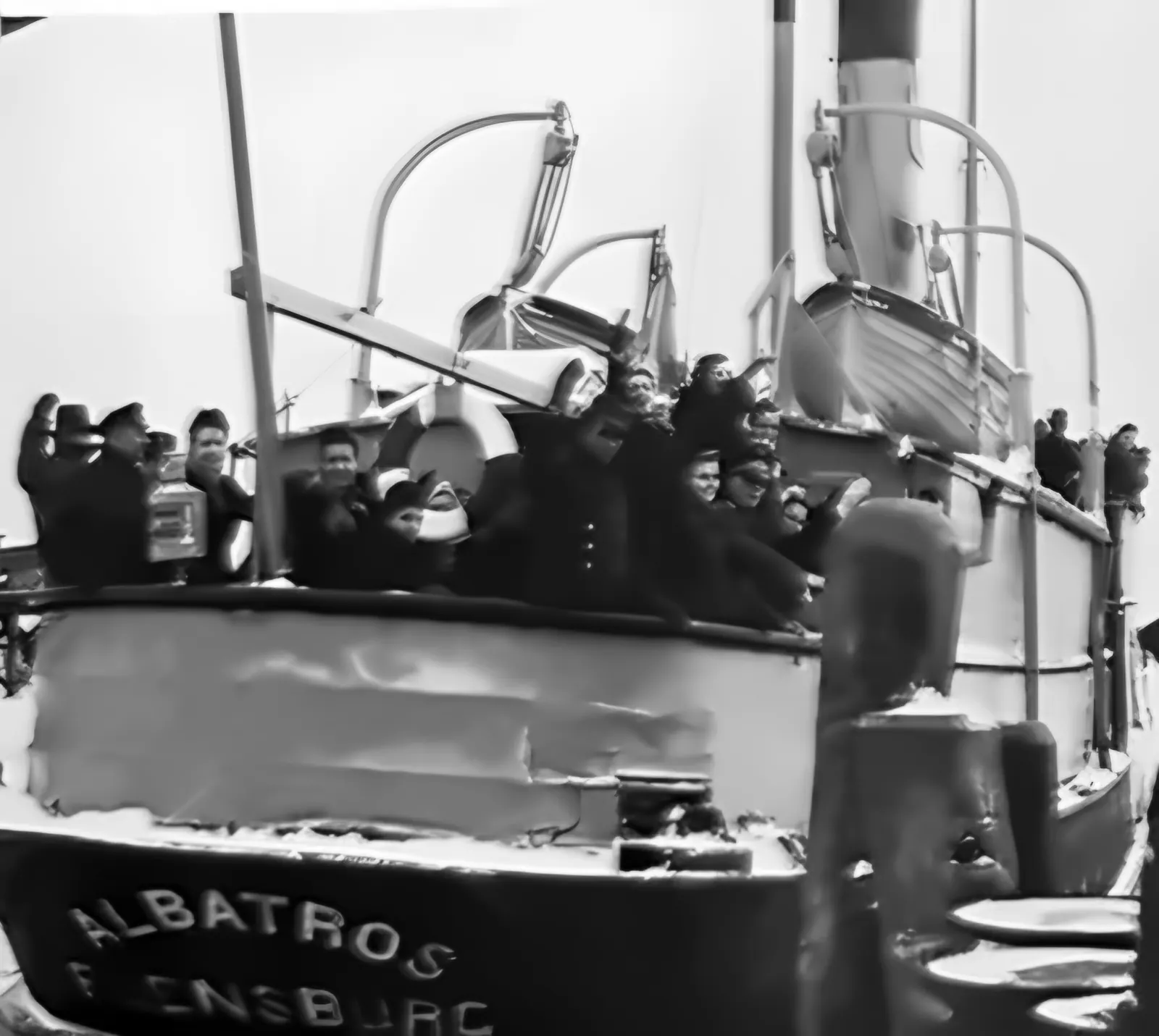
    The steamer carrying staff between Gdynia and Hexengrund sinks after striking a mine. She is replaced by the “Albatros” from Flensburg.

  8. An outpost near Naples

    Together with the Italian Navy Ministry, the TWP opens a small test station with about 70 men at Lucrino near Naples. It is meant to supply the Mediterranean area with F5W torpedoes more quickly.

  9. Field Marshal Milch inspects

    Generalluftzeugmeister Erhard Milch, with the staff of the RLM Technical Office, inspects all the TWP facilities in detail.

  10. An airfield of its own

    On Kępa Oksywska, by the Amalienfelde farm, a test airfield with a single runway opens. Before that, aircraft took off from Rumia-Zagórze, and torpedoes had to be carried along a winding road.

  11. Workshop ship at Apenrade

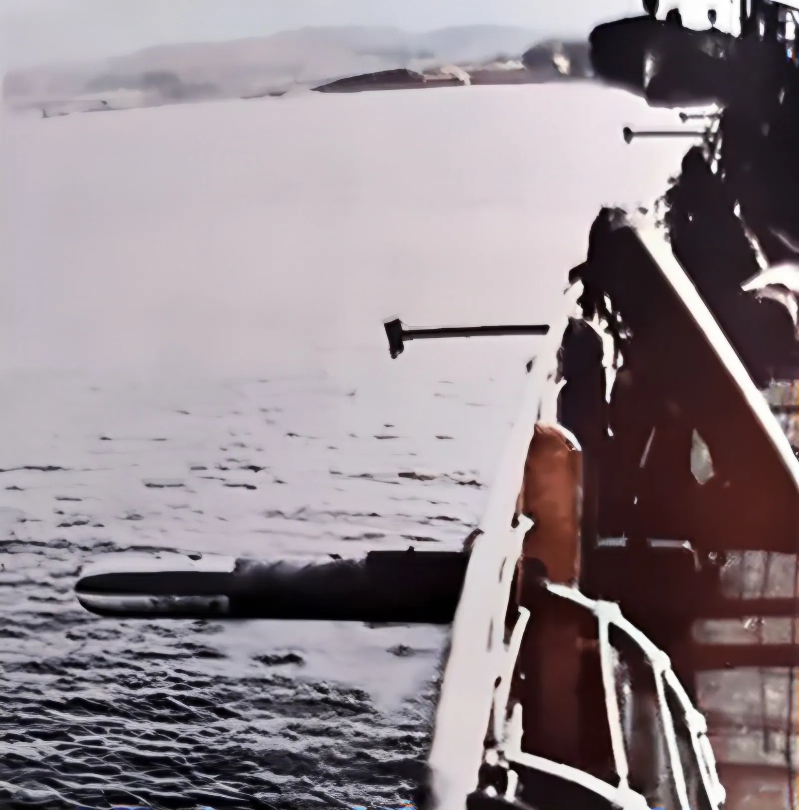
    In Danish Apenrade the TWP opens another test centre. Its base is the workshop ship “Eberstein”, anchored in the bay – built in 1904 as the “California”, with two above-water torpedo tubes, workshops and laboratories. People live and eat on board.

  12. A new commander

    Colonel Jordan is transferred. Major Josef Sched commands the TWP until it is disbanded in March 1945.

  13. Production peak

    German industry produces up to 900 aerial torpedoes a month. The TWP takes delivery of the torpedoes; from 1943 they are test-fired mainly at other ranges, and at Hexengrund only by random sampling. From October 1944 production falls to about 150.

  14. Guests from Japan

    The Japanese military attaché visits the TWP with three officers. Earlier, in September 1942, a delegation of Italian officers had come – for the results of trials with the Italian F5W torpedo.

  15. Escape through the pier

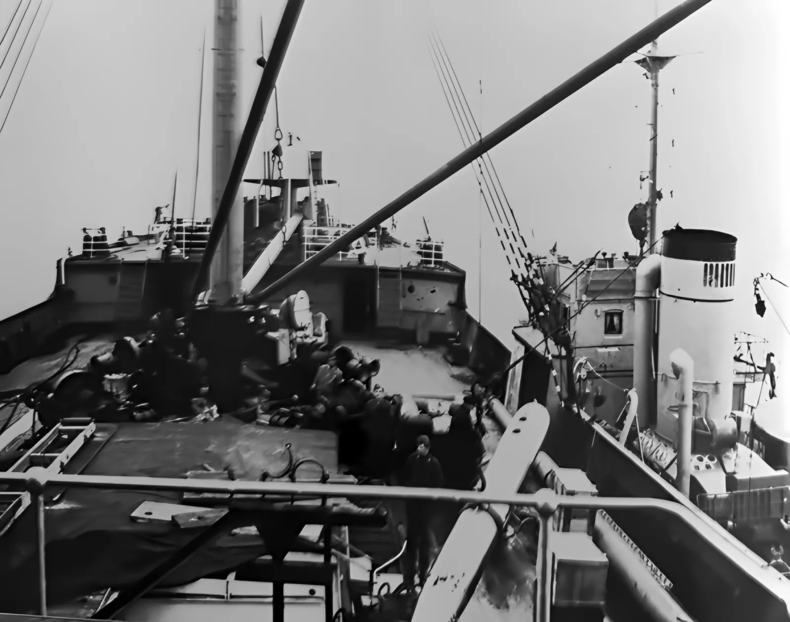
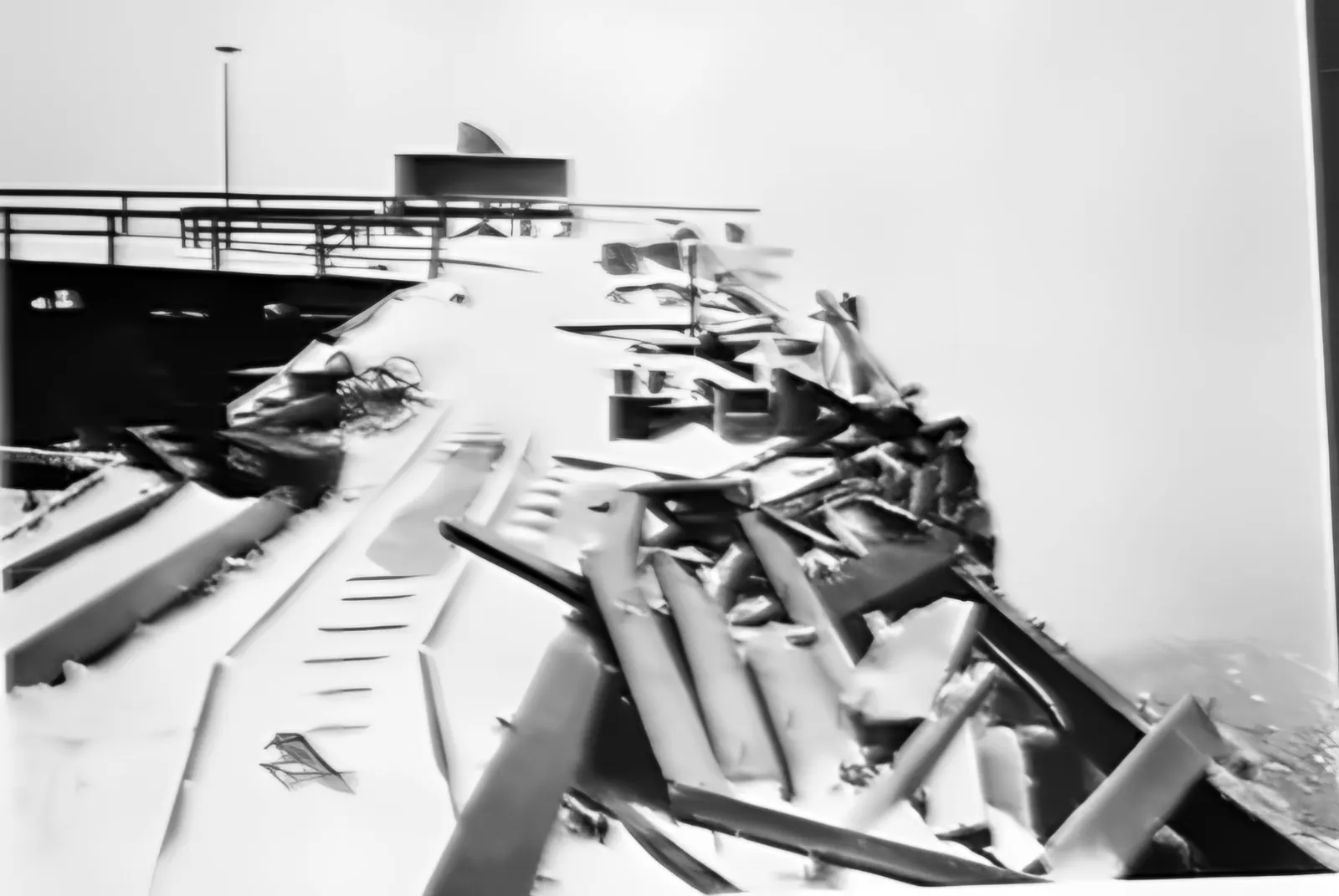
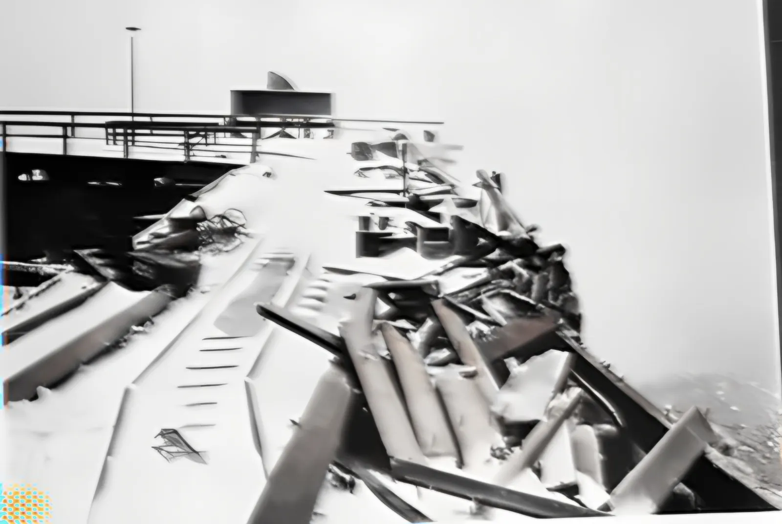
    A storm drives the freighter “Gerrit Fritzen” onto the wooden jetty. The captain breaks through the pier at full speed ahead – the firing range is cut off from its power supply. On 31 January the ship leaves for Travemünde.

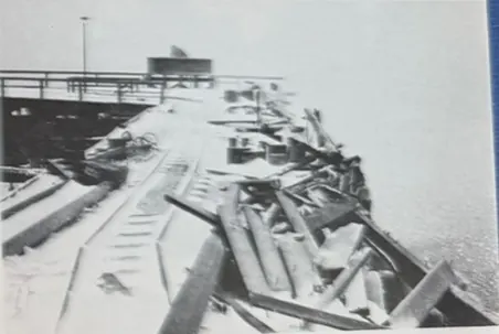
    Broken beams of the wooden pier under snow
    Fig. 168. The pier destroyed by the “Gerrit Fritzen” (January 1945). F. Lauck, Der Lufttorpedo, München 1981
  16. “Walpurgis Night”

    From the encircled Kępa Oksywska the Germans ferry approx. 8,000 soldiers and 30,000 refugees to Hel. The last TWP official watches the burning mess and barracks from the deck.

  17. The Polish military

    The Soviets remove the equipment and the harbour basin silts up. Military divers train at the torpedo station until the 1980s. The airfield is taken over by Polish naval aviation.

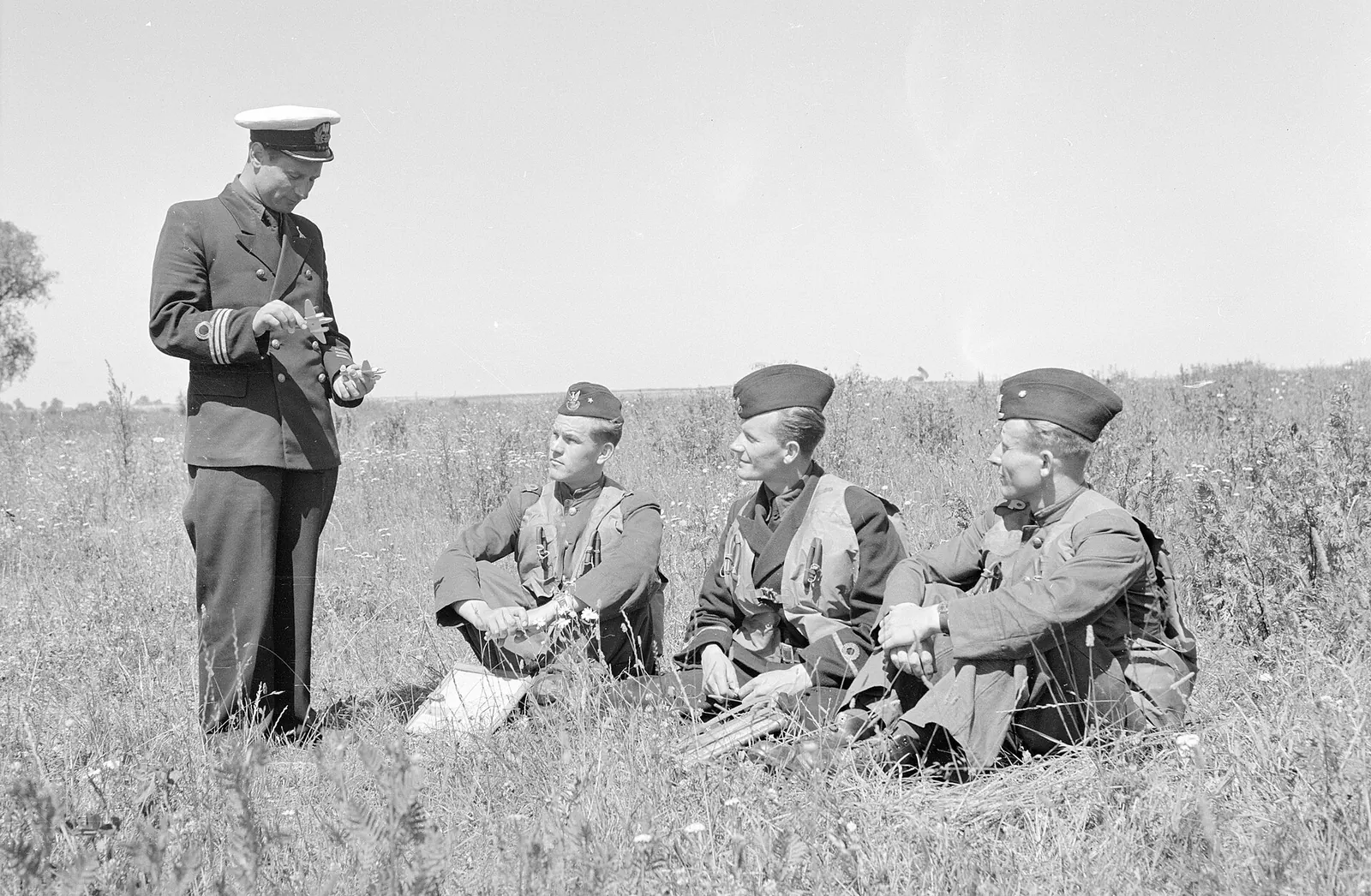
    Polish naval airmen at Babie Doły airfield, 1952
    Polish naval airmen at Babie Doły airfield, 1952. Photo: Wojskowa Agencja Fotograficzna (NAC), public domain, Wikimedia Commons
  18. A frame from “Four Tank-Men and a Dog”

    In the episode “Brzeg morza” (The Sea Shore) the wooden harbour can still be seen, largely intact.

  19. Decay

    After severe winters a wall of the building collapses (sources give different dates). The end of the pier is destroyed to make access harder; the remains were blown up in the mid-1990s.

    The torpedo station in 2002
    The torpedo station in 2002. Photo: Topory, CC BY-SA 3.0, Wikimedia Commons
  20. A stand-in for television

    The ruin is in too poor a state for filming the German series “Sløborn”, so the film crew builds a replica of it on the Seaside Boulevard in Gdynia.

  21. A symbol without a guardian

    The ruin belongs to the State Treasury. We found no confirmation that it is entered in the register of monuments. Year by year there is less of it.

Building the Hexengrund firing range in summer 1941: steel girders, formwork and workers, the cliff behind
Fig. 134. The Hexengrund firing range under construction, summer 1941. Colourisation and 2.5D motion: AI – the colours are a reconstruction, not a record. F. Lauck, Der Lufttorpedo, München 1981
Chapter 3 · How it worked

Pier, compressors, shot

Listen to this chapter · 1 min 43 s

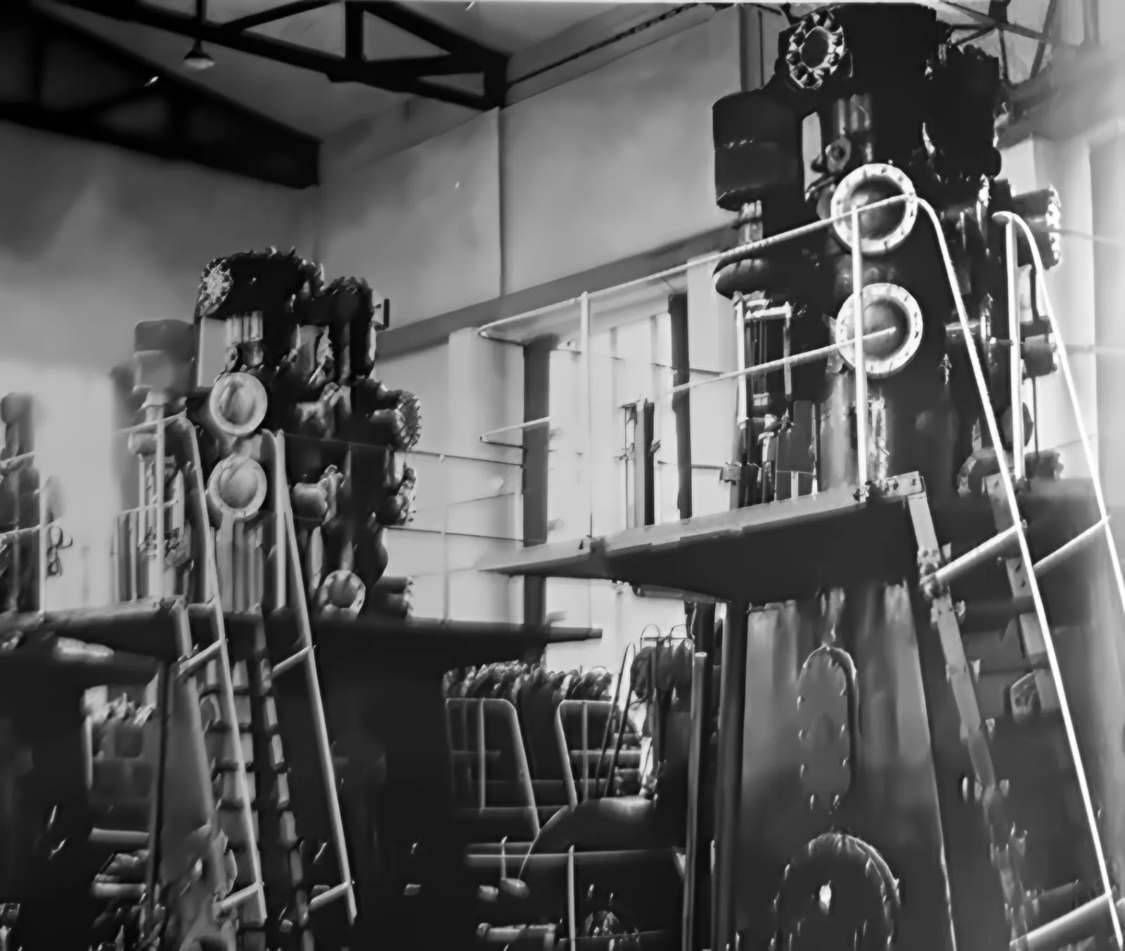
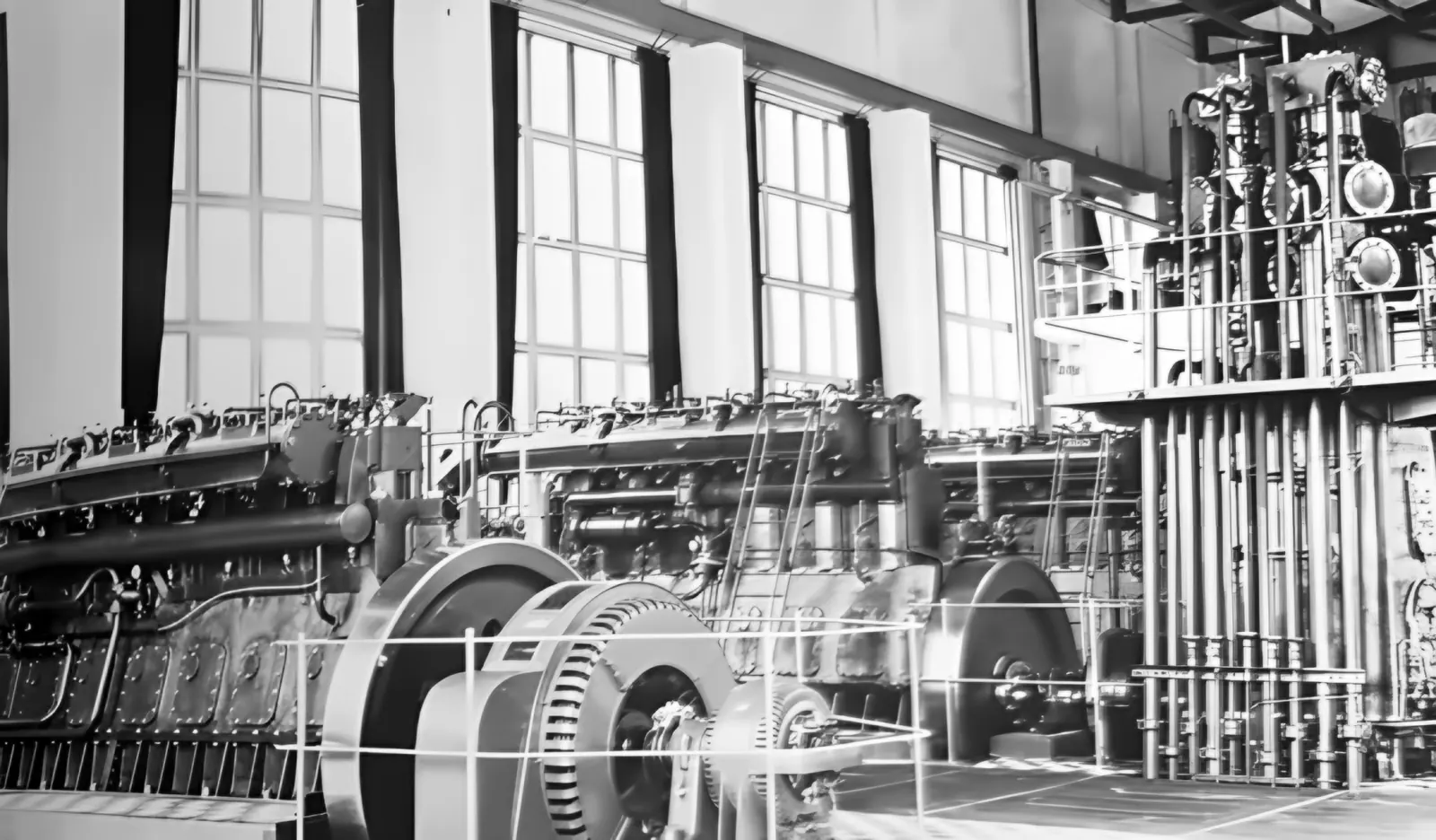
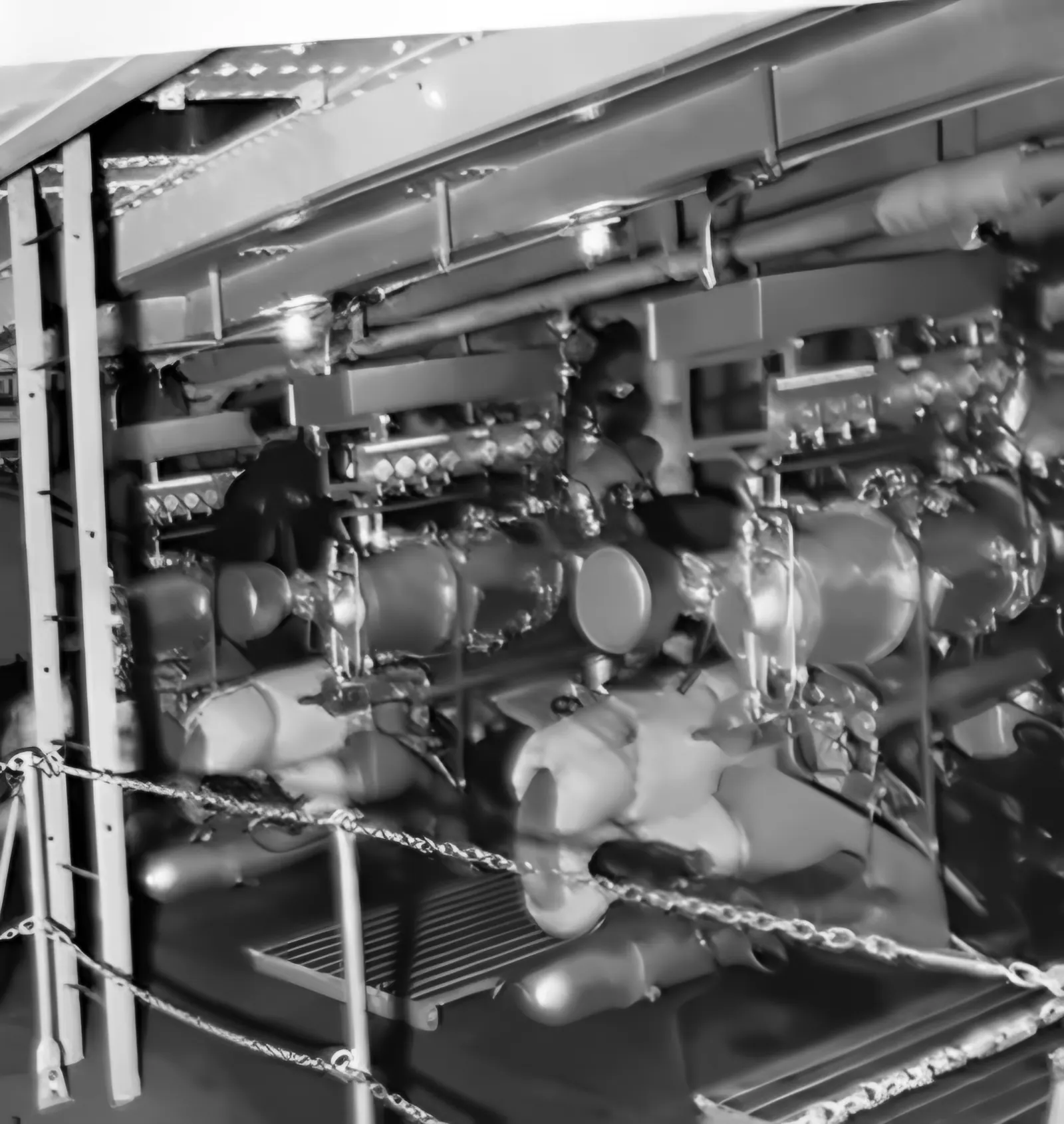
At the landward end of the pier stood the power station: three large Schwartzkopf compressors with diesel engines, a battery of steel compressed-air cylinders and an emergency generator. The lines ran under the pier planking all the way to the firing range. Stores, halls, the firing range and the crane were linked by field-railway tracks.

Halfway along the pier a wooden jetty branched off to the south. It enclosed the harbour of the recovery boats and allowed smaller freighters to moor. On it stood a gantry crane – as Lauck writes, “somewhat too heavy for the wooden structure”. That remark would prove prophetic.

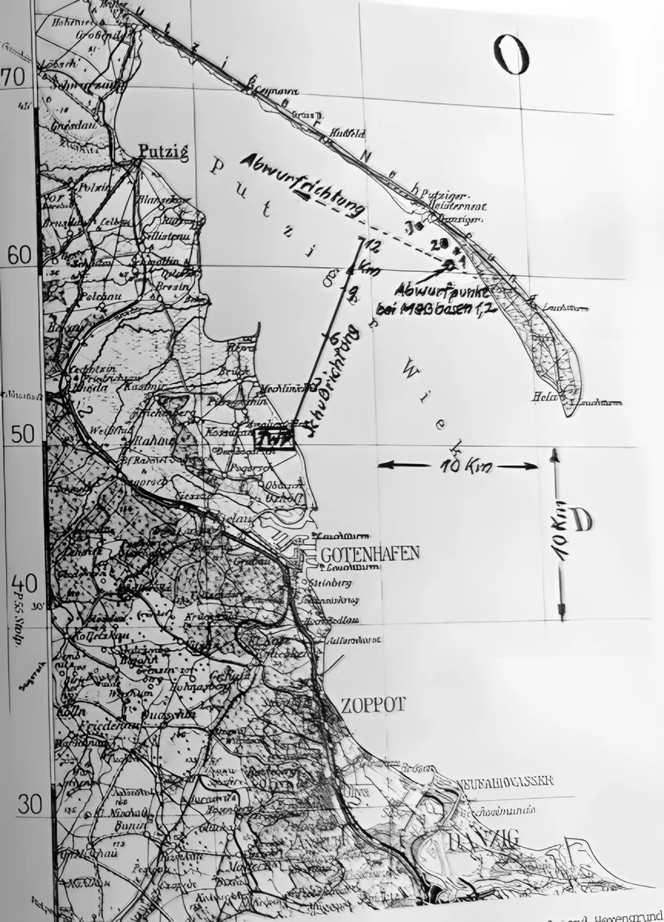
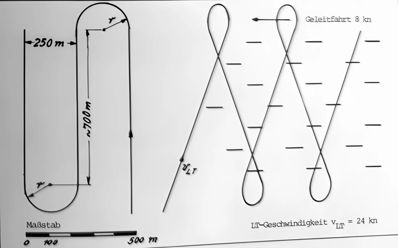
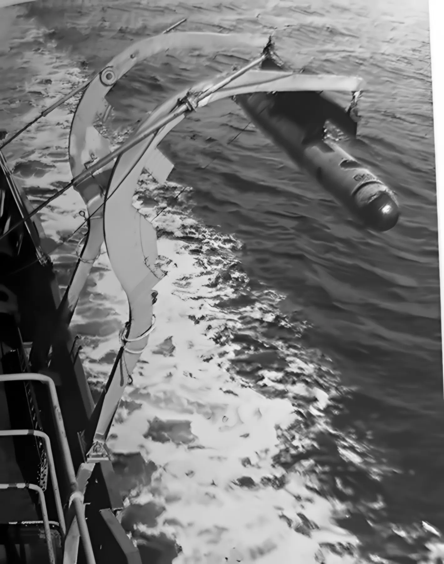
Torpedoes were fired straight out from the range, on a bearing of 22°. Recovery boats (Fangboote) pulled them out of the water and towed them back. Air drops were carried out far from here – over the Bay of Puck, south of Jastarnia, about 900 m from three measuring bases, on a bearing of 292°, over water about 25 m deep.

The firing range had an underwater listening system measuring the running time and direction of the torpedo, and a pontoon with a net for measuring the depth at which it ran. Trials were planned to the minute: the observation posts stood far apart, and voice communication was forbidden for secrecy. Meteorologists supplied visibility, wind, sea state and temperature. Every recovered torpedo was examined for weak points, and the results were entered on forms.

A narrow-gauge coastal railway with a diesel locomotive linked the TWP facilities with one another and with the Kriegsmarine establishment at Oksywie. In mid-1944 a rail link Hexengrund–Gotenhafen was added.

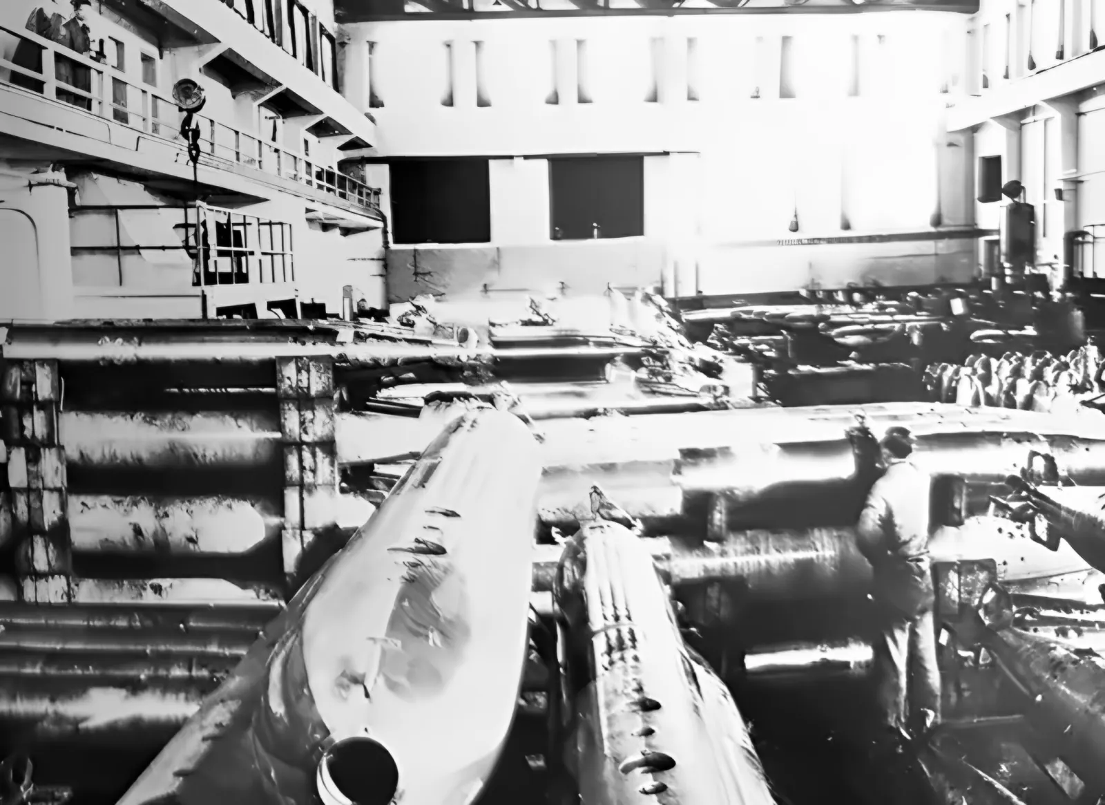
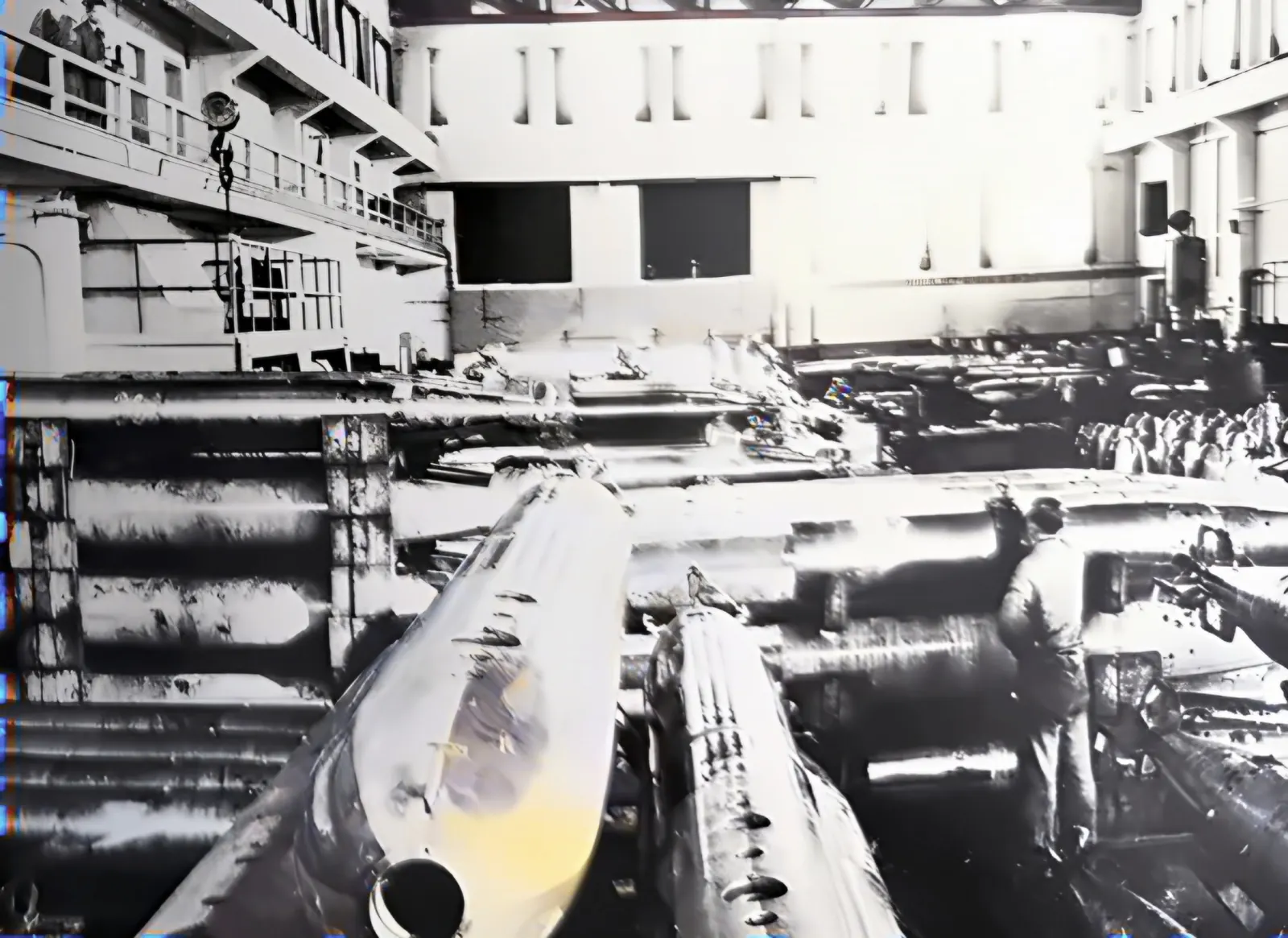
The firing-range hall full of torpedoes lying on racks
Fig. 141. Inside the firing range – torpedoes ready to be fired. F. Lauck, Der Lufttorpedo, München 1981
Diagram of the Hexengrund torpedo firing range From the cliff and the power station a pier about 300 metres long leads out to sea. Halfway along, a jetty with a crane branches off, sheltering the recovery-boat harbour. From the firing range at the end of the pier the torpedo runs on a bearing of 22 degrees. cliff of Kępa Oksywska (50 m) power station wooden pier approx. 300 m jetty with gantry crane recovery-boatharbour firing range (depth approx. 7 m) bearing 22° N

Diagram based on Lauck's description and aerial photographs from 1942. Proportions and angles approximate.

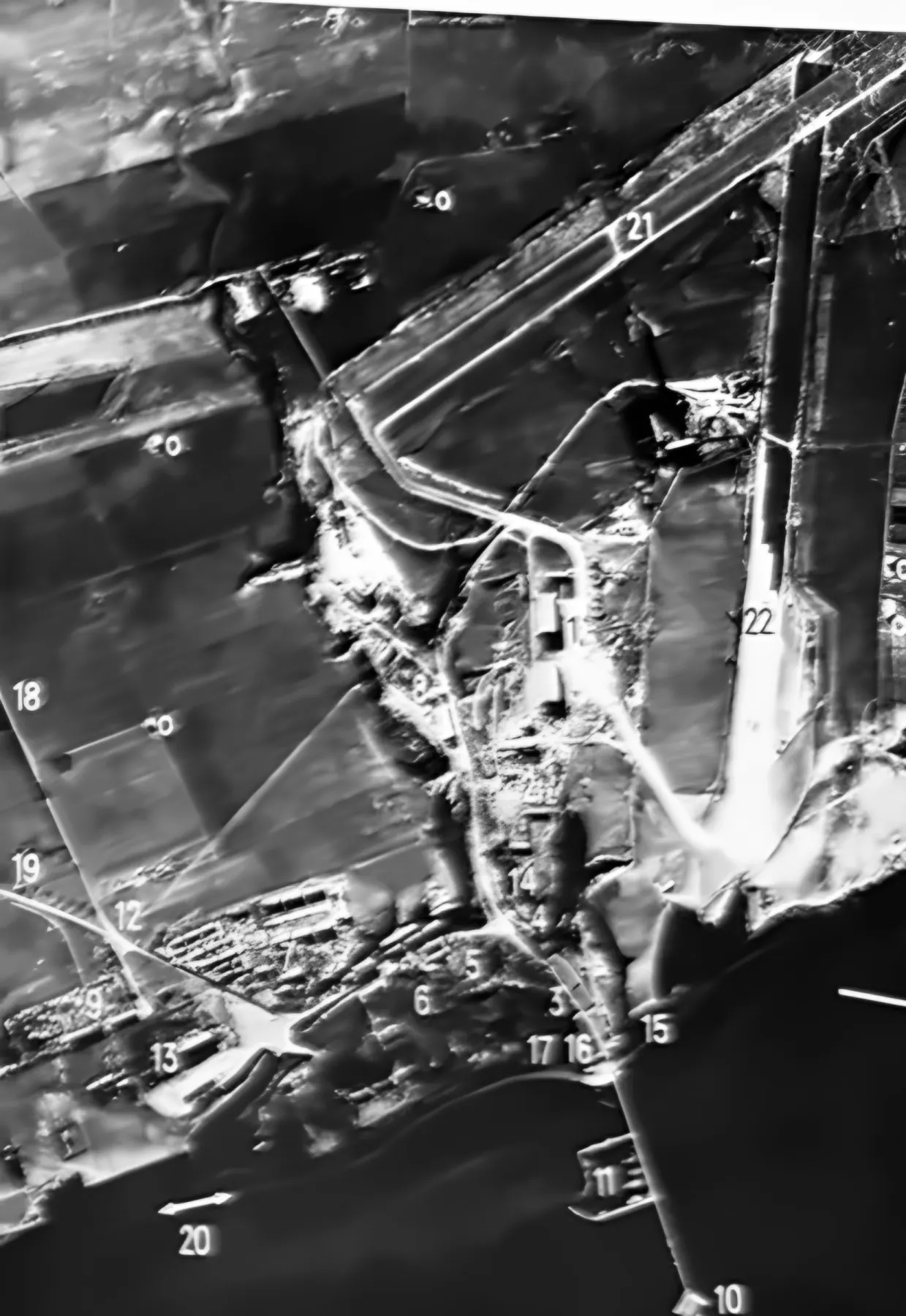
Aerial photograph 1944: what is what?

The German caption lists 22 features. Click a number to see what stood there.

Choose a point on the photograph.
  • 1Aircraft workshop with hangars
  • 2New office building
  • 3LT test workshop
  • 4Headquarters and trials management
  • 5Canteen, mess
  • 6Officers' quarters
  • 7Enlisted men's quarters
  • 8Luftmuna – ammunition depot (Major Mahling)
  • 9“Russian camp” – approx. 1,500 Ukrainians
  • 10Firing range
  • 11Recovery-boat harbour
  • 12Main guardhouse
  • 13Air-base commandant
  • 14TWP commander's residence
  • 15LT production
  • 16Power station
  • 17“Station” of the “Kaschuben-Express” light railway
  • 18Road to Obłuże
  • 19Road to Oksywie
  • 20Coastal railway (“Kaschuben-Express”)
  • 21Runway, 1,800 m
  • 22Small runway (extension under construction)
Vertical aerial photograph of the TWP from 1944 with numbered features
Fig. 143. Aerial photograph of the TWP with the facilities marked (1944), AI reconstruction. “o” – bomb craters; Lauck stresses that the bombs fell far from the target. F. Lauck, Der Lufttorpedo, München 1981
Tall compressors with pressure gauges in the power-station hall
Fig. 139. Air compressors in the power station. F. Lauck, Der Lufttorpedo, München 1981
German map of the Bay of Puck with the firing and drop directions marked
Fig. 113. Map of the Bay of Puck: firing direction from the Hexengrund range, the perpendicular drop direction, the drop point and three measuring bases south of Jastarnia (Heisternest). F. Lauck, Der Lufttorpedo, München 1981
Chapter 4 · The people of Hexengrund

Engineers, soldiers, and those the book is silent about

Listen to this chapter · 3 min 24 s

More than 30 engineers came from Travemünde, and young torpedo specialists from the navy. The establishment was divided into test groups: E I dealt with the body and the drop, E II with propulsion, E III with guidance (headed by Friedrich Lauck himself), E IV with sights, E V with fuzes, E VI with acoustic homing. Alongside them worked the workshops W I–W IV and the firing range.

Companies worked here too: Askania, AEG, Atlas, LGW and others; the AEG group at times numbered 30 people. Lauck lists dozens of disciplines – from hydroacoustics to explosives engineering.

The TWP worked closely with the Kriegsmarine establishment at Oksywie: both developed proximity fuzes and torpedo homing in parallel.

The payroll office served about 2,500 people. Some 200 clerks and assistants handled catering, quarters, clothing and the cash office. A military kitchen and a kitchen for civilians each served meals for 500 people. The airfield company numbered just under 200 soldiers, and the test squadron flew, among others, the Ju 52, He 111, Fi 156 and BV 141.

Some of the staff commuted from nearby villages such as Obłuże and Pogórze, or by the “Kashubian Express” – a light railway running along the shore from the direction of Oksywie. A Luftwaffe bus carried people from Spechtswalde, and a steamer from Gdynia.

Beyond the main gate stood the “Russian camp”. About 1,500 Ukrainians lived there, working in the workshops, on construction and in transport. Before arriving, the women took a course in “workshop German”: hammer, file, screw. Lauck does not say on what terms they came here. Ukrainian workers in the Reich in 1942–1945 were overwhelmingly forced labourers (Ostarbeiter). No one knows their names.

Roll call in front of the headquarters building on the day the TWP opened
Fig. 136. Opening of the Luftwaffe Torpedo Weapons Range Gotenhafen-Hexengrund, 4 July 1942. On the left the headquarters building – formerly the Polish quarantine station. F. Lauck, Der Lufttorpedo, München 1981
“The synthesis of officer and engineer – that was the practical and human guiding idea of Hexengrund.”
Entry by the head of trials in the diary for the departing commander, 19 March 1945.

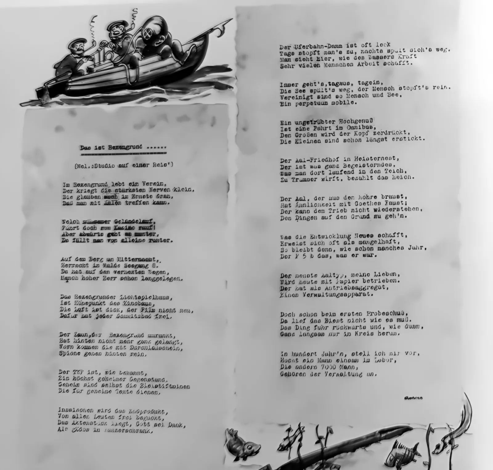
The house poet

The administration grew faster than the technical departments. The house poet summed it up in a poem about the “newest eel” – as torpedoes were called:

The newest type of eel, my dears, today is powered by paper. For its propulsion unit it has an administrative apparatus. But at the very first test shot the thing did not run as it should: it ran backwards and – how silly – only very slowly round in circles. “Der neu'ste Aaltyp, meine Lieben, / wird heute mit Papier betrieben …” – the rhymed German original; above, a translation of the sense.
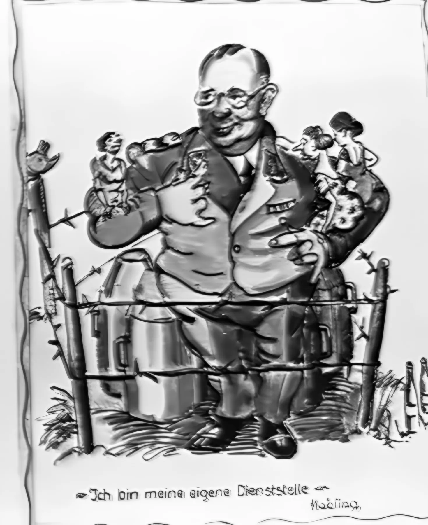
Caricature of a stout major sitting on ammunition crates
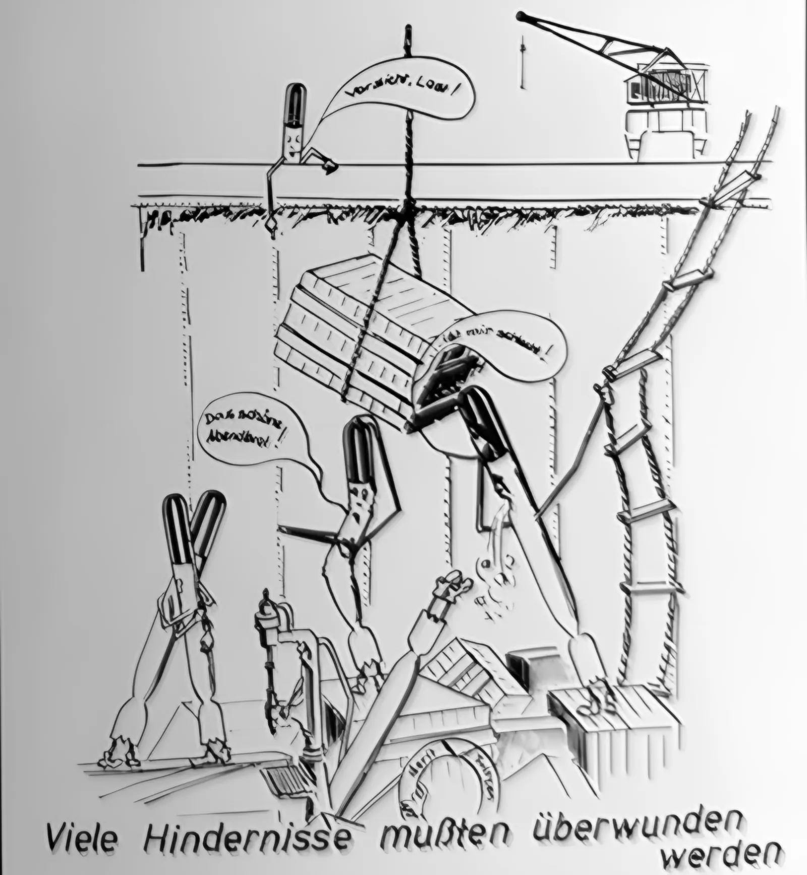
Fig. 156. “I am my own department” – caricature of Major Mahling, head of the Luftmuna, by the TWP draughtsman. F. Lauck, Der Lufttorpedo, München 1981
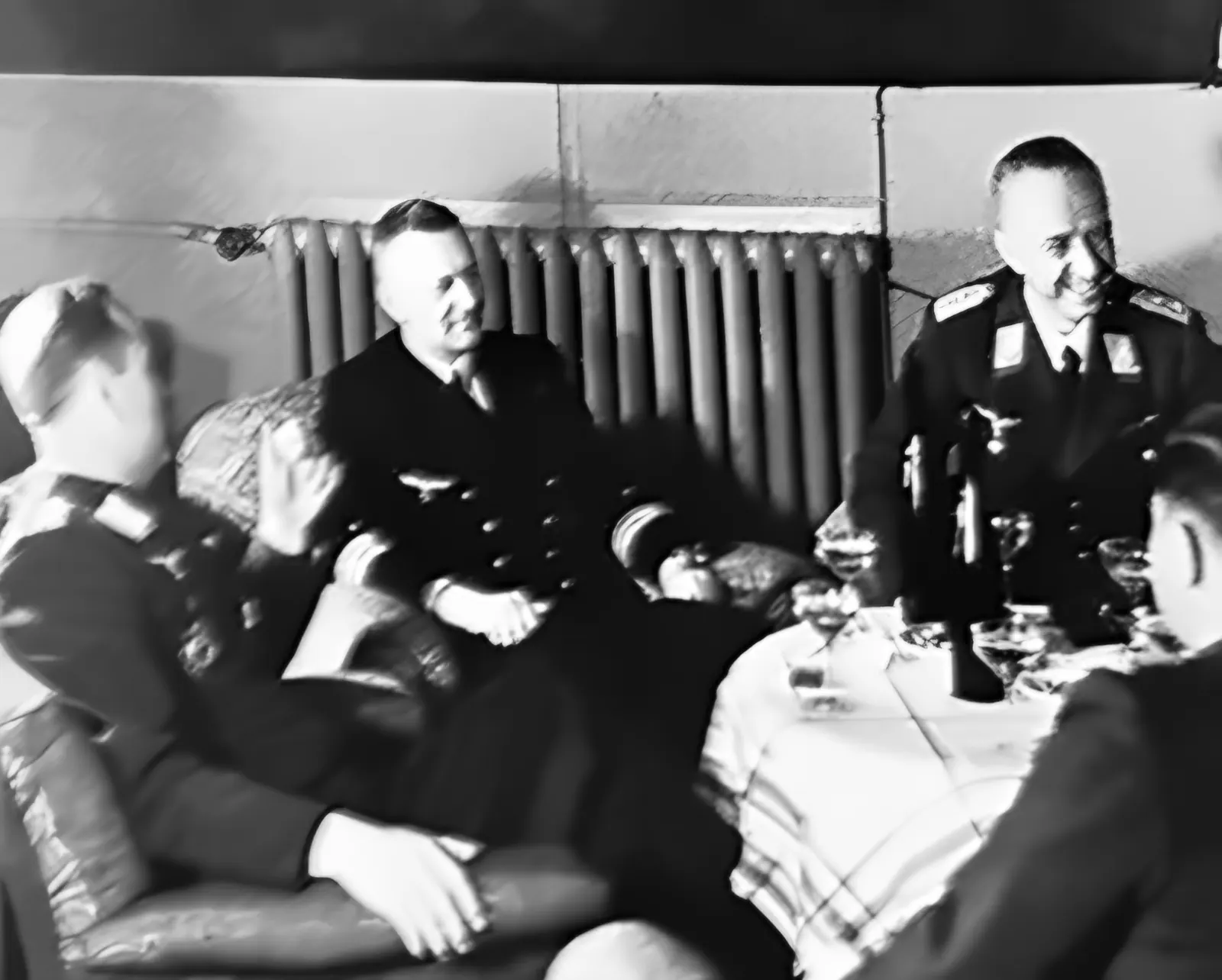
Four officers at a table in the mess
Fig. 155. The TWP under construction. A friendly briefing in the Hexengrund mess. From left: Major Sched (TWP), Lieutenant Commander Prall (TVA Oxhöft), Oberstingenieur Beckmann (TWP), Stabsingenieur Weikardt (E-Stelle Travemünde), mid-1942. F. Lauck, Der Lufttorpedo, München 1981
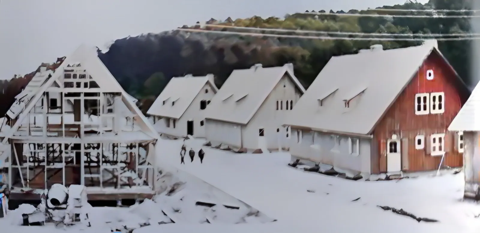
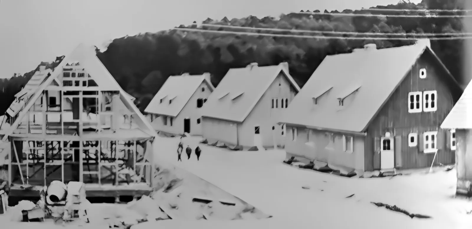
Wooden houses with gabled roofs under construction
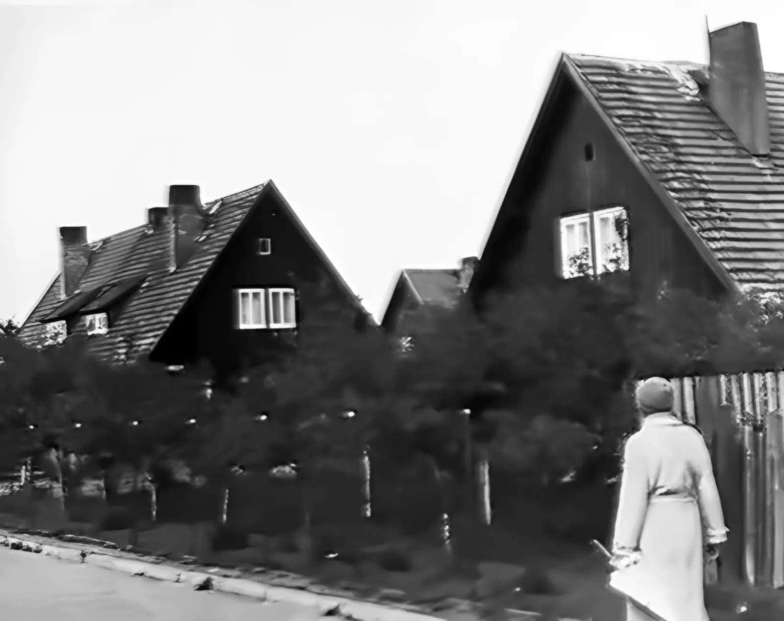
Fig. 146. Wooden houses of the Spechtswalde estate under construction (spring 1943). F. Lauck, Der Lufttorpedo, München 1981

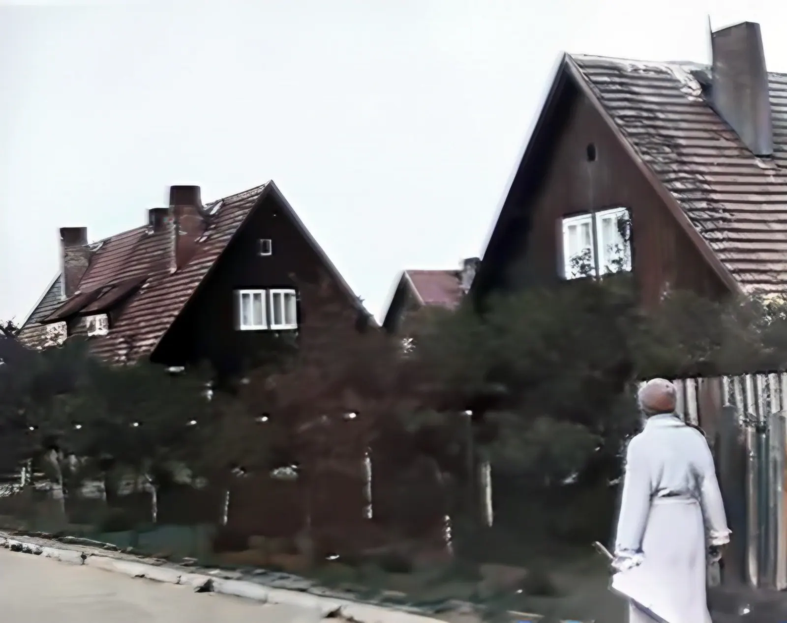
For about 30 families an estate of wooden houses, Spechtswalde, was built south of Chylonia (Kielau) – today around Pustki Cisowskie. A house had 86 m², five rooms, a bathroom and 180 m² of garden; the annual rent was 372 marks. The first residents moved in in July 1943. In 1981 Lauck noted that all the houses but one were standing and inhabited – including those in which the Lauck and Hillermann families had lived.

Wooden houses with gabled roofs behind a hedge, a woman in a light coat on the pavement
Fig. 172. The Spechtswalde estate on 12.09.1979. On the left the former homes of Lauck and Eger, on the right Hillermann's house. F. Lauck, Der Lufttorpedo, München 1981
Archive brought to life

Frames that move

Each photograph passed through three AI models: sharpness reconstruction (Real-ESRGAN), colourisation (DDColor) and scene-depth estimation (Depth Anything V2). From the depth map the browser builds a 2.5D camera movement in real time – move the cursor or tilt your phone.

2.5D · AI
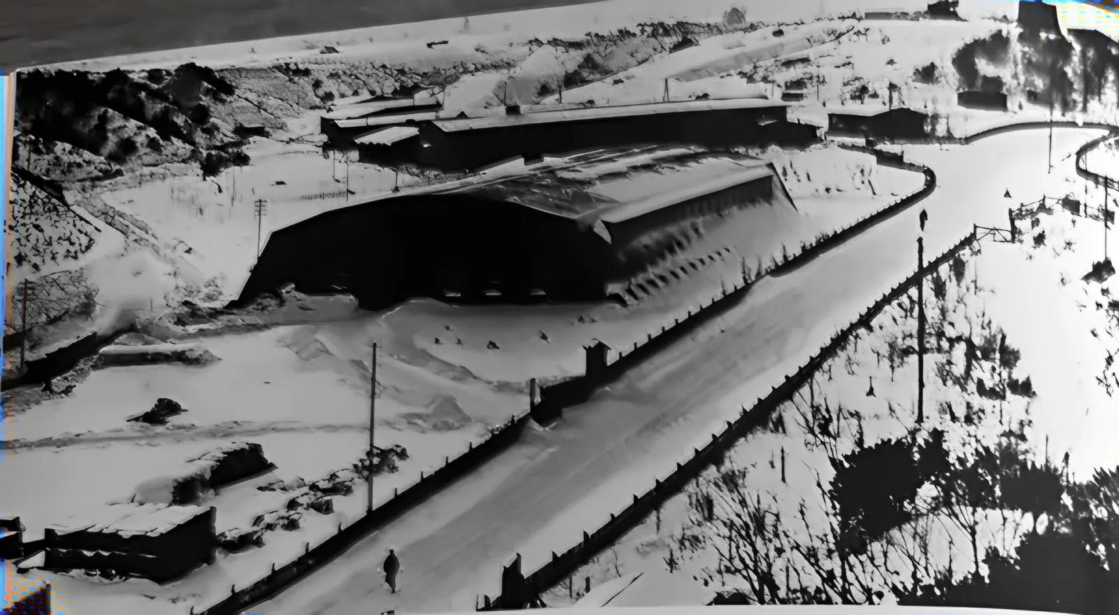
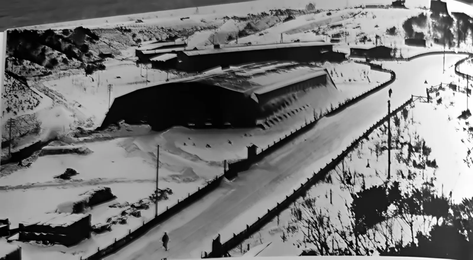
A snow-covered ravine with a large hall and a winding road
Fig. 145. Hexengrund in winter 1944 – looking inland.
2.5D · AI
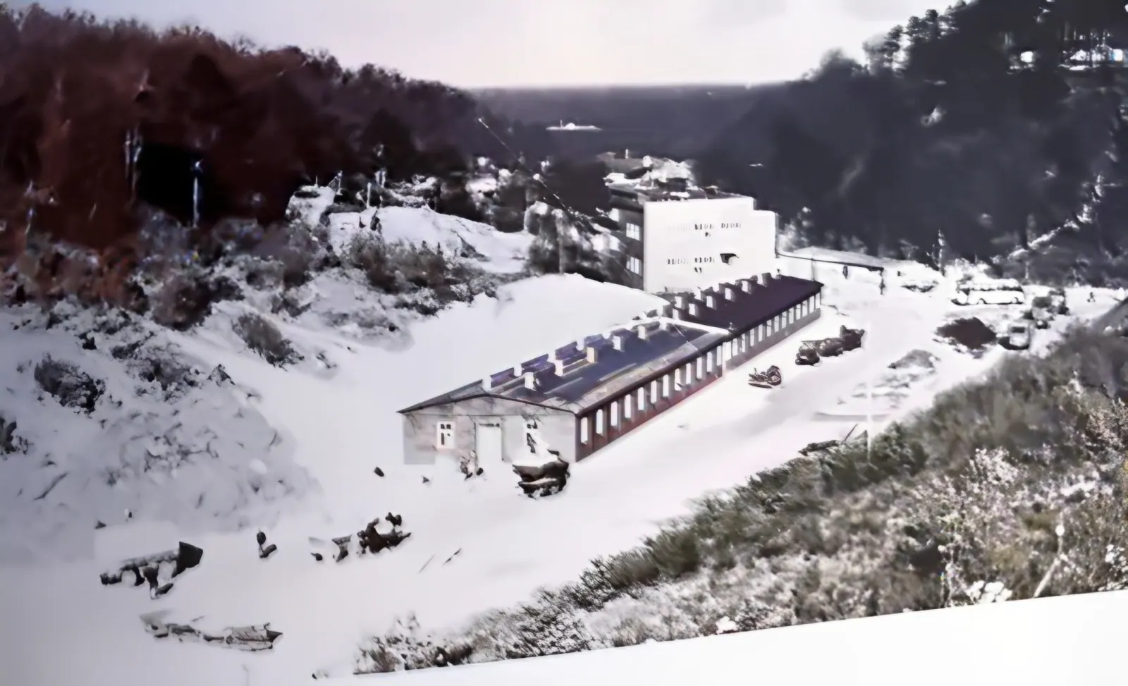
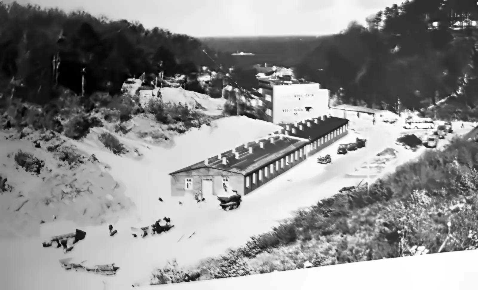
The Babie Doły ravine in summer, barracks and an office building, the sea behind
Fig. 144. Hexengrund in summer – looking out to sea.
2.5D · AI
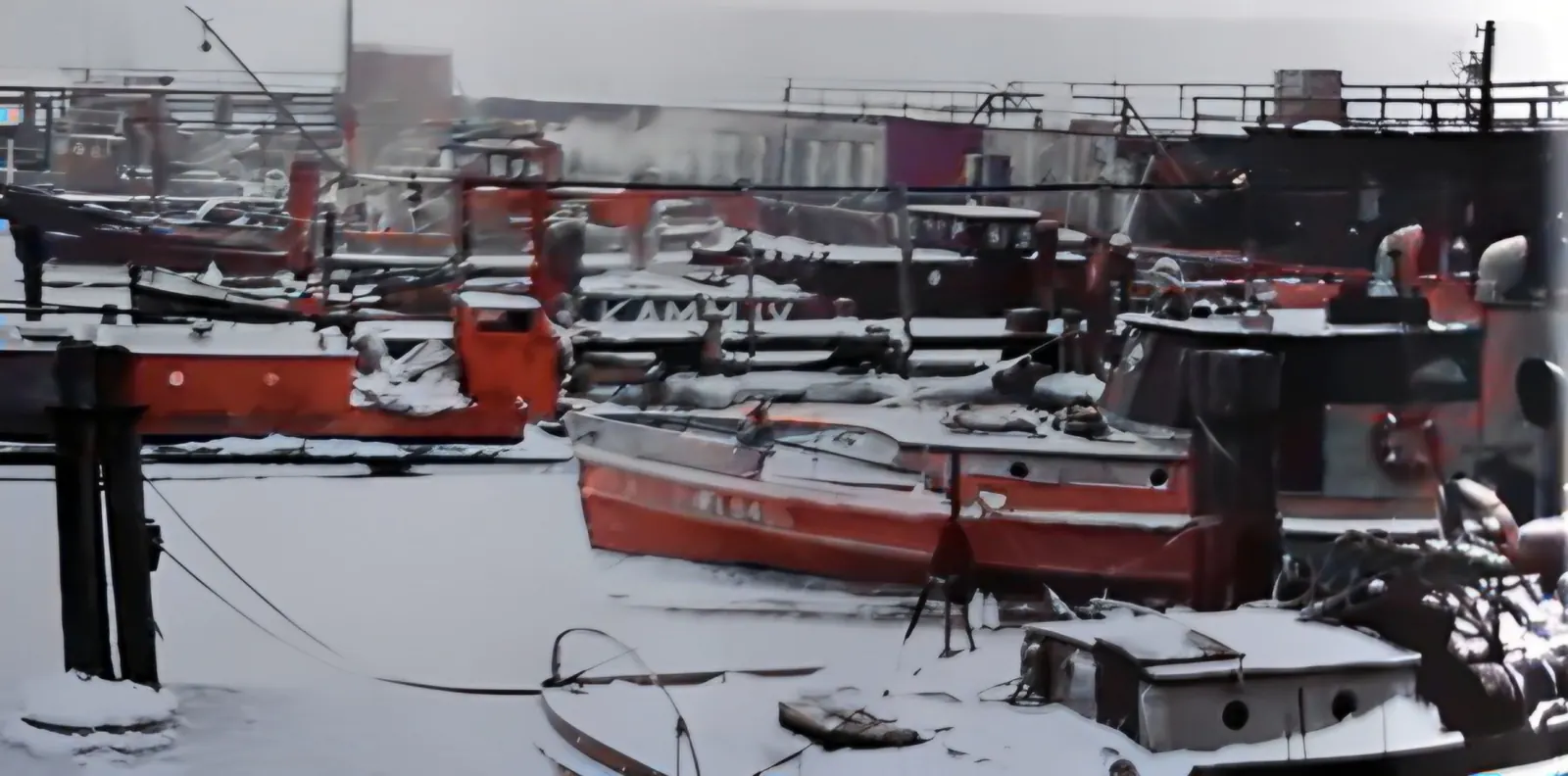
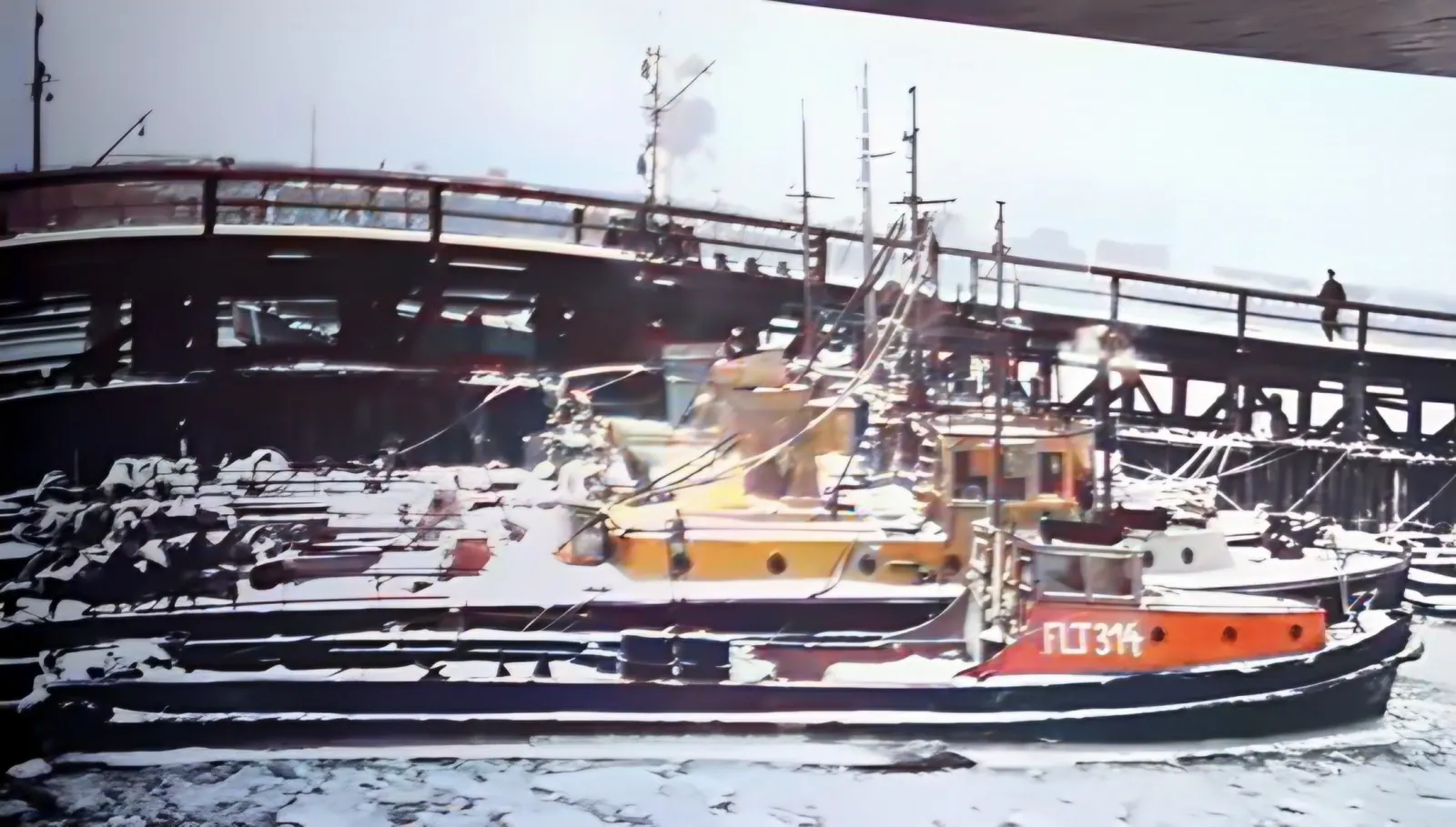
Snow-covered boats in the harbour by the wooden pier
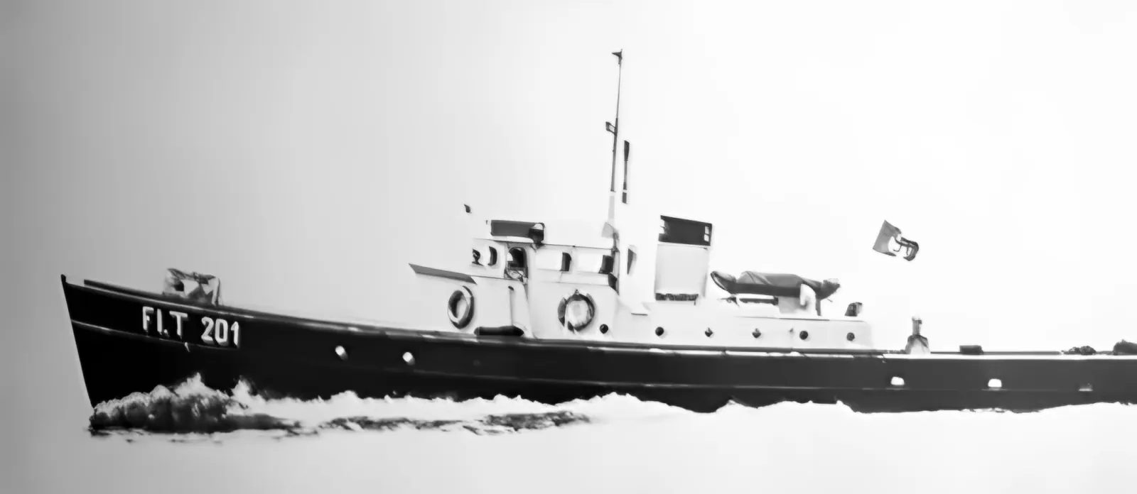
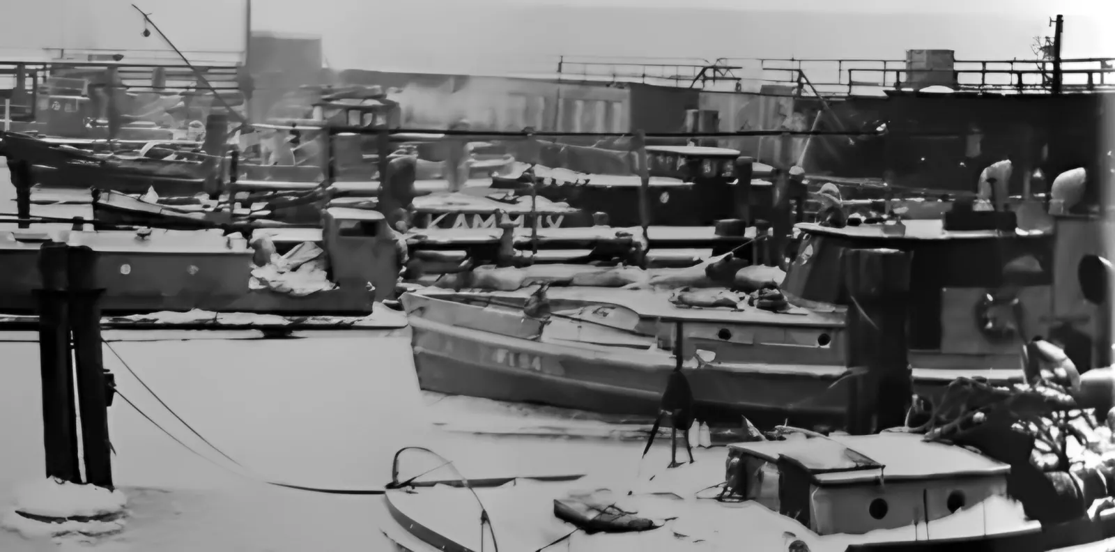
Fig. 160. Winter lay-up in the Hexengrund recovery-boat harbour (1944/45).
2.5D · AI
Passengers waving from the deck of the steamer Albatros
Fig. 147. The “Albatros” carries the staff by sea to Gotenhafen (1944).
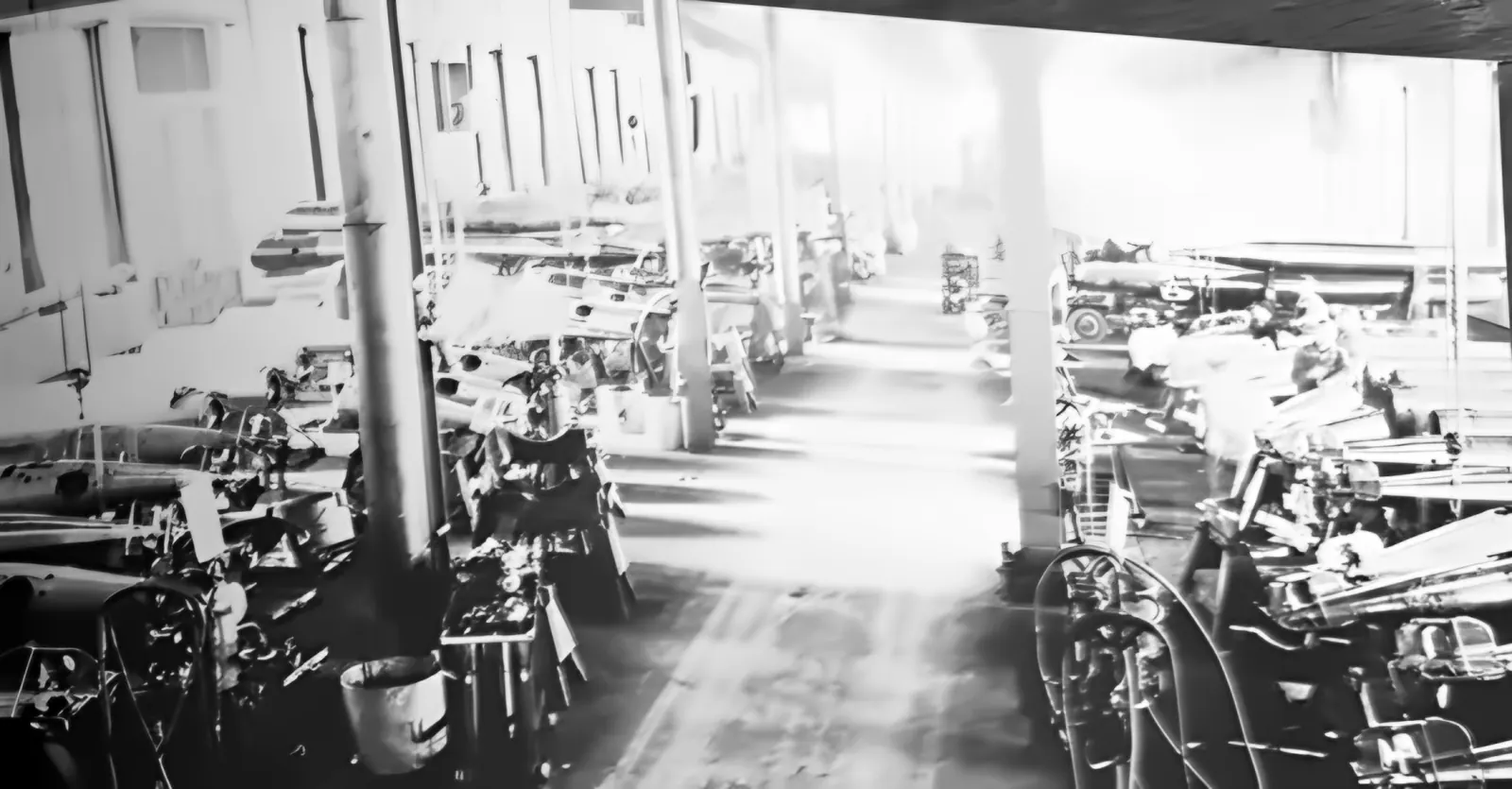
2.5D · AI
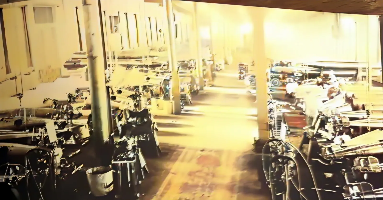
A long workshop hall with rows of torpedoes on stands
Fig. 148. Inside the LT workshop.
2.5D · AI
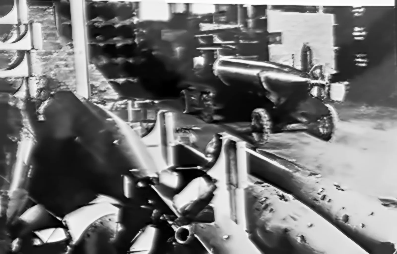
A torpedo leaving a launcher on the side of a ship
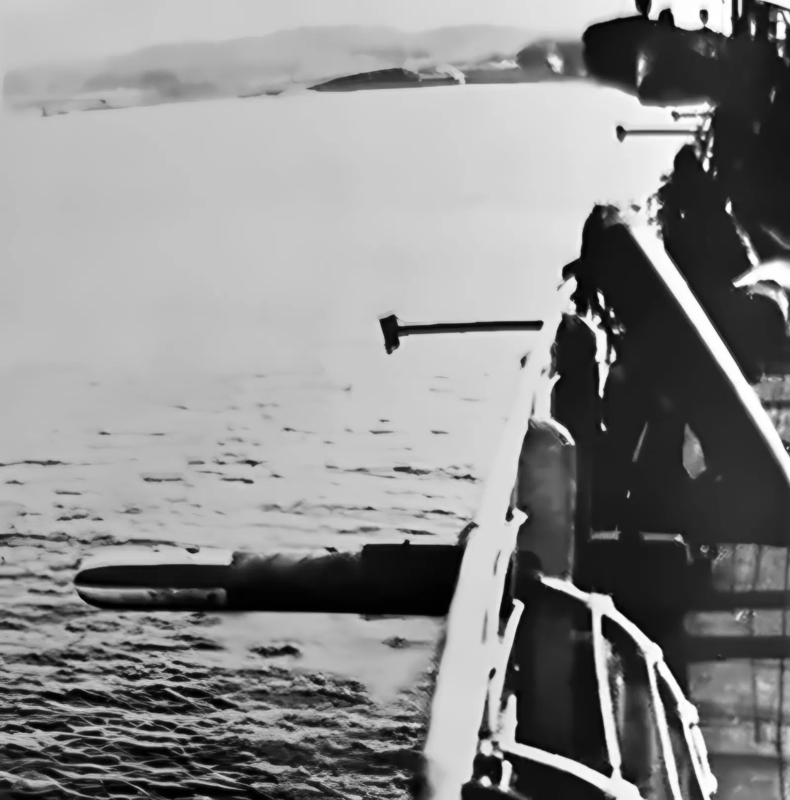
Fig. 153. A torpedo fired from the “Eberstein” (1943).
2.5D · AI
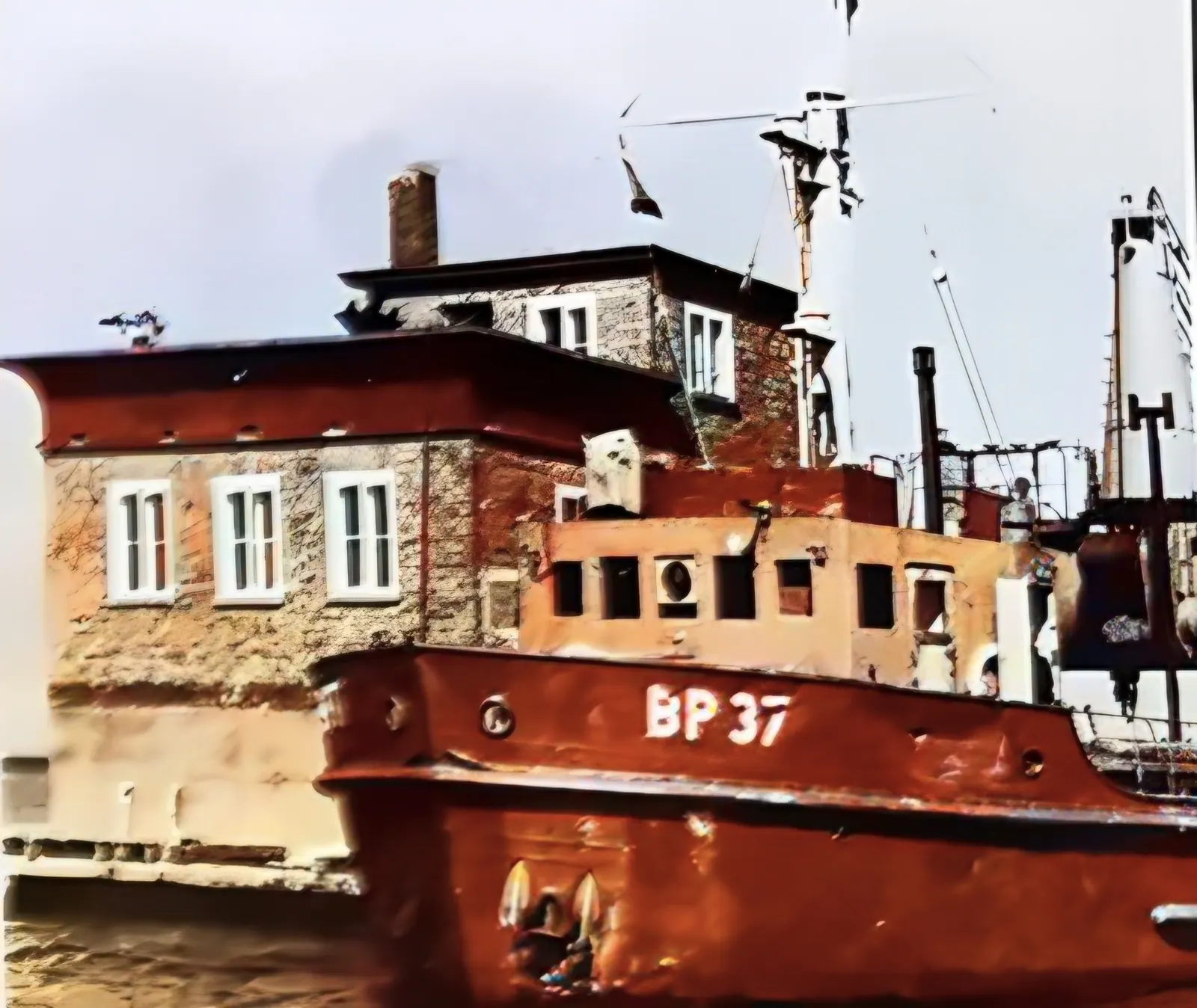
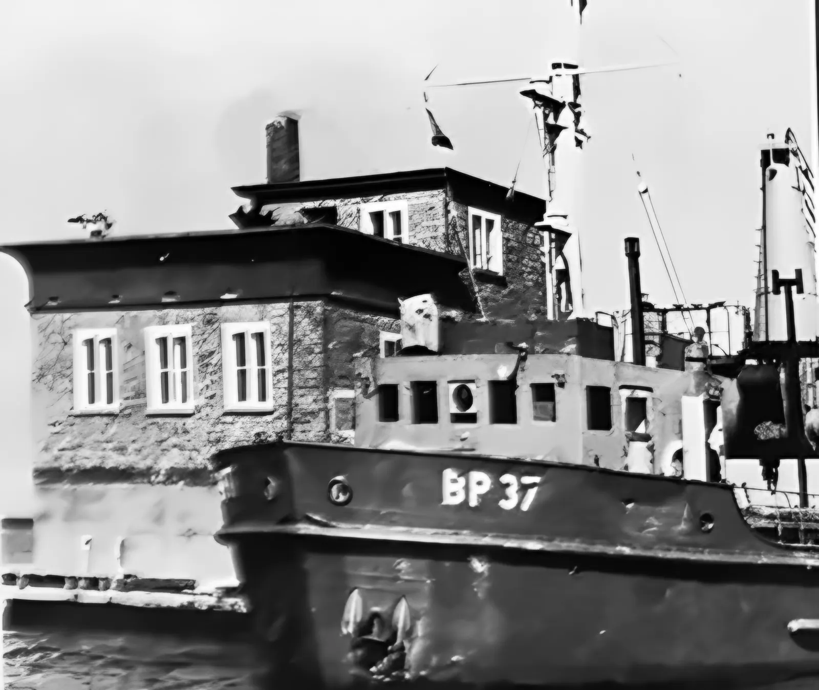
A brick measuring tower in the sea with the vessel BP 37 moored to it
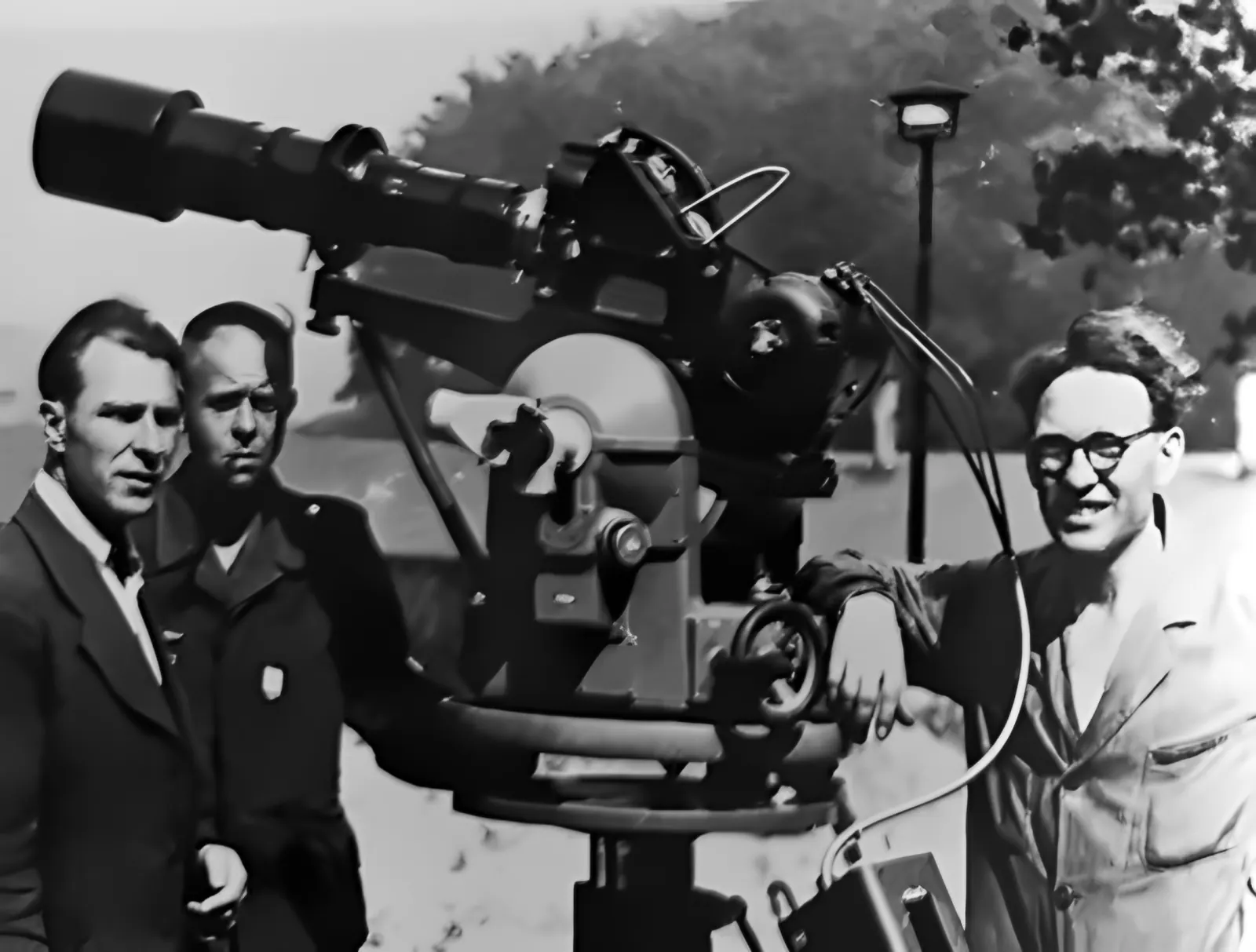
Fig. 116. One of the three measuring bases – a cine-theodolite on the upper platform.
2.5D · AI
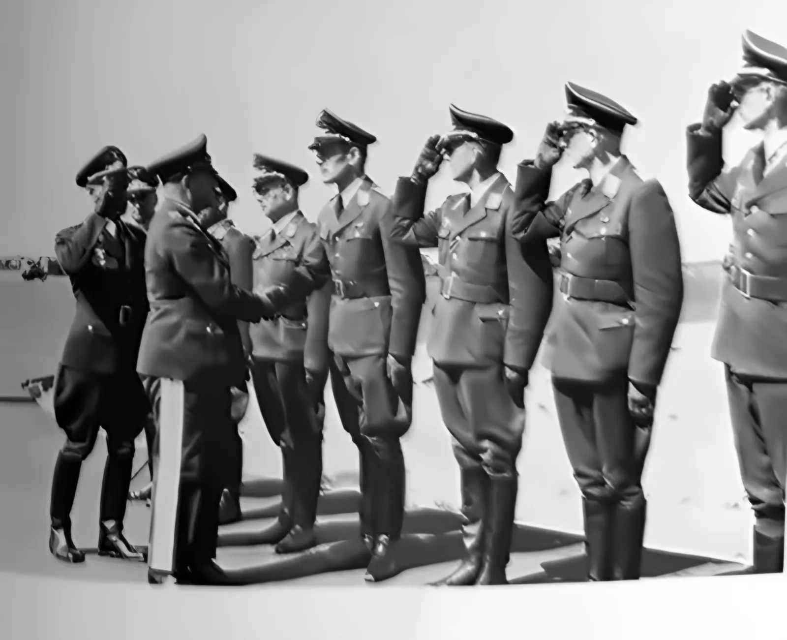
Roll call in front of the headquarters building on the day the TWP opened
Fig. 136. Opening of the Luftwaffe Torpedo Weapons Range Gotenhafen-Hexengrund, 4 July 1942.
2.5D · AI
The firing-range hall full of torpedoes lying on racks
Fig. 141. Inside the firing range – torpedoes ready to be fired.
2.5D · AI
Recovery boats by the wooden pier in winter
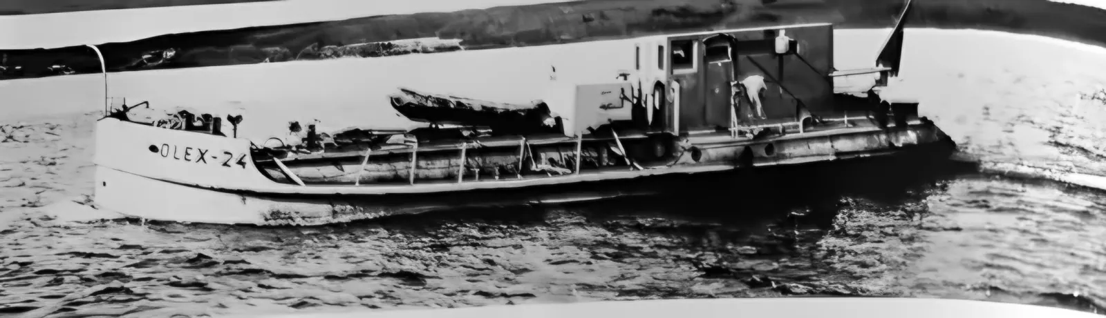
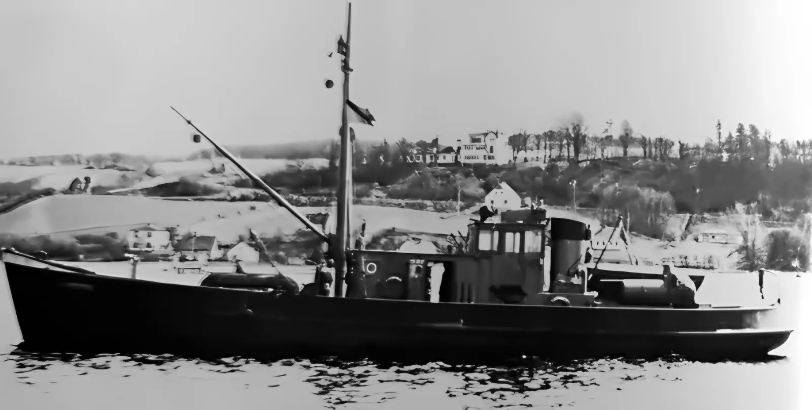
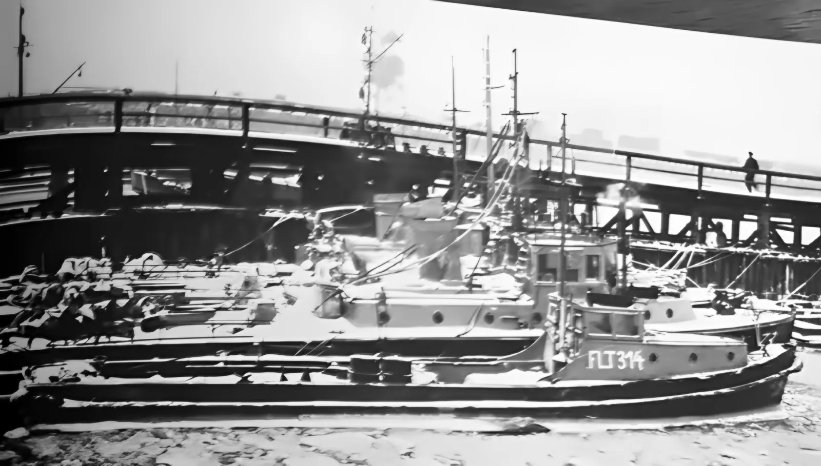
Fig. 161. Recovery boats at Hexengrund, early 1945: three boats of the Fl.T IV class and Fl.T 314.
2.5D · AI
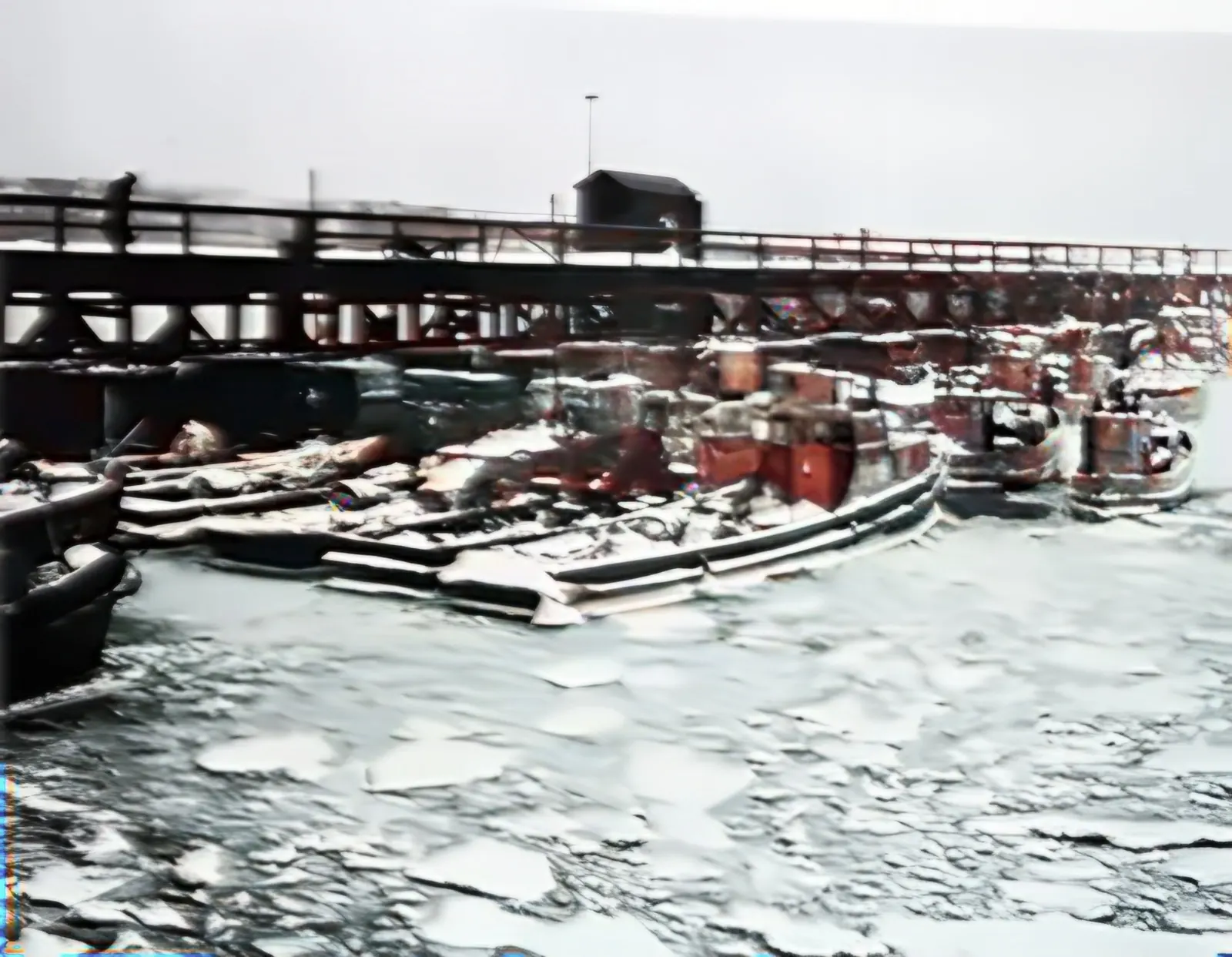
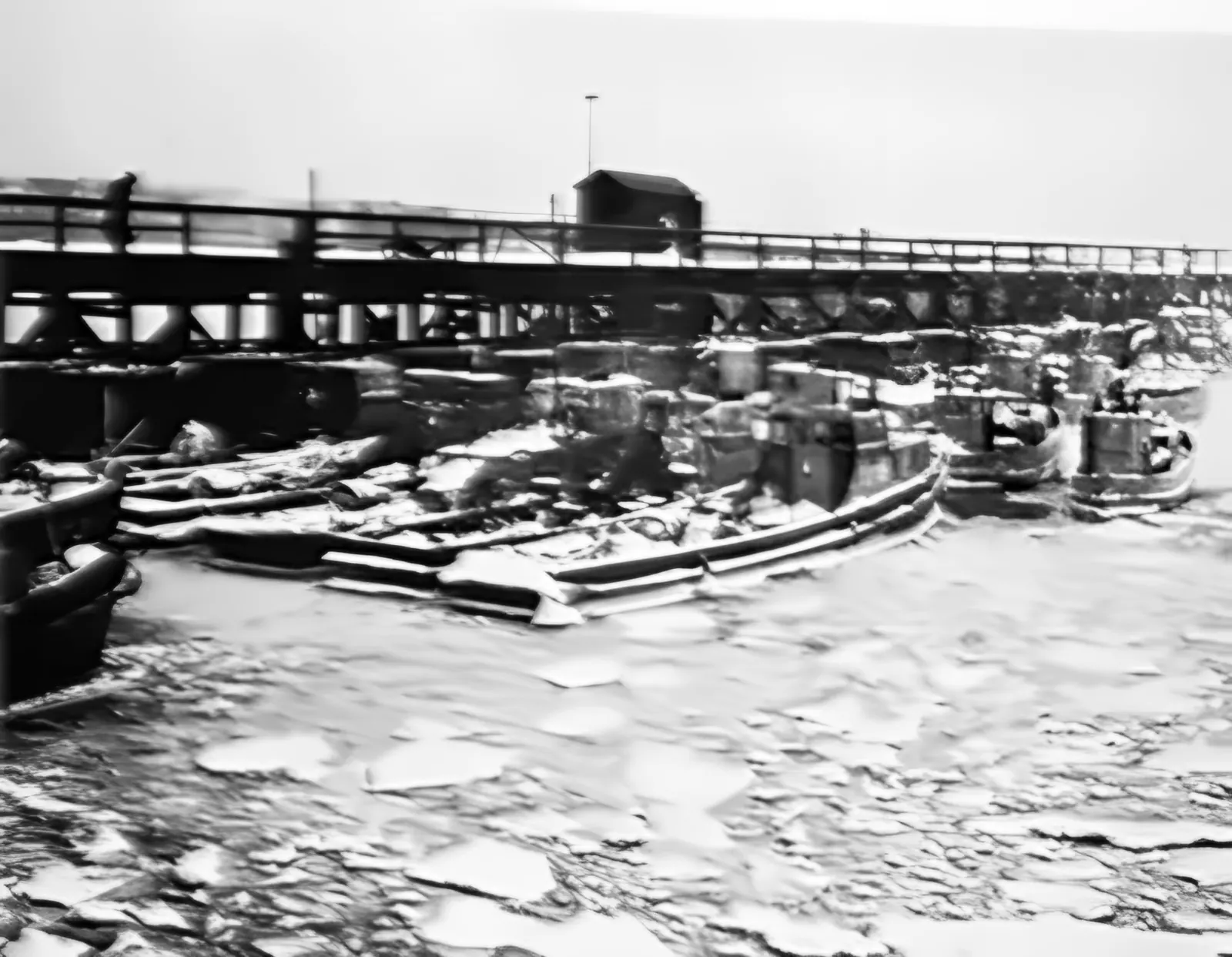
Boats locked in ice by the long pier
Fig. 162. Outside Hexengrund harbour, January 1945 – about 15 recovery boats and launches among the ice floes.
2.5D · AI
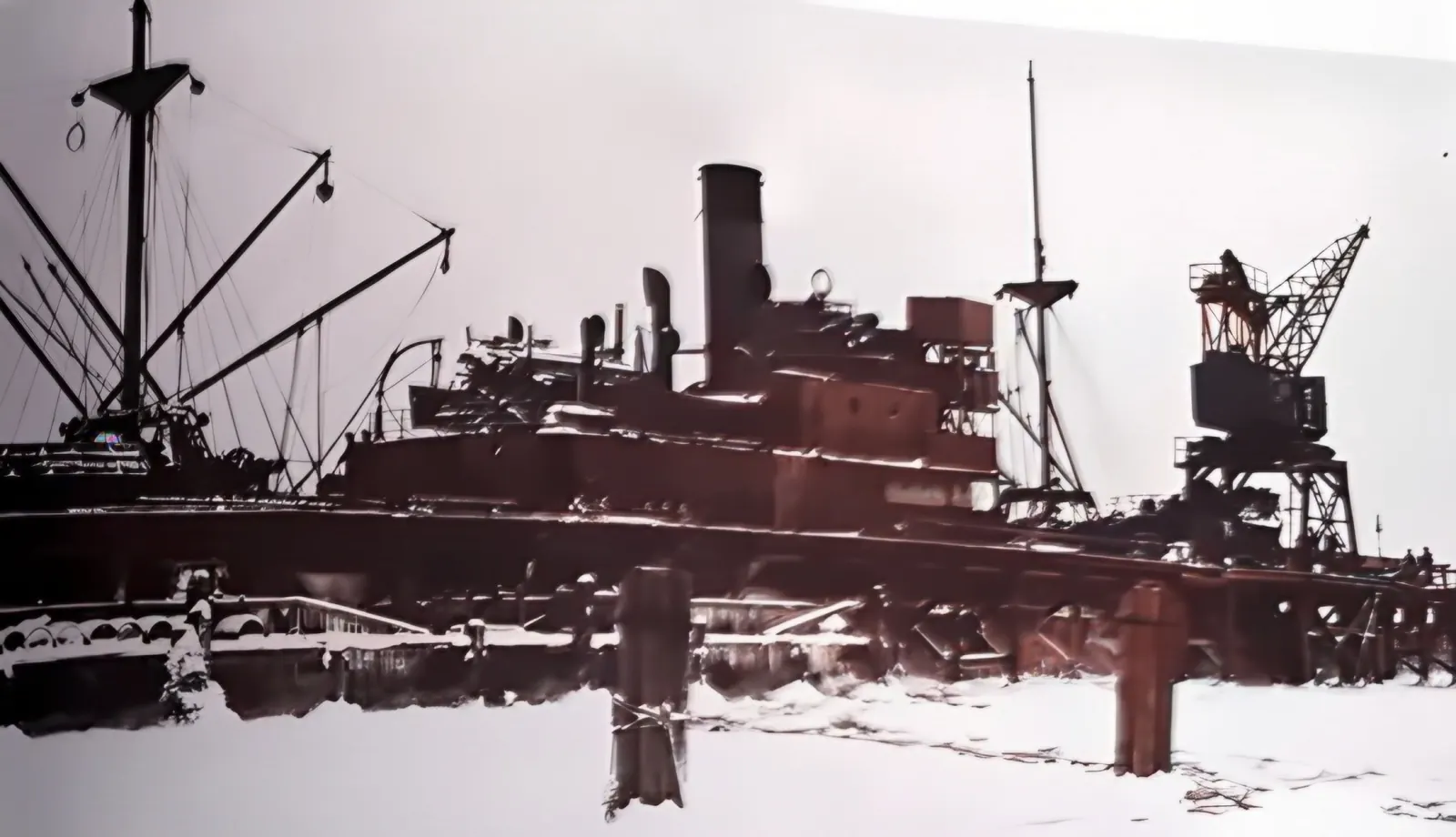
A freighter by the snow-covered pier with a gantry crane
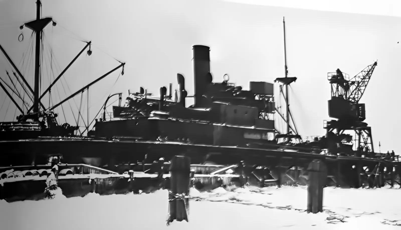
Fig. 167. The evacuation ship “Gerrit Fritzen” by the recovery-boat harbour, January 1945.
Chapter 5 · January–April 1945

Frost, storm and the last voyage

Listen to this chapter · 3 min 22 s

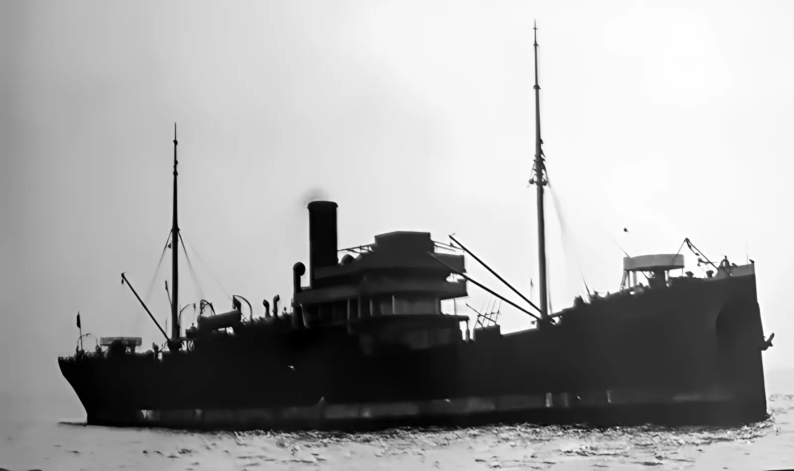
At the end of January 1945 there was a fierce frost at Hexengrund and deep snow. The Red Army stood outside Elbląg (Elbing). A special group was to keep preparing homing torpedoes and torpedoes with proximity fuzes until the last moment; the rest of the equipment was to be taken to Travemünde by the freighter “Gerrit Fritzen”.

The ship was moored at the jetty outside the harbour. When a strong east wind got up, a long swell began to push her rhythmically against the wooden structure. The gantry crane started to sway and threatened to fall onto the bridge. The captain could not back out – he went full speed ahead and broke through the pier leading to the firing range. The firing range's power supply was cut and its work was over.

On 31 January the “Gerrit Fritzen” sailed, having been anchored in the roads beforehand and loaded from boats. She sailed along the route on which the “Wilhelm Gustloff” had sunk the night before. She arrived. Six weeks later, on 12 March 1945, she was sunk by bombs while carrying refugees from the Gulf of Gdańsk.

A freighter by the snow-covered pier with a gantry crane
Fig. 167. The evacuation ship “Gerrit Fritzen” by the recovery-boat harbour, January 1945. F. Lauck, Der Lufttorpedo, München 1981
Book scan: the broken pier
Version reconstructed and colourised by AI: the broken pier
Book scanAI: reconstruction + colour

Fig. 168. The pier destroyed by the “Gerrit Fritzen”, January 1945. F. Lauck, Der Lufttorpedo, München 1981

“On 30 January there was a snowstorm and bitter cold. As motor vehicles could not get through, the group responsible for provisions had to travel from Hexengrund to Gotenhafen by horse-drawn sledge. […] The straw bales for lining the cattle wagons still had to be fetched from Oksywie. A hastily organised column of horse sledges managed it at the last minute.” — F. Hartenbach, head of the TWP payroll office, on the rail transport of 31.01–7.02.1945

Major Sched began the evacuation against the orders of his superiors (the head of GL). Major Pflaume was in charge of the rail transport. According to Hartenbach, many residents of Gotenhafen and the surrounding area – former Polish citizens, “Kashubians and those Germanised after 1939” – stayed behind. On 8 February the steamer “Lotte” sailed with machinery for torpedo production.

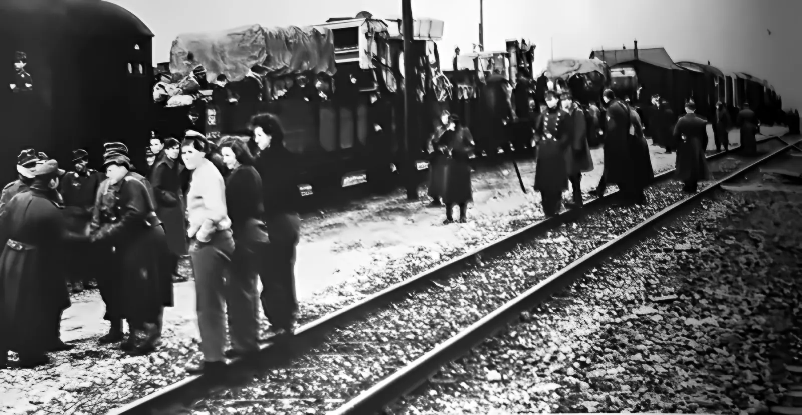
People in coats and uniforms by the tracks next to a long freight train with loads under tarpaulins
Fig. 171. The TWP relocated by rail (February 1945). F. Lauck, Der Lufttorpedo, München 1981

Two ships and two trains carried almost the entire staff to the west. A few families with infants were flown out on 26 January in a Ju 52. A rear detachment stayed behind. Gdynia fell on 28 March. On the night of 4 to 5 April, in Operation “Walpurgis Night”, the navy ferried 8,000 soldiers and about 30,000 refugees from Kępa Oksywska to Hel.

“My last impression from the ship was a huge sea of fire, in which the officers' mess and all the barracks on the hill went down.”
Oberstabsintendant Alfred Eisenach, the last TWP official at Hexengrund

After the evacuation

The rear detachment was to save equipment by sea. In January four of the larger TWP boats helped carry refugees on the route Piława (Pillau)–Hel–Ustka (Stolpmünde); on the way back the diving vessel “Sirius” sank in a storm because her scuppers froze. The core of the detachment left for Travemünde after 17 February on the torpedo transport “Delphin”. An attempt to return for equipment at the end of March got stuck in Sassnitz, in a mined harbour.

In Travemünde the first special torpedoes were fired as early as 21 February 1945. At the end of March the TWP was disbanded: some of its people joined department E 9 of the Travemünde establishment, the younger ones were sent to the front. In April 26 special torpedoes went to Norway on the “Delphin” and reached the area of Trondheim by rail on 6 May. They were neither used nor did they fall into enemy hands.

The most important documents were soldered into a torpedo head and sunk in the Pötenitzer Wiek. Someone informed the British; the documents were only raised when the British threatened to replace the German divers with their own. The Allies collected all the documents on aerial torpedoes, translated them and put them on microfilm. The originals returned to West Germany in the early 1960s.

Boats locked in ice by the long pier
Fig. 162. Outside Hexengrund harbour, January 1945 – about 15 recovery boats and launches among the ice floes. F. Lauck, Der Lufttorpedo, München 1981
The firing-range building in the sea and the broken pier
Fig. 169. The cut-off firing range without power (January 1945). F. Lauck, Der Lufttorpedo, München 1981
Chapter 6 · After the war and today

A castle with no road to it

Listen to this chapter · 1 min 54 s

After the war the area was taken over by the Polish military. The airfield at Babie Doły serves Polish naval aviation, and since 2006 the Open'er festival has been held there every year. The Oksywie torpedo station – known as “Formoza” – carried on working: torpedoes were still fired from it in the 1980s, and a special forces unit took over its name.

The one at Babie Doły was less fortunate. The Russians removed its equipment, the harbour silted up, and the wooden pier was dismantled and blown up. It appeared in films – from “Four Tank-Men and a Dog” to “Kryminalni” – and by 2019 it was in such poor condition that German television built a copy of it on the Gdynia promenade.

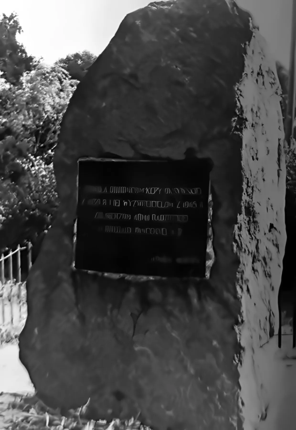
This is how Lauck saw the place – the photographs for the book were taken in 1979, some of them on 12 September. The area was military and closed to the public. On the hill, where the mess and barracks had stood, blocks of flats had gone up, and at their start a wartime fighter aircraft had been placed on a tall pylon. A path between the remains of the barracks led to the cliff, from where the burnt-out walls of the firing range could be seen – the wooden pier was already gone. At the bus terminus stood a boulder with a plaque commemorating the defence of Kępa Oksywska in 1939 and the liberation in 1945. The Oksywie torpedo station, Lauck wrote, unlike the one at Hexengrund, looked well preserved.

The firing range in January 1945
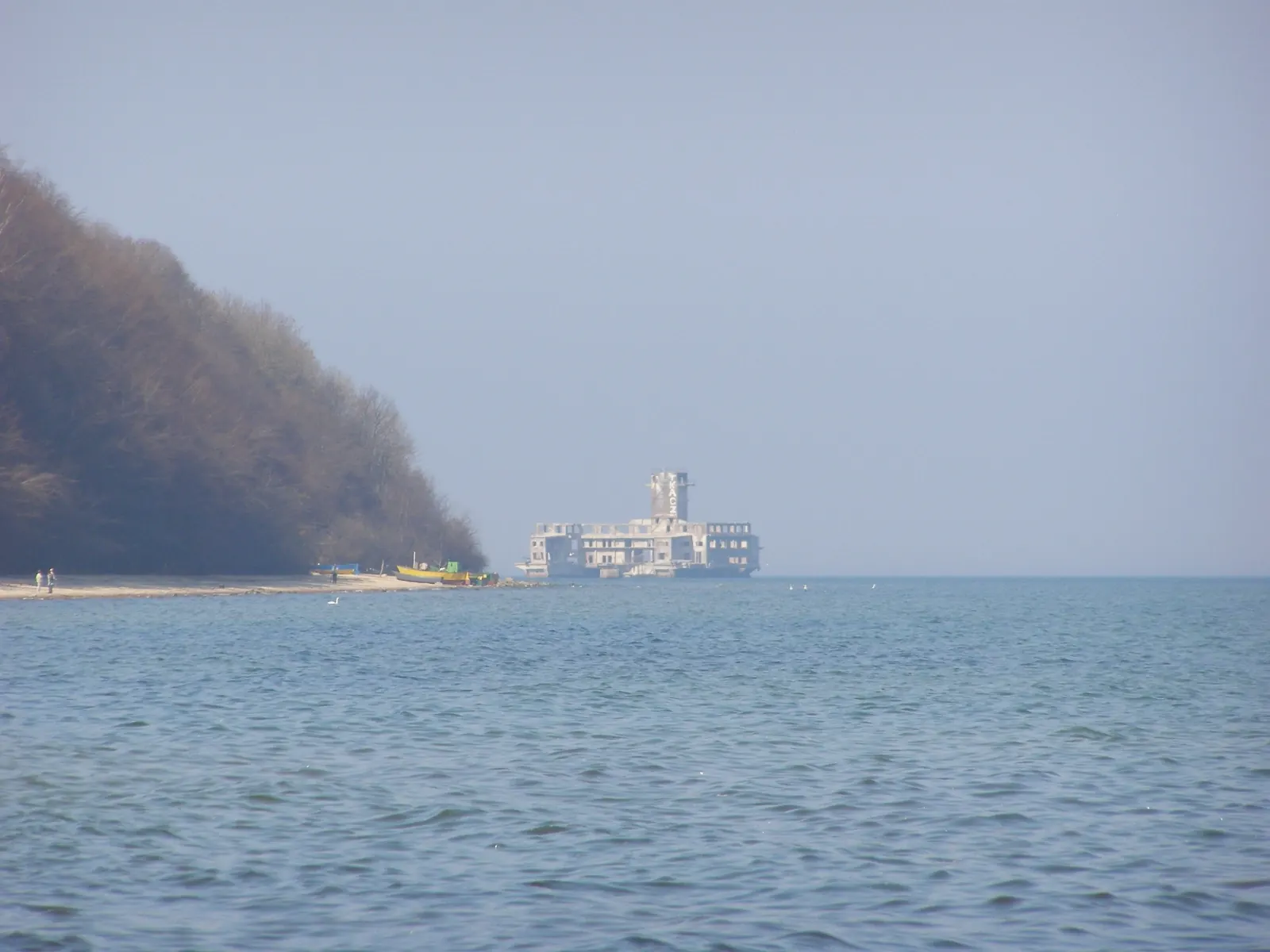
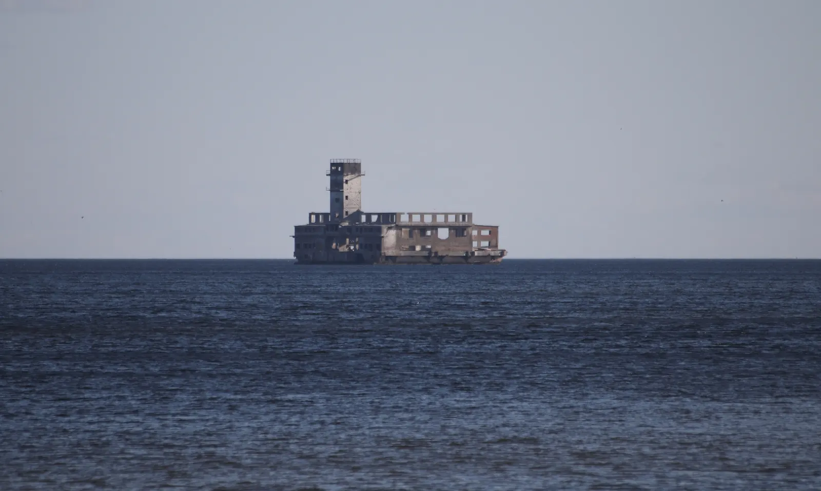
The torpedo-station ruin seen from afar in 2009
January 19452009

Then and now: fig. 169 (Lauck) and photo Andrzej Otrębski, CC BY-SA 3.0. Taken from different positions.

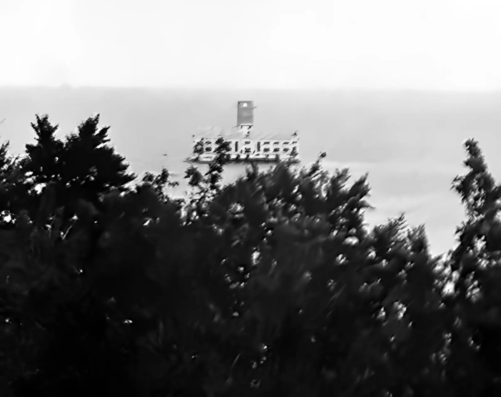
The firing-range ruin in the sea seen from the cliff through trees
Fig. 174. View of the firing range “today” (12.09.1979). F. Lauck, Der Lufttorpedo, München 1981
A large boulder with a dark inscribed plaque, trees and a fence behind
Fig. 173. Boulder with a bronze plaque at the entrance to Hexengrund (1979). F. Lauck, Der Lufttorpedo, München 1981
How to see the torpedo station? Best from the beach at Babie Doły (ZKM Gdynia bus to the Babie Doły terminus, then down to the sea), from the beach at Oksywie or from Mechelinki. In summer there are kayak tours and yacht trips around the ruin. Do not go inside – the structure is ruined, there is no pier, and the clifftop area is military.
Ruins of the torpedo station and remains of the pier piles, 27.09.2014
Ruins of the torpedo station and remains of the pier piles, 27.09.2014. Photo: Piotr Chomiak, CC BY 3.0, Wikimedia Commons
The torpedo station seen from Mechelinki, 6.03.2021
The torpedo station seen from Mechelinki, 6.03.2021. Photo: Andrzej Otrębski, CC BY-SA 4.0, Wikimedia Commons
The beach at Babie Doły – the torpedo station is visible from the shore
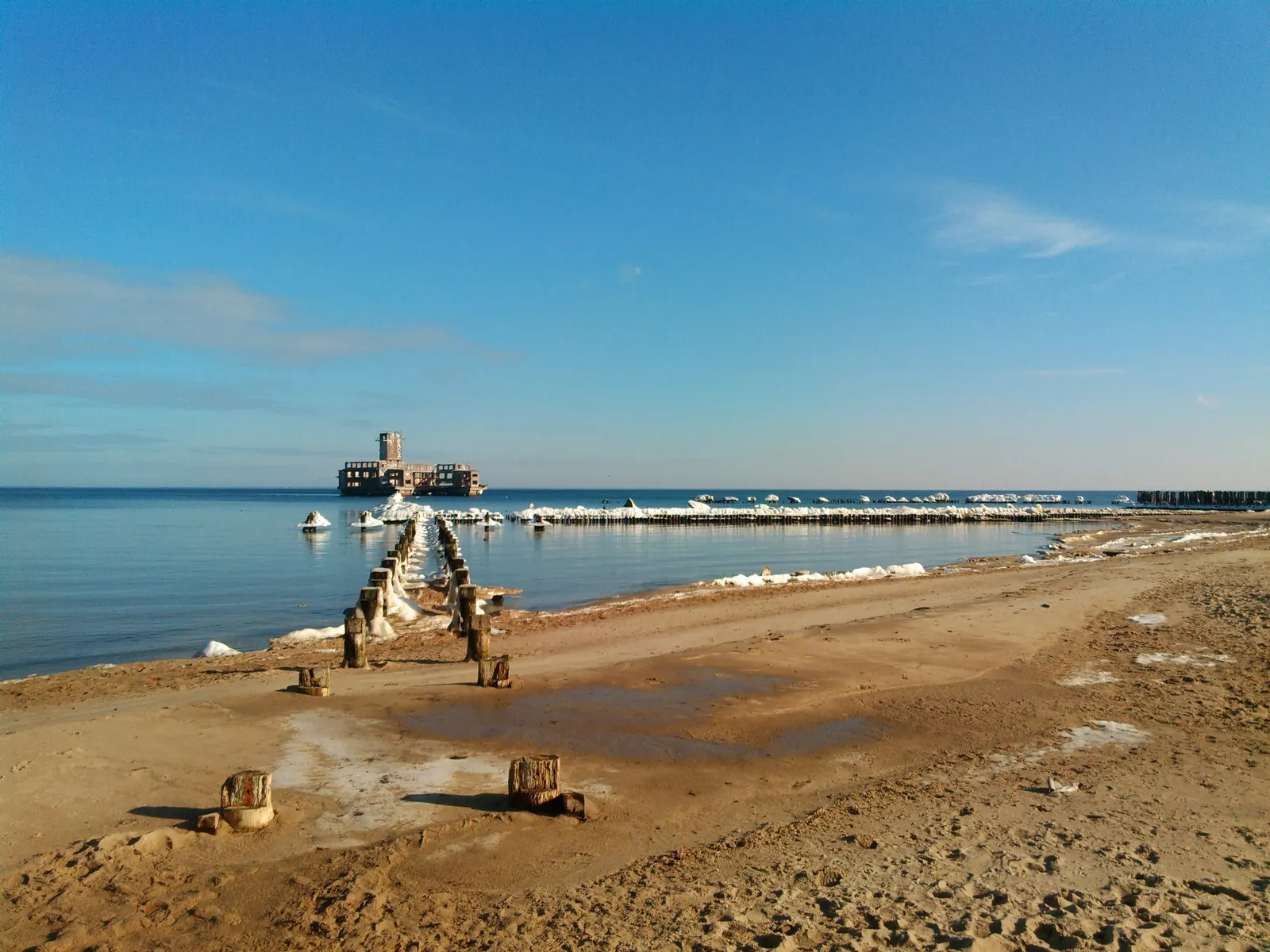
The beach at Babie Doły – the torpedo station is visible from the shore. Photo: Karo Karo, CC BY 3.0, Wikimedia Commons
A row of piles of the former torpedo-station pier, 2018
A row of piles of the former torpedo-station pier, 2018. Photo: Karo Karo, CC BY 3.0, Wikimedia Commons
The torpedo station from the air, 5.07.2007
The torpedo station from the air, 5.07.2007. Photo: Jack11 Poland, CC BY-SA 3.0, Wikimedia Commons
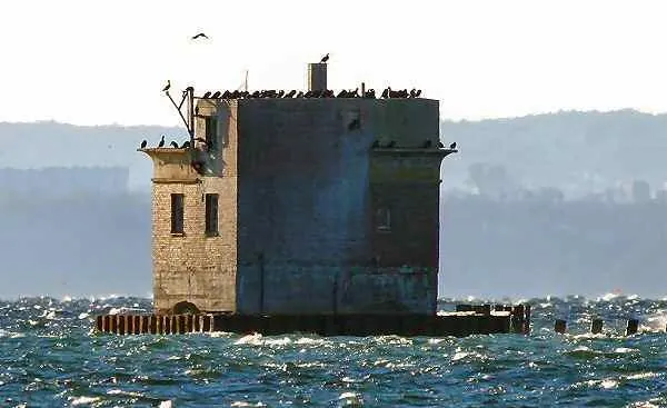
Ruin of a measuring tower in the Bay of Puck near Jurata, 2024
Ruin of a measuring tower in the Bay of Puck near Jurata, 2024. Photo: Dwxn, CC BY-SA 4.0, Wikimedia Commons
Chapter 7 · Today, from the water

The torpedo station from the water

Listen to this chapter · 1 min 18 s

The Babie Doły torpedo station – Hexengrund – is today a heavily damaged structure that is gradually being worn down by winter storms. There is no way to reach it and get onto it safely.

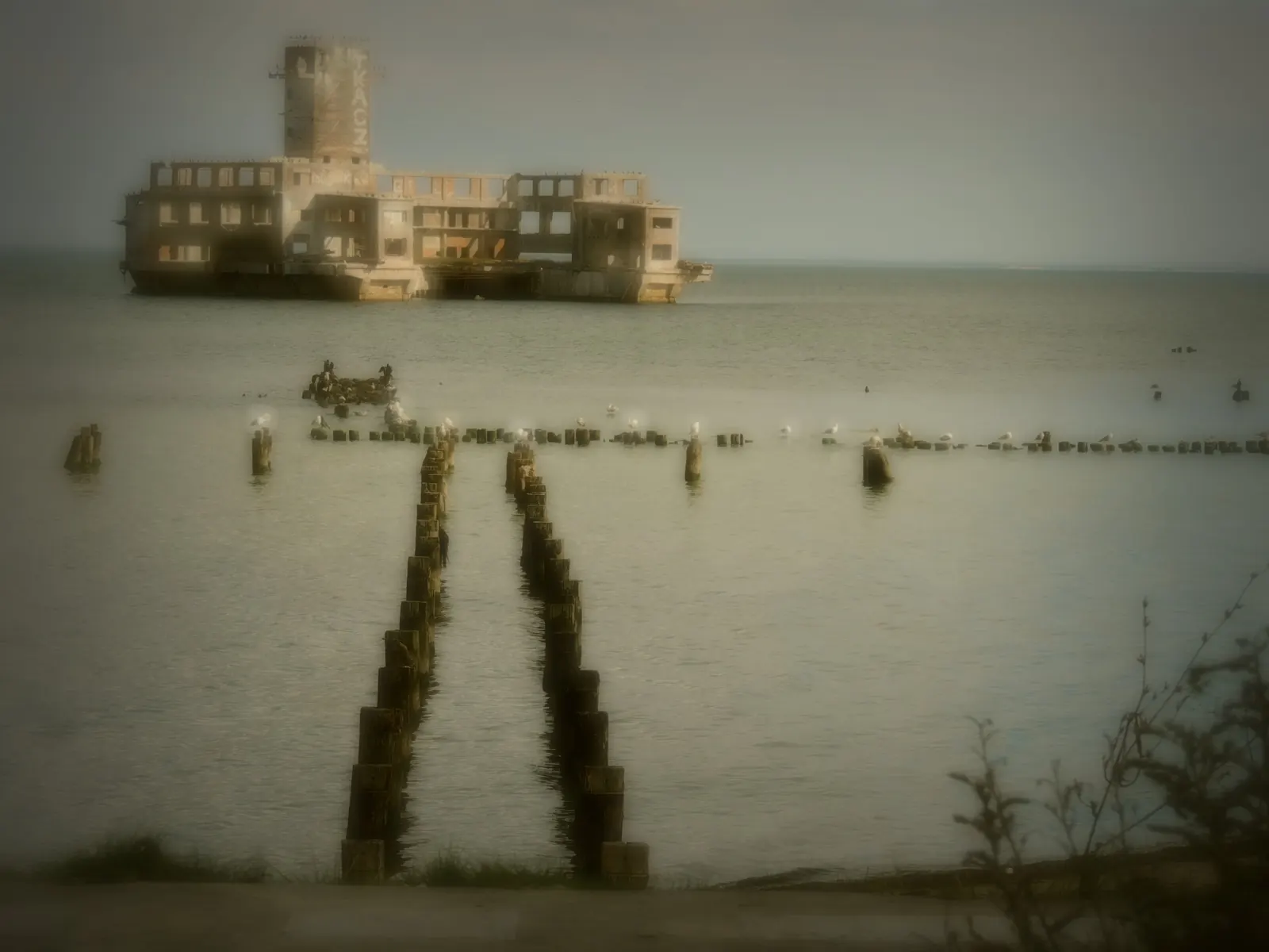
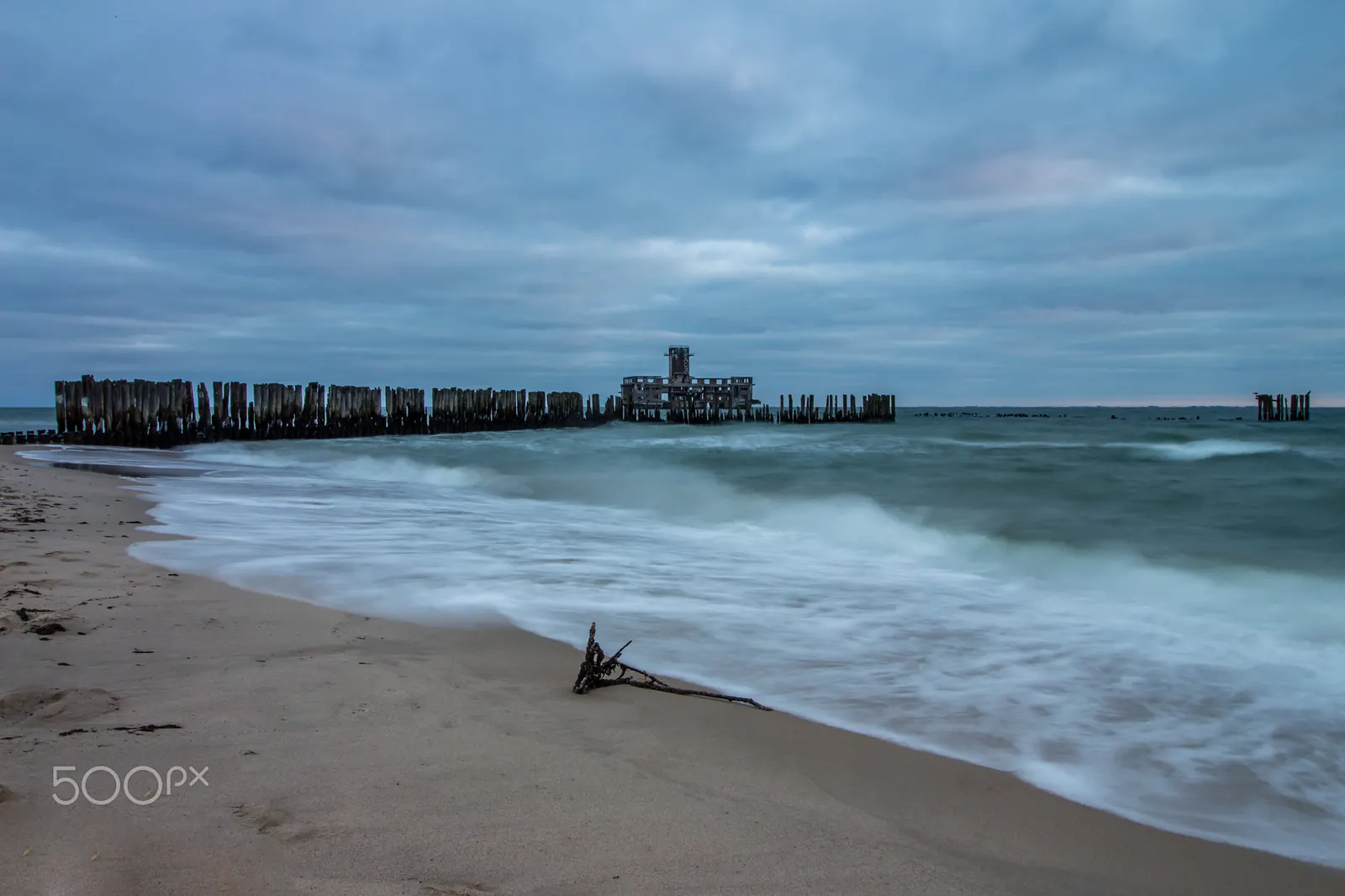
All that remains of the wooden pier are support posts sticking out of the water – and only those close to the beach. The present structure does not resemble the original: without photos from that period it is hard to imagine what it looked like in its heyday.

The firing range in January 1945
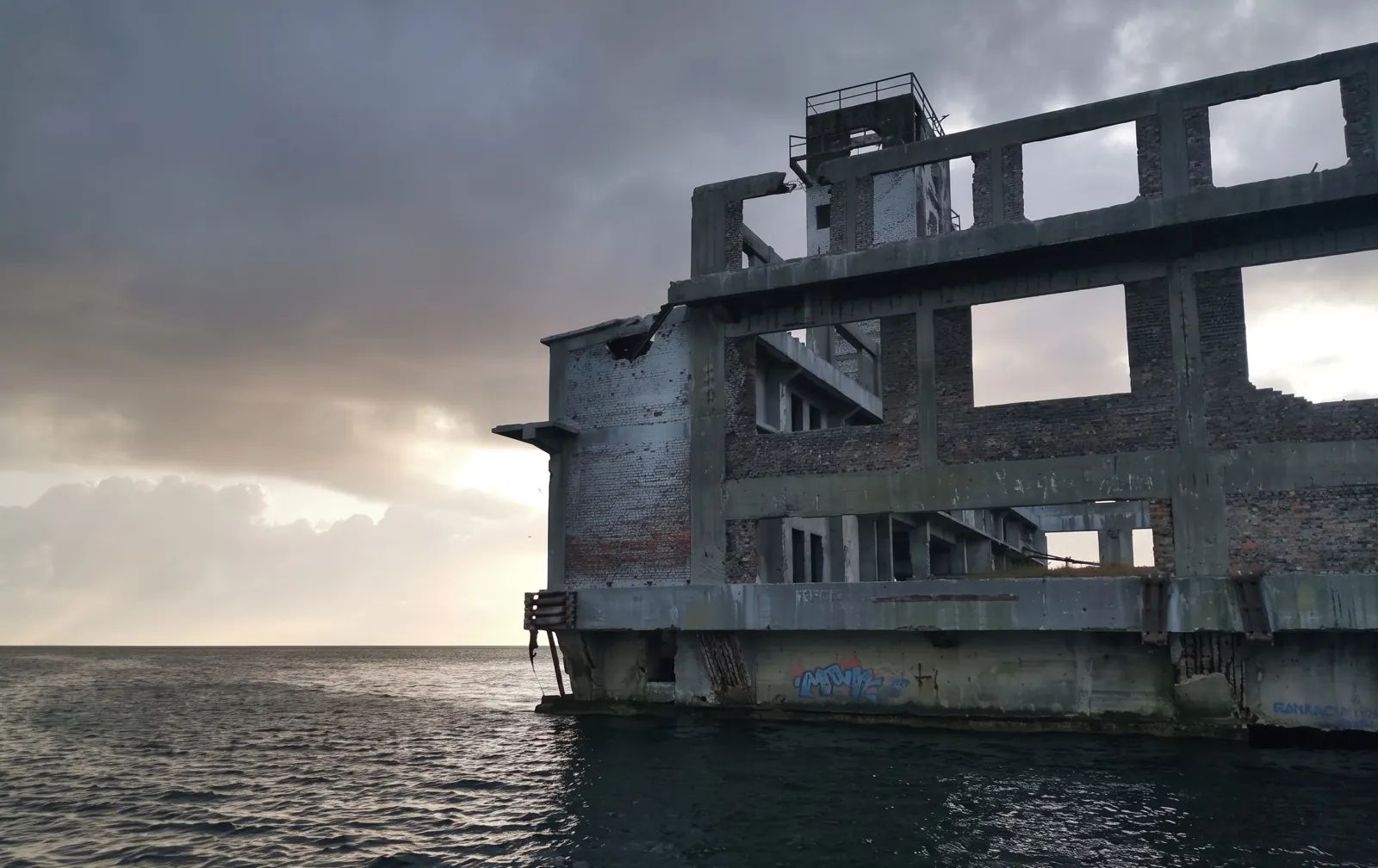
The torpedo-station ruin close up, seen from a boat
January 1945Today

Then and now: fig. 169 (Lauck) and photo RIBY.PL (AI restoration). Taken from different positions.

Aerial photograph from 1942: the torpedo firing range in the sea, the long wooden pier and the cliff of Kępa Oksywska
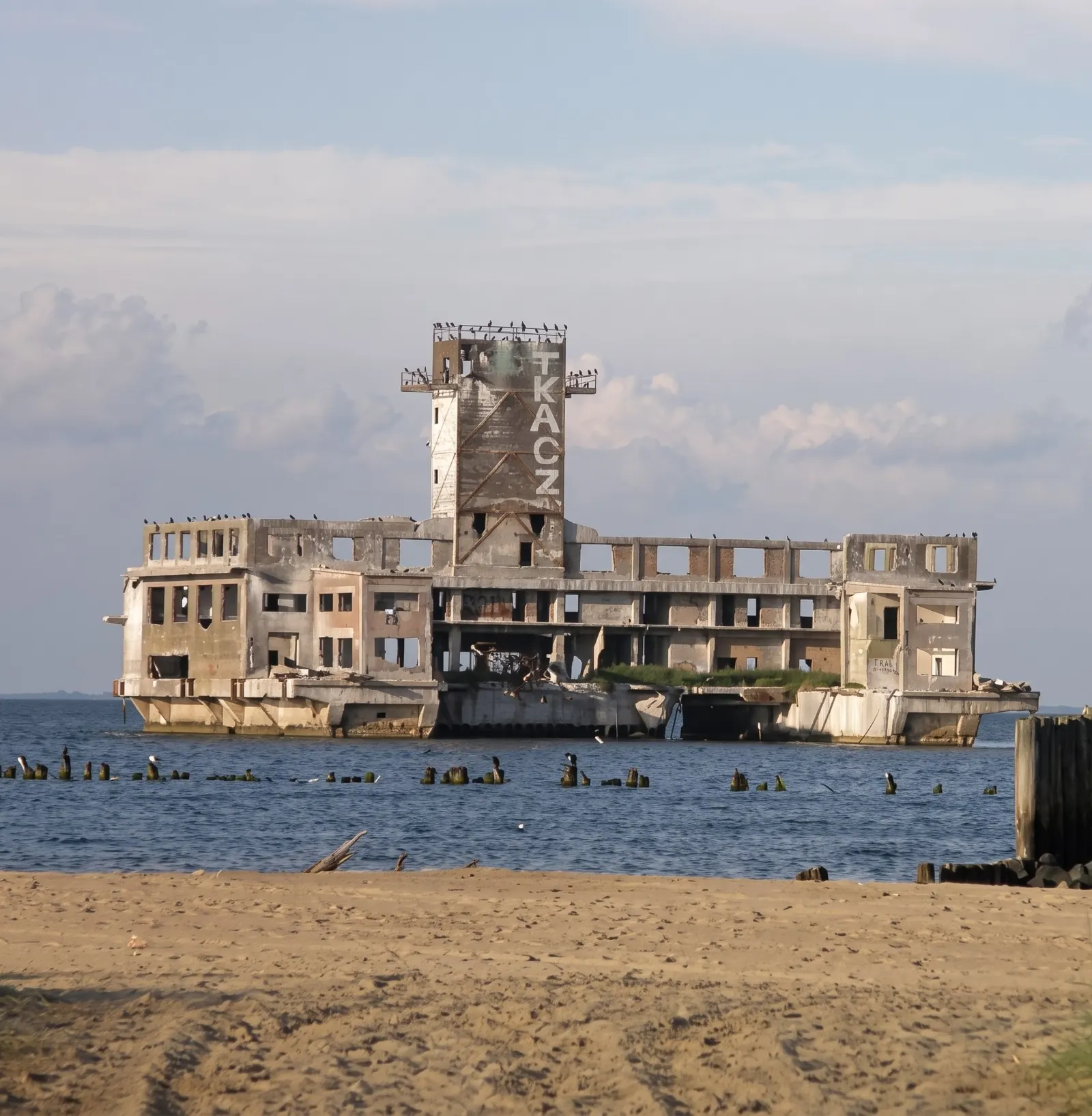
The torpedo-station ruin seen from the beach at Babie Doły, with a row of former pier piles in front
1942Today

Then and now: fig. 137 (Lauck) and photo RIBY.PL (AI restoration). Taken from different positions: from the air and from the beach.

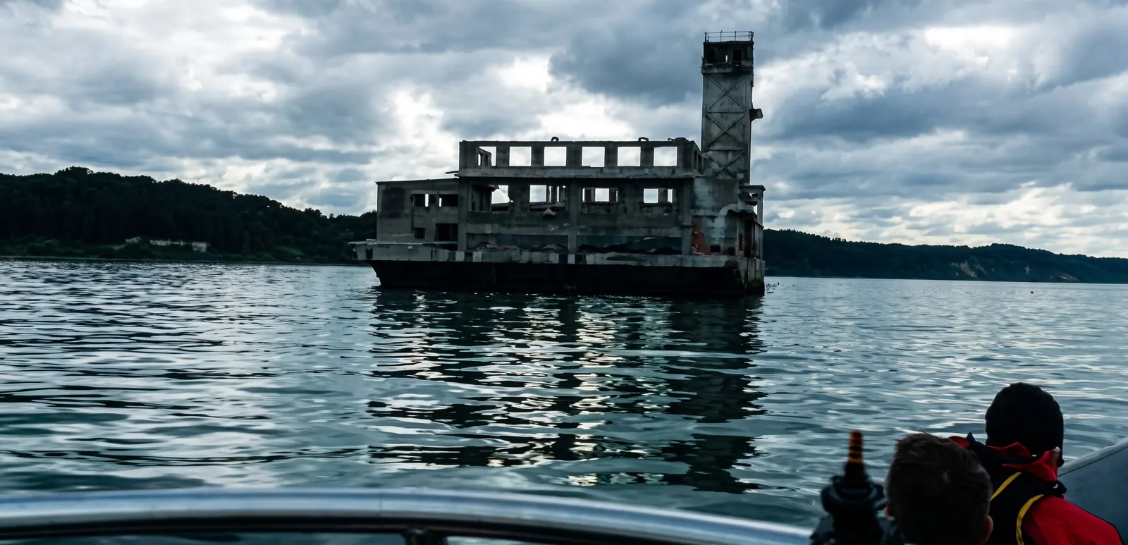
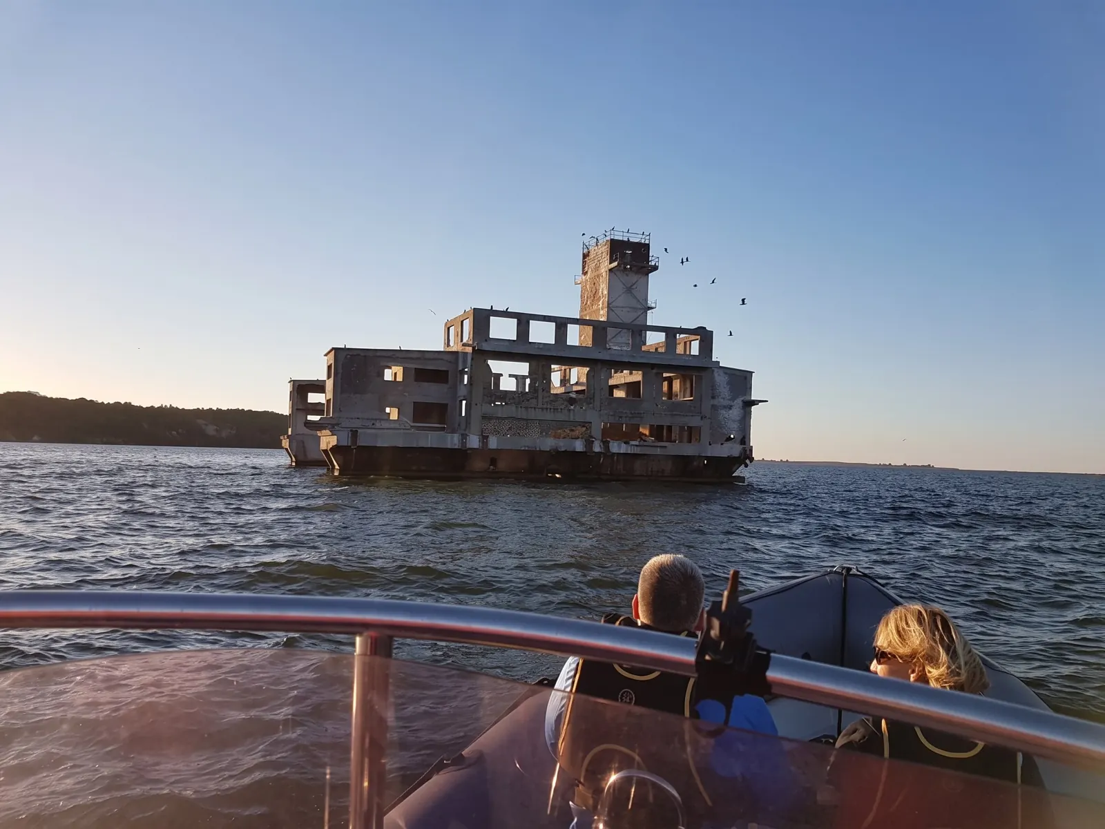
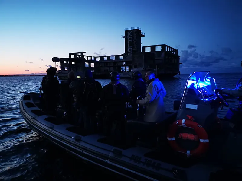
What remains can be viewed in the greatest detail from the deck of a boat. Today Hexengrund is a must-see on RIB motorboat trips around the Gulf of Gdańsk and the Bay of Puck.

The damage makes it hard to imagine the original building, but it adds mystery. This is noticed by film crews from Poland, the Czech Republic, Germany and England, and the torpedo station was the lead character in documentaries by National Geographic and Discovery.

The second torpedo station – Formoza in Oksywie – can be admired in all its glory, with its pier rebuilt in concrete. The area, however, is managed by the Navy, so civilians cannot get any closer – neither from land nor from the water.

The torpedo-station ruin seen from the deck of a motorboat, passengers in jackets at the stern
From the deck of a motorboat. Photo: RIBY.PL, AI restoration
The torpedo-station ruin with its tower, RIB passengers in the foreground
Approaching by RIB. Photo: RIBY.PL, AI restoration
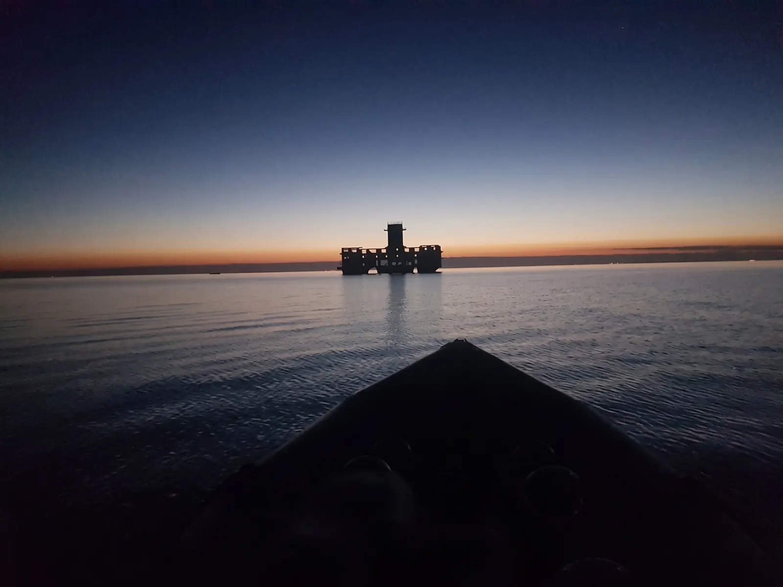
Silhouette of the torpedo station on the horizon at dawn, the bow of the boat in the foreground
At dawn, from the bow of the boat. Photo: RIBY.PL, AI restoration
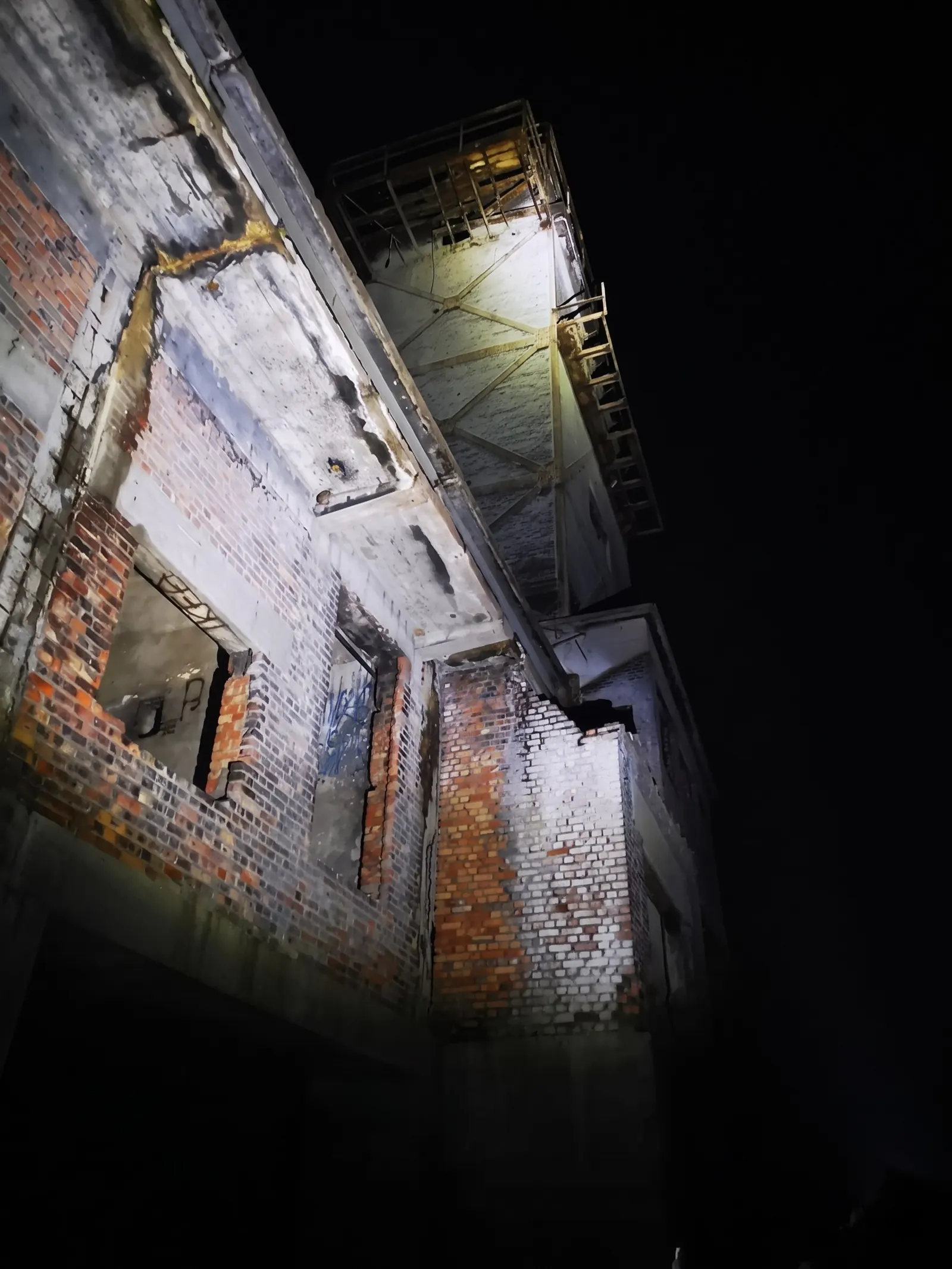
The lit wall of the torpedo station in the dark
At night. Photo: RIBY.PL, AI restoration
A group in a RIB in front of the torpedo-station ruin at dusk
At dusk. Photo: RIBY.PL
Archive

All photographs

Photographs from Friedrich Lauck's book and from Wikimedia Commons. In the viewer you can switch between the book scan, the AI reconstruction and the AI colourisation. The colours are the product of an algorithm, not a record of reality – uniforms, paint and sky may have looked different.

Sources, licences, method

How we know

Main source

Friedrich Lauck, Der Lufttorpedo. Entwicklung und Technik in Deutschland 1915–1945, Wehrtechnische Handbücher series, Bernard & Graefe, München 1981, ISBN 3-7637-5230-7. Chapter C: “Die Geschichte des Torpedowaffenplatzes der Luftwaffe Gotenhafen-Hexengrund (TWP)”, pp. 128–155, and the illustration section, figs. 77–170. Translation of excerpts: the site's editors.

Lauck was a member of the TWP staff. His account is invaluable, but it is written from the perspective of German engineers: it passes over the working conditions of the workers from the East and does not judge the purpose the establishment served.

Other sources

Discrepancies

Sources differ on the date construction began (1940 or 1941), the date the wall collapsed (1970 – the 1980s), the distance of the Oksywie torpedo station from the shore (500 or 700 m) and the number of shots per day. Where possible we give Lauck's version and flag the uncertainty.

A gap in knowledge: Oksywie

We know a great deal about the Babie Doły torpedo station, because the author of our main source worked there. We know much less about the Oksywie torpedo station (the Kriegsmarine TVA): Lauck mentions it only a few times – in connection with the cooperation between the two establishments and in describing its state in 1979 – and we have found no other detailed sources. The information about it comes from the publications listed above.

Checked against the scan

We checked the text of the site and the captions against a scan of chapter C (pp. 128–155) and the illustration section (pp. 217–281) of Lauck's book. Figures 171–174 were added in 2026 from this scan, using the same processing method as the others.

How the images were made

The book's spreads were photographed with a phone. Each picture was cut out and straightened (perspective correction), the print screen and noise were removed, and then:

  1. Reconstruction – the Real-ESRGAN x4plus model (4× upscaling, blended with the source image to limit “invented” detail).
  2. Colourisation – the DDColor model. The colours are the algorithm's hypothesis.
  3. Depth – Depth Anything V2 Small; from the depth map the browser (WebGL) builds a 2.5D parallax effect.

AI can add details that were not there. For research purposes always use the scan (“Book scan” in the switcher).

Photographs from Wikimedia Commons

The ruin of the torpedo station at Babie Doły – present state.
Photo: Czonek, CC BY-SA 3.0 / GFDL, Wikimedia Commons

The torpedo station at Babie Doły, 3 May 2009.
Photo: Mariusz Chilmon, CC BY 2.0, Wikimedia Commons

Ruins of the torpedo station and remains of the pier piles, 27.09.2014.
Photo: Piotr Chomiak, CC BY 3.0, Wikimedia Commons

Remains of the pier on the beach at Babie Doły, February 2014.
Photo: pzdziarski, CC BY-SA 3.0, Wikimedia Commons
A row of piles of the former torpedo-station pier, 2018.
Photo: Karo Karo, CC BY 3.0, Wikimedia Commons

The beach at Babie Doły – the torpedo station is visible from the shore.
Photo: Karo Karo, CC BY 3.0, Wikimedia Commons

The torpedo station seen from Mechelinki, 6.03.2021.
Photo: Andrzej Otrębski, CC BY-SA 4.0, Wikimedia Commons

The Babie Doły torpedo station seen from the beach at Oksywie, 2009.
Photo: Andrzej Otrębski, CC BY-SA 3.0, Wikimedia Commons
The torpedo station in 2002.
Photo: Topory, CC BY-SA 3.0, Wikimedia Commons
The torpedo station from the air, 5.07.2007.
Photo: Jack11 Poland, CC BY-SA 3.0, Wikimedia Commons
The Oksywie torpedo station (“Formoza”) – still used by the Polish Navy, 2016.
Photo: Andrzej Otrębski, CC BY-SA 4.0, Wikimedia Commons

The Oksywie torpedo station with its concrete pier, 17.04.2022.
Photo: Andrzej Otrębski, CC BY-SA 4.0, Wikimedia Commons

Polish naval airmen at Babie Doły airfield, 1952.
Photo: Wojskowa Agencja Fotograficzna (NAC), public domain, Wikimedia Commons

Kępa Oksywska on the WIG map of 1935 – before the war Babi Dół was just a ravine.
Photo: Wojskowy Instytut Geograficzny, public domain, Wikimedia Commons

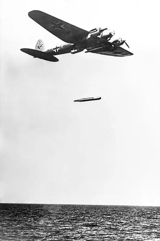
An He 111 drops an aerial torpedo, October 1941.
Photo: Stöcker / Bundesarchiv, Bild 183-L20414, CC BY-SA 3.0 DE, Wikimedia Commons

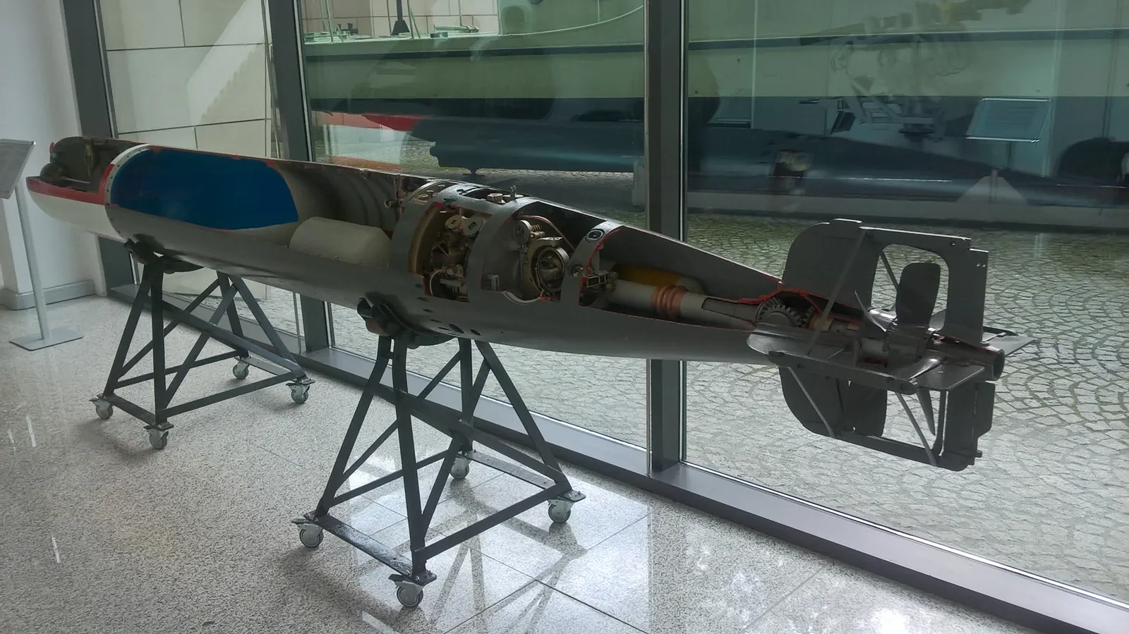
F5b aerial torpedo (450 mm calibre) in the Naval Museum in Gdynia, 2017.
Photo: Zala, CC BY-SA 4.0, Wikimedia Commons

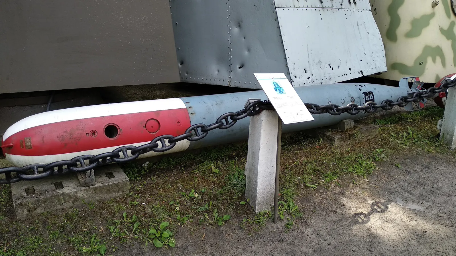
F5b torpedo in the Polish Army Museum in Warsaw, 2018.
Photo: Zala, CC BY-SA 4.0, Wikimedia Commons

A gun of the Polish coastal battery at Oksywie, 1939 (German postcard).
Photo: Foto-Sönnke, public domain, Wikimedia Commons

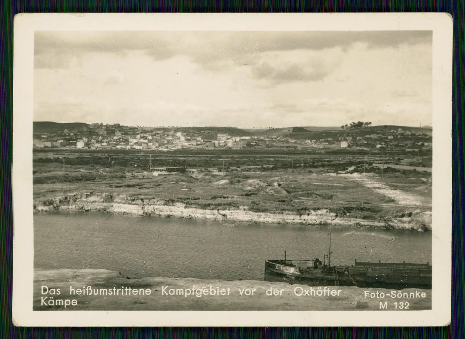
“Fiercely contested ground in front of Kępa Oksywska” – German postcard, 1939.
Photo: Foto-Sönnke, public domain, Wikimedia Commons

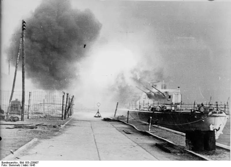
A German cruiser shelling Soviet positions near Gdynia, March 1945.
Photo: Steinmetz / Bundesarchiv, Bild 183-J28907, CC BY-SA 3.0 DE, Wikimedia Commons

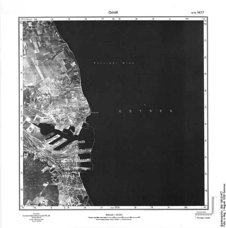
Oksywie in a German reconnaissance photograph, August 1939.
Photo: Bundesarchiv, Bild 196-01477, CC BY-SA 3.0 DE, Wikimedia Commons

Ruin of a measuring tower in the Bay of Puck near Jurata, 2024.
Photo: Dwxn, CC BY-SA 4.0, Wikimedia Commons

Observation tower of the former torpedo test range in the Bay of Puck.
Photo: Andrzej Jóźwik, CC BY-SA 3.0, Wikimedia Commons
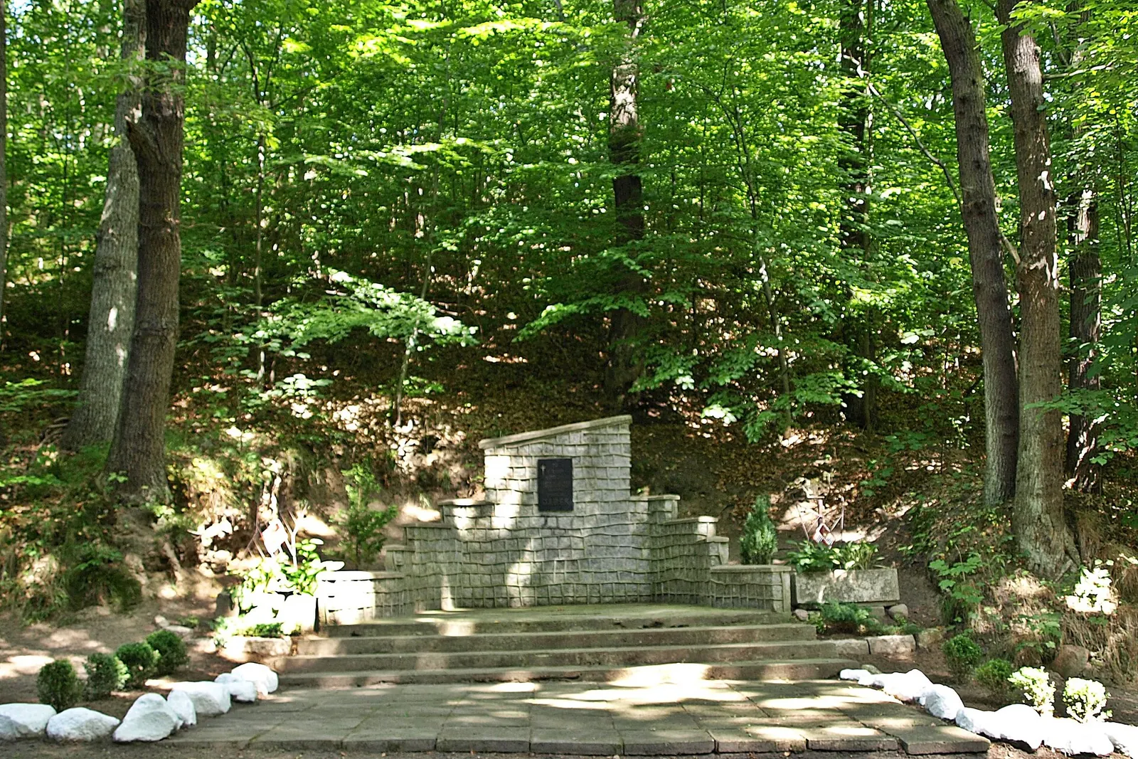
Monument to Colonel Stanisław Dąbek at Babie Doły, 2013.
Photo: Farafaratonga, CC BY-SA 3.0, Wikimedia Commons